
File:JezreelZionistMap1925-bright.jpg

Size of this preview: 800 × 513 pixels. Other resolutions: 320 × 205 pixels | 640 × 410 pixels | 1,024 × 656 pixels | 1,280 × 820 pixels | 3,100 × 1,987 pixels.
Original file (3,100 × 1,987 pixels, file size: 966 KB, MIME type: image/jpeg)
| This is a file from the Wikimedia Commons. Information from its description page there is shown below. Commons is a freely licensed media file repository. You can help. |
Summary
| Description |
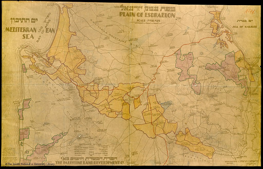
English: This map shows the Jewish land holdings in the Jezreel Valley (Plain of Esdraelon) in Palestine in 1925. The meaning of the colors is not explained but may indicate which Zionist company bought the land. |
| Date | |
| Source | National Library of Israel |
| Author | The Palestine Land Development Co. |
Licensing
This work was created or ordered by the State of Israel, and is in the public domain because it satisfies one of the conditions stipulated in Israel's copyright statute from 2007 (translation) regarding the State's copyrights:
|

|
File history
Click on a date/time to view the file as it appeared at that time.
| Date/Time | Thumbnail | Dimensions | User | Comment | |
|---|---|---|---|---|---|
| current | 03:03, 8 February 2021 | | 3,100 × 1,987 (966 KB) | Zero0000 | Uploaded a work by The Palestine Land Development Co. from National Library of Israel with UploadWizard |
File usage
The following pages on the English Wikipedia use this file (pages on other projects are not listed):
Global file usage
The following other wikis use this file:
- Usage on es.wikipedia.org
- Usage on zh.wikipedia.org