
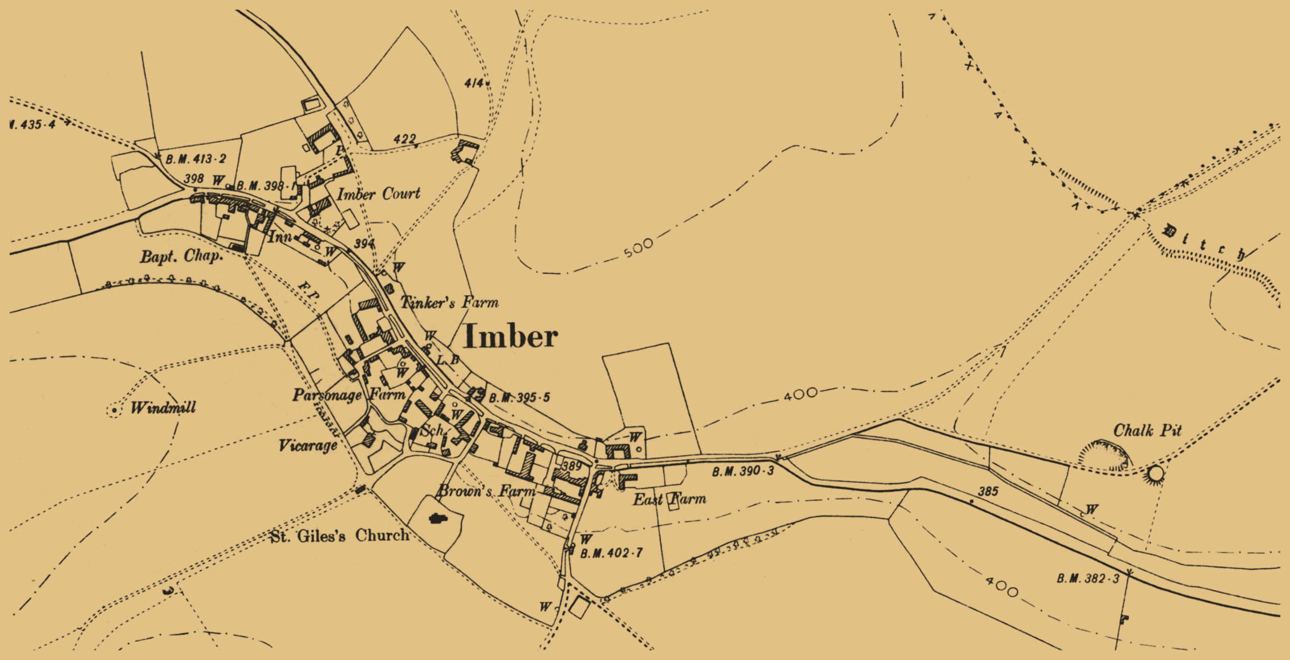
File:Imber Wiltshire England 1902 .png
Size of this preview: 800 × 410 pixels. Other resolutions: 320 × 164 pixels | 640 × 328 pixels | 1,024 × 524 pixels | 1,280 × 656 pixels | 2,542 × 1,302 pixels.
Original file (2,542 × 1,302 pixels, file size: 1,016 KB, MIME type: image/png)
| This is a file from the Wikimedia Commons. Information from its description page there is shown below. Commons is a freely licensed media file repository. You can help. |
Summary
| Description |
English: Map of Imber, England, as it existed in 1902 |
| Date | 14 October 2019 (upload date) |
| Source | The uploader on Wikimedia Commons received this from the author/copyright holder via photosubmissions. |
| Author | Ordnance Survey map published 1902 |
| Permission (Reusing this file) |
Licensing
This work is an Ordnance Survey map over 50 years old, which is covered by Crown Copyright which in this case expires 50 years after publication. Ordnance Survey does however ask that they be credited and that the date of publication be given.
Any ancillary rights gained through the creation of the electronic version are granted as freely usable under any circumstances.
|
This work created by the United Kingdom Government is in the public domain.
This is because it is one of the following:
HMSO has declared that the expiry of Crown Copyrights applies worldwide (ref: HMSO Email Reply)
|
 |
File history
Click on a date/time to view the file as it appeared at that time.
| Date/Time | Thumbnail | Dimensions | User | Comment | |
|---|---|---|---|---|---|
| current | 17:06, 14 October 2019 | | 2,542 × 1,302 (1,016 KB) | JGHowes | {{Information |Description={{en|1=Map of '''Imber, England''', as it existed in 1902}} |Source={{author source|photosubmissions (OTRS)}} |Author= {{w|Ordnance Survey}} map published 1902 |Date={{upload date|2019-10-14}} |Permission={{PermissionOTRS|id=2019081610007093}} |other_versions= }} == {{int:license-header}} == {{OldOS}} |
File usage
The following pages on the English Wikipedia use this file (pages on other projects are not listed):