
File:Ile Mysterieuse 03.jpg

Size of this preview: 392 × 600 pixels. Other resolutions: 157 × 240 pixels | 314 × 480 pixels | 502 × 768 pixels | 669 × 1,024 pixels | 1,443 × 2,208 pixels.
Original file (1,443 × 2,208 pixels, file size: 751 KB, MIME type: image/jpeg)
| This is a file from the Wikimedia Commons. Information from its description page there is shown below. Commons is a freely licensed media file repository. You can help. |
Summary
| Description |
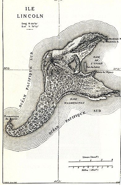
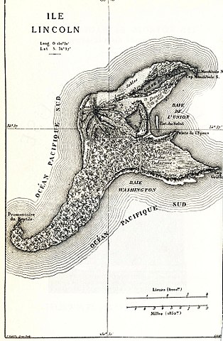
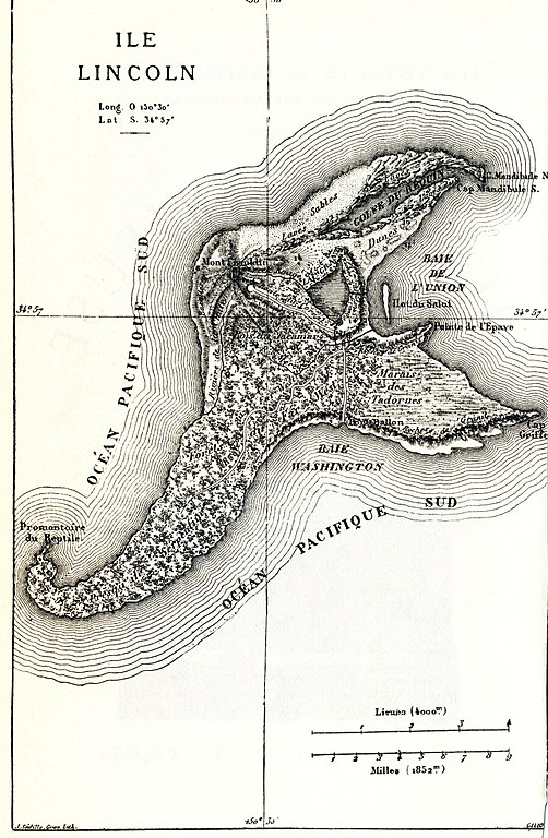
English: Map of the fictional Lincoln Island (The Mysterious Island). |
|||||||||||||||||||||||||||||||||||||||||||||||||||||||||||||||||||||
| Date | ||||||||||||||||||||||||||||||||||||||||||||||||||||||||||||||||||||||
| Source |
English: This image was originally featured in the Hetzel edition of Mysterious Island, and has also been featured in more recent editions (this particular instance was scanned from a recent edition). |
|||||||||||||||||||||||||||||||||||||||||||||||||||||||||||||||||||||
| Author |
|
|||||||||||||||||||||||||||||||||||||||||||||||||||||||||||||||||||||
| Permission (Reusing this file) |
This is a French work. French law applies. France does not use the notion of "copyright", but a "Droit d'auteur" system. They are now the public domain, since their Droit d'auteur is expired. | |||||||||||||||||||||||||||||||||||||||||||||||||||||||||||||||||||||
| Other versions |
|
|||||||||||||||||||||||||||||||||||||||||||||||||||||||||||||||||||||


| Camera location | | View this and other nearby images on: OpenStreetMap |
|---|
Licensing
|
This work is in the public domain in its country of origin and other countries and areas where the copyright term is the author's life plus 100 years or fewer. This work is in the public domain in the United States because it was published (or registered with the U.S. Copyright Office) before January 1, 1929. | |
| This file has been identified as being free of known restrictions under copyright law, including all related and neighboring rights. | |
File history
Click on a date/time to view the file as it appeared at that time.
| Date/Time | Thumbnail | Dimensions | User | Comment | |
|---|---|---|---|---|---|
| current | 13:57, 10 August 2017 | | 1,443 × 2,208 (751 KB) | The RedBurn | Levels corrected with XnView |
| 21:41, 25 February 2005 |  | 1,443 × 2,208 (664 KB) | Rama | {{PD}} |
File usage
The following pages on the English Wikipedia use this file (pages on other projects are not listed):
Global file usage
The following other wikis use this file:
- Usage on bn.wikipedia.org
- Usage on cs.wikipedia.org
- Usage on da.wikipedia.org
- Usage on de.wikipedia.org
- Usage on es.wikipedia.org
- Usage on et.wikipedia.org
- Usage on eu.wikipedia.org
- Usage on fr.wikipedia.org
- Usage on fr.wikisource.org
- Usage on gl.wikipedia.org
- Usage on he.wikipedia.org
- Usage on hr.wikipedia.org
- Usage on it.wikipedia.org
- Usage on it.wikisource.org
- Usage on ja.wikipedia.org
- Usage on nl.wikipedia.org
- Usage on ro.wikipedia.org
- Usage on sr.wikipedia.org
- Usage on uk.wikipedia.org
- Usage on vi.wikipedia.org
- Usage on www.wikidata.org
- Usage on zh.wikipedia.org