
File:Horsford Castle - geograph.org.uk - 2049220.jpg
No higher resolution available.
Horsford_Castle_-_geograph.org.uk_-_2049220.jpg (800 × 531 pixels, file size: 177 KB, MIME type: image/jpeg)
| This is a file from the Wikimedia Commons. Information from its description page there is shown below. Commons is a freely licensed media file repository. You can help. |
Summary
| Description |
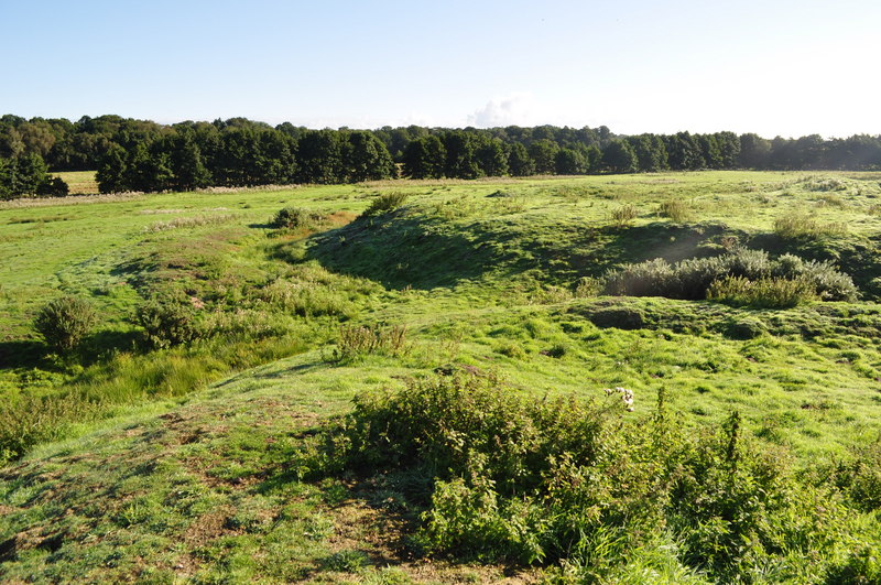
English: Horsford Castle, near to Horsford, Norfolk, Great Britain.
A view of the 11th century motte and bailey castle. Consisting of a deep ditch, large bailey and low motte. Founded by Robert Malet or possibly his tenant Walter of Caen. After the main use of defence became less important the castle probably became a hunting lodge. Abandoned after 1431, the bailey was ploughed in the 1980s. Still well worth a look and access is good. |
| Date | |
| Source | From geograph.org.uk; transferred by User:Rubberstamp using geograph_org2commons. |
| Author | Ashley Dace |
| Permission (Reusing this file) |
Creative Commons Attribution Share-alike license 2.0 |
| Attribution (required by the license) | Ashley Dace / Horsford Castle / |
| Camera location | | View this and other nearby images on: OpenStreetMap |
|---|
| Object location | | View this and other nearby images on: OpenStreetMap |
|---|
_region:GB-GBN_heading:67.00&language=en)
Licensing

|
This image was taken from the Geograph project collection. See this photograph's page on the Geograph website for the photographer's contact details. The copyright on this image is owned by Ashley Dace and is licensed for reuse under the Creative Commons Attribution-ShareAlike 2.0 license.
|
This file is licensed under the Creative Commons Attribution-Share Alike 2.0 Generic license.
Attribution: Ashley Dace
- You are free:
- to share – to copy, distribute and transmit the work
- to remix – to adapt the work
- Under the following conditions:
- attribution – You must give appropriate credit, provide a link to the license, and indicate if changes were made. You may do so in any reasonable manner, but not in any way that suggests the licensor endorses you or your use.
- share alike – If you remix, transform, or build upon the material, you must distribute your contributions under the same or compatible license as the original.
File history
Click on a date/time to view the file as it appeared at that time.
| Date/Time | Thumbnail | Dimensions | User | Comment | |
|---|---|---|---|---|---|
| current | 13:28, 8 September 2010 | | 800 × 531 (177 KB) | File Upload Bot (Magnus Manske) | == {{int:filedesc}} == {{Information |Description={{en|1=Horsford Castle, near to Horsford, Norfolk, Great Britain. A view of the 11th century motte and bailey castle. Consisting of a deep ditch, large bailey and low motte. Founded by Robert Malet or poss |
File usage
The following pages on the English Wikipedia use this file (pages on other projects are not listed):
Global file usage
The following other wikis use this file:
- Usage on ceb.wikipedia.org
- Usage on de.wikipedia.org
- Usage on www.wikidata.org