
File:Hellas basin topo.jpg

Size of this preview: 600 × 600 pixels. Other resolutions: 240 × 240 pixels | 480 × 480 pixels | 1,000 × 1,000 pixels.
Original file (1,000 × 1,000 pixels, file size: 971 KB, MIME type: image/jpeg)
| This is a file from the Wikimedia Commons. Information from its description page there is shown below. Commons is a freely licensed media file repository. You can help. |


Summary
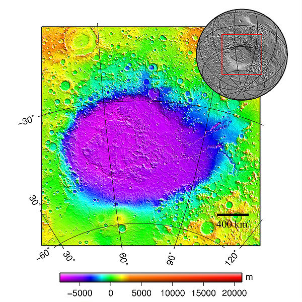
| Description | Hellas basin (Mars) topography |
| Date | 5.10.2006 |
| Source | plotted using GMT and gridded MOLA data archive meg0031t.grd |
| Author | Martin Pauer (Power) |
| Permission (Reusing this file) |
PD |
Licensing
| I, the copyright holder of this work, release this work into the public domain. This applies worldwide. In some countries this may not be legally possible; if so: I grant anyone the right to use this work for any purpose, without any conditions, unless such conditions are required by law. |
File history
Click on a date/time to view the file as it appeared at that time.
| Date/Time | Thumbnail | Dimensions | User | Comment | |
|---|---|---|---|---|---|
| current | 15:37, 26 June 2009 | | 1,000 × 1,000 (971 KB) | Power | better layout + scale |
| 17:29, 9 October 2006 |  | 1,024 × 1,068 (842 KB) | Power | ||
| 23:13, 5 October 2006 |  | 1,024 × 1,062 (1.06 MB) | Power | {{Information |Description=Hellas basin (Mars) topography |Source=plotted using GMT and gridded MOLA data archive meg0031t.grd |Date=5.10.2006 |Author=Martin Pauer (Power) |Permission=PD }} |
File usage
The following pages on the English Wikipedia use this file (pages on other projects are not listed):
Global file usage
The following other wikis use this file:
- Usage on ca.wikipedia.org
- Usage on cs.wikipedia.org
- Usage on eo.wikipedia.org
- Usage on es.wikipedia.org
- Usage on fr.wikipedia.org
- Usage on gl.wikipedia.org
- Usage on it.wikipedia.org
- Usage on ml.wikipedia.org
- Usage on pl.wiktionary.org
- Usage on pnb.wikipedia.org
- Usage on pt.wikipedia.org
- Usage on ro.wikipedia.org
- Usage on ru.wikipedia.org
- Usage on uk.wikipedia.org
- Usage on ur.wikipedia.org
- Usage on vi.wikipedia.org
- Usage on www.wikidata.org
- Usage on zh.wikipedia.org