
File:Haiyan 2007-08-05 0205Z.jpg

Size of this preview: 450 × 600 pixels. Other resolutions: 180 × 240 pixels | 360 × 480 pixels | 576 × 768 pixels | 768 × 1,024 pixels | 1,536 × 2,048 pixels | 3,000 × 4,000 pixels.
Original file (3,000 × 4,000 pixels, file size: 8.94 MB, MIME type: image/jpeg)
| This is a file from the Wikimedia Commons. Information from its description page there is shown below. Commons is a freely licensed media file repository. You can help. |
Summary
| Description |
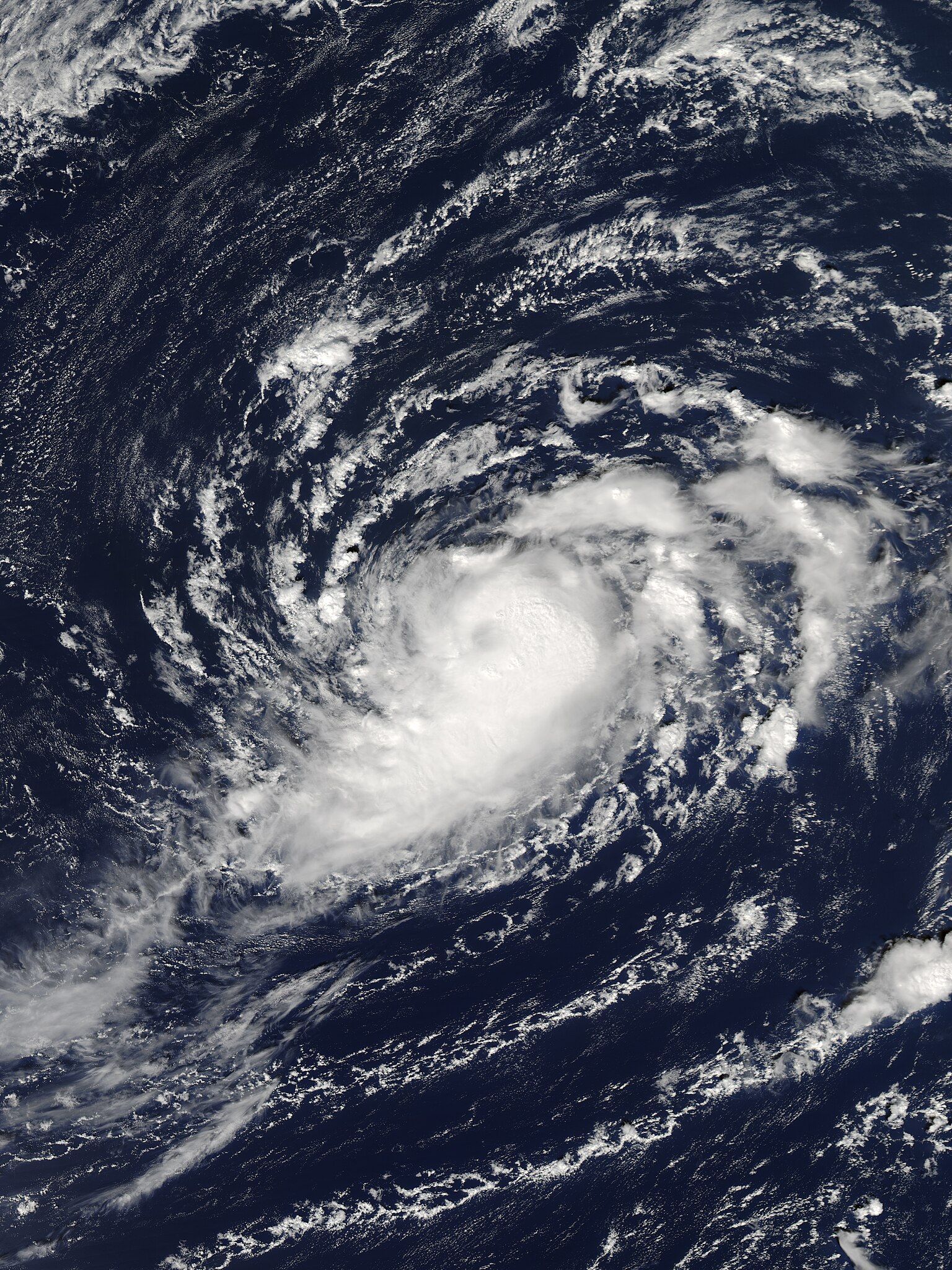
English: Tropical Storm Haiyan near peak intensity on October 5, 2007. |
| Date | |
| Source | http://www.nrlmry.navy.mil/tcdat/tc07/WPAC/27W.HAIYAN/vis/modis/qkm/ |
| Author | U.S. Naval Research Laboratory |
| Camera location | | View this and other nearby images on: OpenStreetMap |
|---|
Licensing
This file is a work of a sailor or employee of the U.S. Navy, taken or made as part of that person's official duties. As a work of the U.S. federal government, it is in the public domain in the United States.
|
 | |
| This file has been identified as being free of known restrictions under copyright law, including all related and neighboring rights. | ||
File history
Click on a date/time to view the file as it appeared at that time.
| Date/Time | Thumbnail | Dimensions | User | Comment | |
|---|---|---|---|---|---|
| current | 06:35, 25 October 2019 | | 3,000 × 4,000 (8.94 MB) | Nino Marakot | Removed bluish colors and adjusted size. |
| 05:23, 22 June 2014 |  | 3,900 × 4,600 (13.46 MB) | Supportstorm | Color HDF file | |
| 20:55, 18 December 2009 |  | 4,096 × 3,962 (2.94 MB) | Supportstorm | Cropped | |
| 04:05, 27 June 2009 |  | 4,096 × 4,096 (2.35 MB) | Supportstorm | {{Information |Description={{en|1=Tropical Storm Haiyan on October 5, 2007.}} |Source=http://199.9.2.143/tcdat/tc07/WPAC/27W.HAIYAN/vis/modis/qkm/ |Author=Navy |Date=2007-10-05 |Permission= |other_versions= }} <!--{{ImageUpload|full}}--> [[Category:2007 |
File usage
The following pages on the English Wikipedia use this file (pages on other projects are not listed):
Global file usage
The following other wikis use this file:
- Usage on hr.wikipedia.org
- Usage on ja.wikipedia.org
- Usage on pt.wikipedia.org
- Usage on vi.wikipedia.org
- Usage on zh.wikipedia.org