
File:Gyelimap.svg

Size of this PNG preview of this SVG file: 167 × 139 pixels. Other resolutions: 288 × 240 pixels | 577 × 480 pixels | 923 × 768 pixels | 1,230 × 1,024 pixels | 2,461 × 2,048 pixels.
Original file (SVG file, nominally 167 × 139 pixels, file size: 156 KB)
| This is a file from the Wikimedia Commons. Information from its description page there is shown below. Commons is a freely licensed media file repository. You can help. |
Summary
| Description |
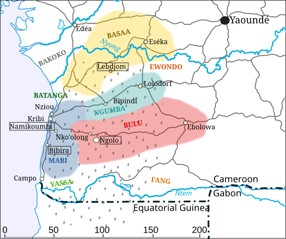
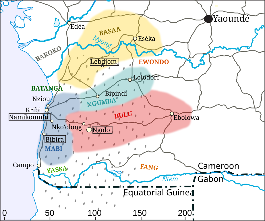
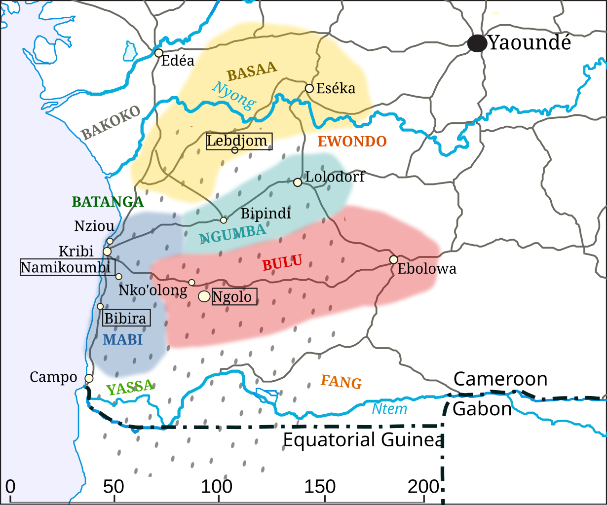
English: This map shows the southern part of Cameroon where the Gyeli/Kwasio people live. They are hunter-gatherers. The area where they roam is given with dots. Neighbouring languages are given in colours. |
| Date | |
| Source | Own work based on United Nations map https://www.un.org/Depts/Cartographic/map/profile/cameroon.pdf. The UN requires to remove the UN name and the map reference number: https://www.un.org/geospatial/mandates/public |
| Author | Jasy jatere |
| Permission (Reusing this file) |
https://www.un.org/geospatial/mandates/public : "If you wish to use any United Nations map as a basis for derived products or for creating your own map, you may do so. However, you will be solely responsible for the content of any modified map. We require you to remove the United Nations name and the map reference number. Should you wish to credit the source you may include the phrase “based on United Nations map.” " |
| Camera location | | View this and other nearby images on: OpenStreetMap |
|---|
Licensing
I, the copyright holder of this work, hereby publish it under the following license:
This file is licensed under the Creative Commons Attribution-Share Alike 4.0 International license.
- You are free:
- to share – to copy, distribute and transmit the work
- to remix – to adapt the work
- Under the following conditions:
- attribution – You must give appropriate credit, provide a link to the license, and indicate if changes were made. You may do so in any reasonable manner, but not in any way that suggests the licensor endorses you or your use.
- share alike – If you remix, transform, or build upon the material, you must distribute your contributions under the same or compatible license as the original.
File history
Click on a date/time to view the file as it appeared at that time.
| Date/Time | Thumbnail | Dimensions | User | Comment | |
|---|---|---|---|---|---|
| current | 08:54, 13 August 2021 | | 167 × 139 (156 KB) | Jasy jatere | Uploaded own work with UploadWizard |
File usage
The following pages on the English Wikipedia use this file (pages on other projects are not listed):
Global file usage
The following other wikis use this file:
- Usage on eu.wikipedia.org
- Usage on ig.wikipedia.org
- Usage on www.wikidata.org