
File:Grolla - Map of Groenlo, after 1628 (J.Blaeu, 1649).jpg
Size of this preview: 783 × 599 pixels. Other resolutions: 314 × 240 pixels | 627 × 480 pixels | 1,003 × 768 pixels | 1,280 × 980 pixels | 2,560 × 1,960 pixels | 5,500 × 4,211 pixels.
Original file (5,500 × 4,211 pixels, file size: 2.7 MB, MIME type: image/jpeg)
| This is a file from the Wikimedia Commons. Information from its description page there is shown below. Commons is a freely licensed media file repository. You can help. |
.jpg)
Summary
| Description |
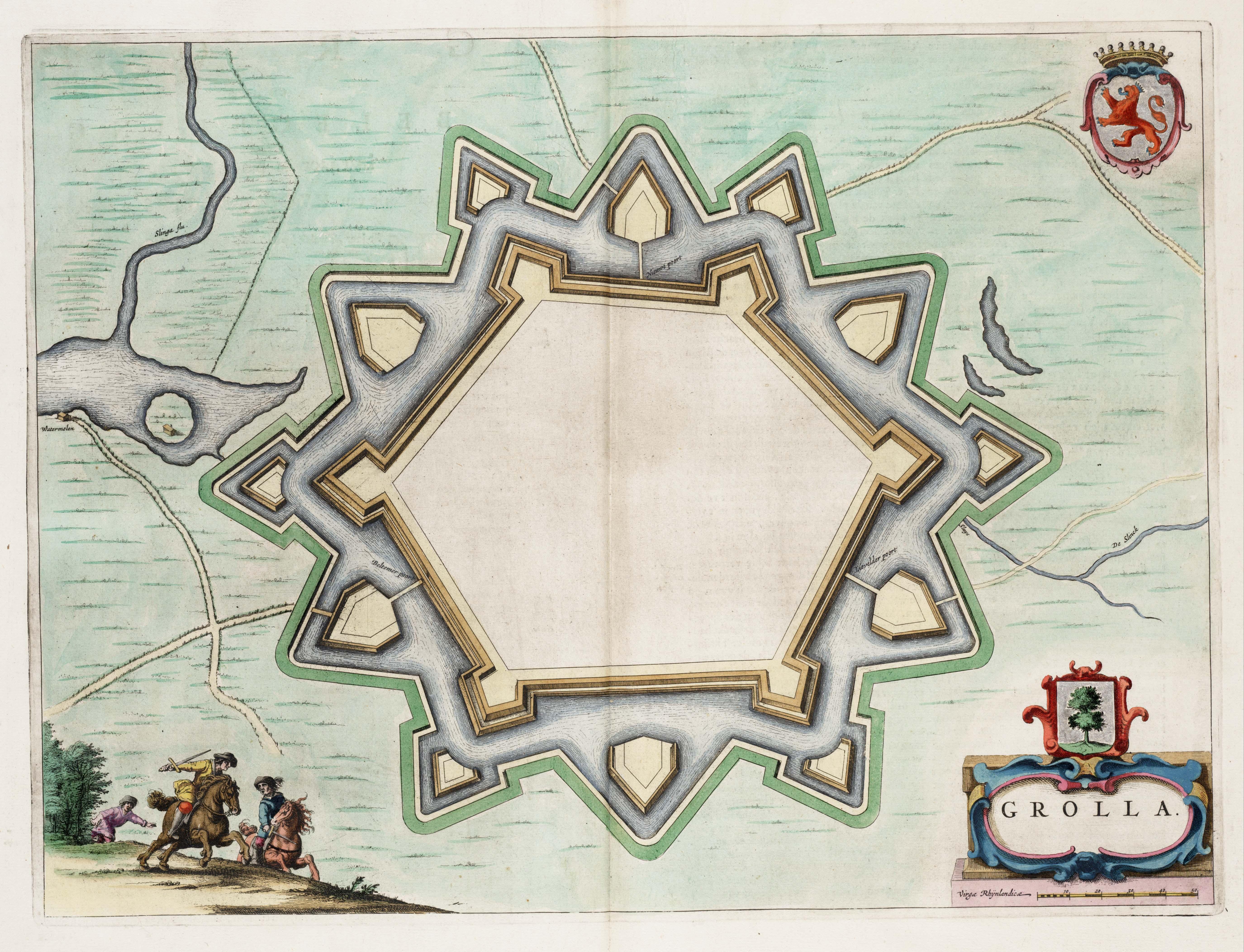
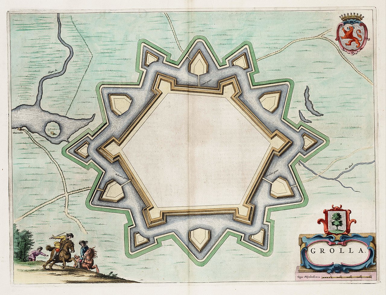
English: Map of the defensive works of Grolla (Groenlo) - the Netherlands, after the restaurations made in 1628. Map found in the Theater of Cities of 1649.
Nederlands: Kaart van de wallen in Grolle (Groenlo), na de herstelwerkzaamheden van 1628. Kaart uit het Toonneel der Steeden van 1649. |
| Date | |
| Source | Toonneel der Steeden van de vereenighde Nederlanden |
| Author | J.Blaeu |
| Permission (Reusing this file) |
Public Domain |
Licensing
|
This work is in the public domain in its country of origin and other countries and areas where the copyright term is the author's life plus 100 years or fewer. | |
| This file has been identified as being free of known restrictions under copyright law, including all related and neighboring rights. | |
File history
Click on a date/time to view the file as it appeared at that time.
| Date/Time | Thumbnail | Dimensions | User | Comment | |
|---|---|---|---|---|---|
| current | 01:51, 8 September 2008 | | 5,500 × 4,211 (2.7 MB) | Kweniston | {{Information |Description={{en|1=Map of the defensive works of Grolla (Groenlo), after the restaurations made in 1628. Map found in the ''Theater of Cities'' of 1649.}} {{nl|1=Kaart van de wallen in Grolle (Groenlo), na de herstelwerkzaamheden van 1628. |
File usage
The following pages on the English Wikipedia use this file (pages on other projects are not listed):
Global file usage
The following other wikis use this file:
- Usage on fr.wikipedia.org
- Usage on ja.wikipedia.org
- Usage on nl.wikipedia.org
- Usage on pl.wikipedia.org
- Usage on ru.wikipedia.org
- Usage on www.wikidata.org
.jpg)