
File:Greater Manchester Satelite View bright.png

Size of this preview: 800 × 527 pixels. Other resolutions: 320 × 211 pixels | 640 × 421 pixels | 992 × 653 pixels.
Original file (992 × 653 pixels, file size: 1.52 MB, MIME type: image/png)
| This is a file from the Wikimedia Commons. Information from its description page there is shown below. Commons is a freely licensed media file repository. You can help. |
Summary
| Description | |
| Source | Satellite imagery taken from NASA World Wind software (by screenshot) |
| Author | Photograph: NASA |
Licensing
| This image is in the public domain because it is a screenshot from NASA’s globe software World Wind using a public domain layer, such as Blue Marble, MODIS, Landsat, SRTM, USGS or GLOBE.
|
 |
Original upload log
The original description page was here. All following user names refer to en.wikipedia.
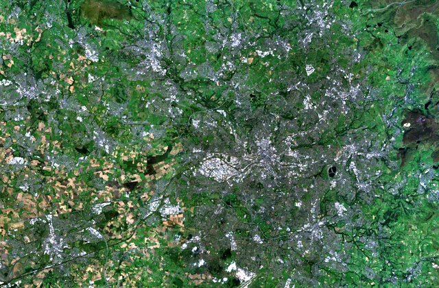
- 2008-03-20 23:06 Mr Stephen 992×653×8 (1589953 bytes) ==Summary== [[NASA]] satelite image of the [[Greater Manchester]] county and conurbation. ==Licencing== {{PD-WorldWind}} [[Category:Maps of Greater Manchester]] [[Category:Manchester]] [[Category:Greater Manchester]]
File history
Click on a date/time to view the file as it appeared at that time.
| Date/Time | Thumbnail | Dimensions | User | Comment | |
|---|---|---|---|---|---|
| current | 21:45, 26 June 2008 | | 992 × 653 (1.52 MB) | File Upload Bot (Magnus Manske) | {{BotMoveToCommons|en.wikipedia}} {{Information |Description={{en|en:NASA satellite image of the en:Greater Manchester county and conurbation. ==Licencing== en:Category:Maps of Greater Manchester en:Category:Manchester [[:en:Categor |
File usage
No pages on the English Wikipedia use this file (pages on other projects are not listed).
Global file usage
The following other wikis use this file:
- Usage on zh.wikipedia.org