
File:Euxton-rof.jpg
No higher resolution available.
Euxton-rof.jpg (640 × 480 pixels, file size: 153 KB, MIME type: image/jpeg)
| This is a file from the Wikimedia Commons. Information from its description page there is shown below. Commons is a freely licensed media file repository. You can help. |
| Description |
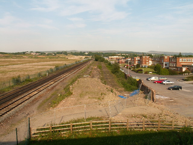
English: The site of Euxton railway station and the Royal Ordnance Factory, Lancashire. In the heyday of the surrounding Royal Ordnance factory, Euxton (pronounced x-ton not youx-ston) station was heavily used by workers travelling to and from work from the surrounding towns of Leyland and Chorley. The Royal Ordnance management offices are still present at the right of the picture and form a business park (now called Xton business park [groan]), the factory covered the whole area to the left of the picture. The station itself has been demolished (centre of the picture), although there is talk about building a new station here. |
| Date | |
| Source | From geograph.org.uk |
| Author | Martin Stockdale |
| Permission (Reusing this file) |
Creative Commons Attribution Share-alike license 2.0 |
| Camera location | | View this and other nearby images on: OpenStreetMap |
|---|

|
This image was taken from the Geograph project collection. See this photograph's page on the Geograph website for the photographer's contact details. The copyright on this image is owned by Martin Stockdale and is licensed for reuse under the Creative Commons Attribution-ShareAlike 2.0 license.
|
This file is licensed under the Creative Commons Attribution-Share Alike 2.0 Generic license.
Attribution: Martin Stockdale
- You are free:
- to share – to copy, distribute and transmit the work
- to remix – to adapt the work
- Under the following conditions:
- attribution – You must give appropriate credit, provide a link to the license, and indicate if changes were made. You may do so in any reasonable manner, but not in any way that suggests the licensor endorses you or your use.
- share alike – If you remix, transform, or build upon the material, you must distribute your contributions under the same or compatible license as the original.
Original upload log
The original description page was here. All following user names refer to en.wikipedia.
- 2007-01-19 08:09 Oxonhutch 640×480×??? (157057 bytes) © Copyright Martin Stockdale and licensed for reuse under this Creative Commons Licence. Geograph Project, UK. https://www.geograph.org.uk/photo/18205 Site of ROF station cleared in 2002.
File history
Click on a date/time to view the file as it appeared at that time.
| Date/Time | Thumbnail | Dimensions | User | Comment | |
|---|---|---|---|---|---|
| current | 22:22, 28 September 2008 | | 640 × 480 (153 KB) | Angusmclellan | {{Information |Description={{en|The site of Euxton railway station and the Royal Ordnance Factory, Lancashire. In the heyday of the surrounding Royal Ordnance factory, Euxton (pronounced x-ton not youx-ston) station was heavily used by workers travelling |
File usage
The following pages on the English Wikipedia use this file (pages on other projects are not listed):
Global file usage
The following other wikis use this file:
- Usage on uk.wikipedia.org