
File:Europa - orografia.jpg

Size of this preview: 701 × 599 pixels. Other resolutions: 281 × 240 pixels | 561 × 480 pixels | 898 × 768 pixels | 1,198 × 1,024 pixels | 1,580 × 1,351 pixels.
Original file (1,580 × 1,351 pixels, file size: 1.71 MB, MIME type: image/jpeg)
| This is a file from the Wikimedia Commons. Information from its description page there is shown below. Commons is a freely licensed media file repository. You can help. |
Summary
| Description |
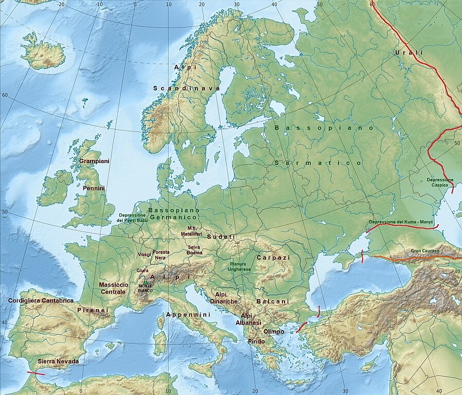
Italiano: Carta geografica con la localizzazione delle principali catene montuose, pianure e depressioni d'Europa |
| Date | Modifica effettuata il 6 novembre 2022, immagine originale caricata il 14 marzo 2010 |
| Source | modifica dell'immagine Europe relief laea location map.jpg, presente in Commons |
| Author | Immagine originale caricata su Commons dall'utente Alexrk2 - modifica effettuata da Giorgio Eusebio Petetti |
Licensing
I, the copyright holder of this work, hereby publish it under the following license:
This file is licensed under the Creative Commons Attribution-Share Alike 4.0 International, 3.0 Unported, 2.5 Generic, 2.0 Generic and 1.0 Generic license.
- You are free:
- to share – to copy, distribute and transmit the work
- to remix – to adapt the work
- Under the following conditions:
- attribution – You must give appropriate credit, provide a link to the license, and indicate if changes were made. You may do so in any reasonable manner, but not in any way that suggests the licensor endorses you or your use.
- share alike – If you remix, transform, or build upon the material, you must distribute your contributions under the same or compatible license as the original.
File history
Click on a date/time to view the file as it appeared at that time.
| Date/Time | Thumbnail | Dimensions | User | Comment | |
|---|---|---|---|---|---|
| current | 10:52, 26 March 2023 | | 1,580 × 1,351 (1.71 MB) | Iktsokh | Added an alternative line for the Greater Caucasus (highlighted in orange). |
| 17:15, 6 November 2022 |  | 1,580 × 1,351 (839 KB) | Giorgio Eusebio Petetti | Inserisco la localizzazione del Monte Bianco | |
| 16:49, 6 November 2022 |  | 1,580 × 1,351 (842 KB) | Giorgio Eusebio Petetti | {{Informazioni file |Descrizione = Carta geografica con la localizzazione delle principali catene montuose, pianure e depressioni d'Europa |Fonte = modifica dell'immagine [https://commons.wikimedia.org/wiki/File:Europe_relief_laea_location_map.jpg Europe relief laea location map.jpg], presente in Commons |Data = Modifica effettuata il 6 novembre 2022, immagine originale caricata il 14 marzo 2010 |Autore = Immagine originale caricata su Commons dall'utente Alexrk2 - modifica effettuata da Gior... |
File usage
No pages on the English Wikipedia use this file (pages on other projects are not listed).
Global file usage
The following other wikis use this file:
- Usage on it.wikipedia.org