
File:English administrative divisions 2010.svg

Size of this PNG preview of this SVG file: 494 × 600 pixels. Other resolutions: 198 × 240 pixels | 395 × 480 pixels | 633 × 768 pixels | 843 × 1,024 pixels | 1,687 × 2,048 pixels | 1,108 × 1,345 pixels.
Original file (SVG file, nominally 1,108 × 1,345 pixels, file size: 366 KB)
| This is a file from the Wikimedia Commons. Information from its description page there is shown below. Commons is a freely licensed media file repository. You can help. |
Summary
| Description |
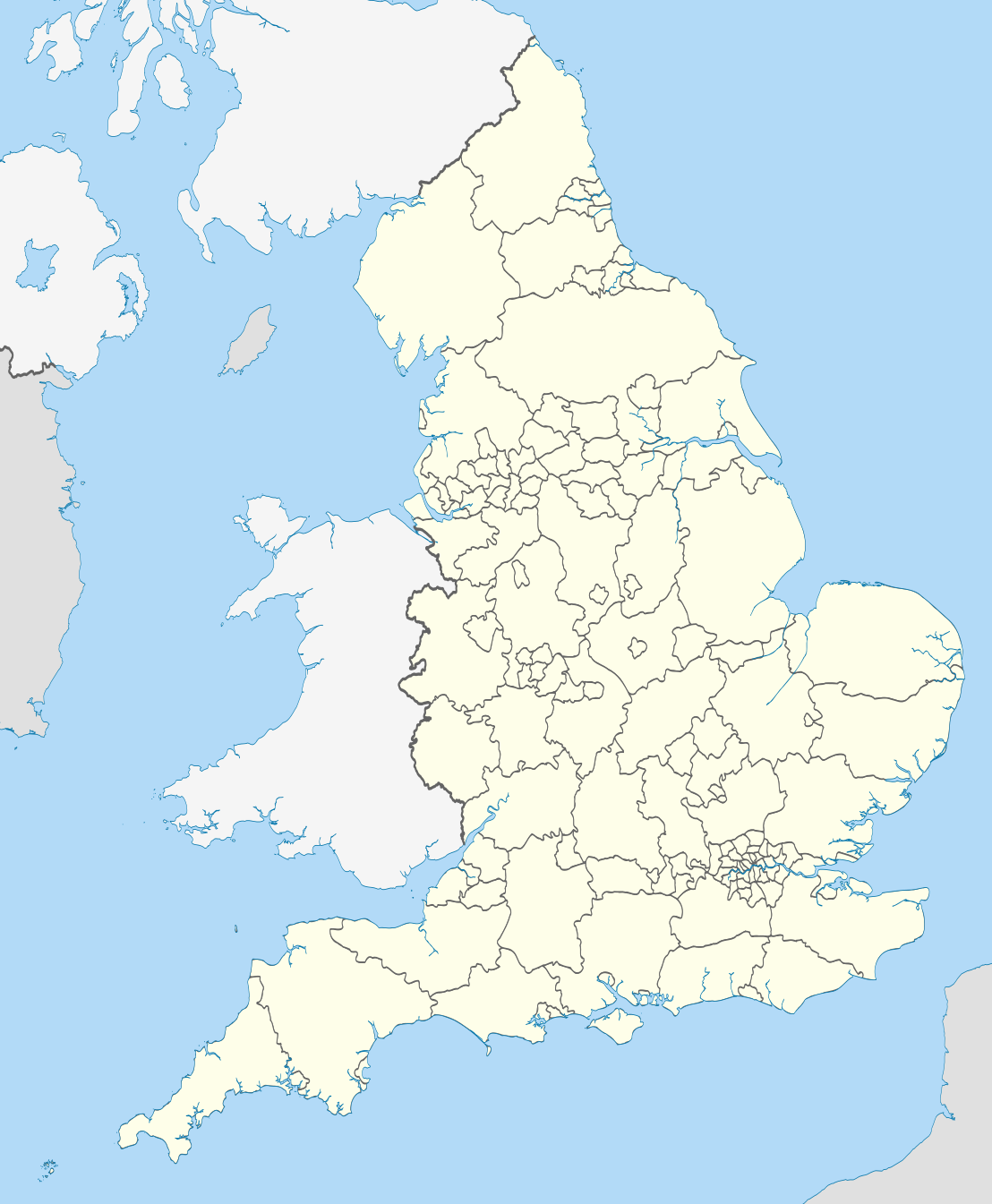
Map showing the all top-tier administrative subdivisions of England (shire counties, metropolitan counties, London boroughs and Unitary Authorities) in 2010 Equirectangular map projection on WGS 84 datum, with N/S stretched 170% Geographic limits:
|
| Date | |
| Source |
National Geospatial-Intelligence Agency
|
| Author | Nilfanion |
| Other versions |
Derivative works of this file: |
Licensing
I, the copyright holder of this work, hereby publish it under the following licenses:
This file is licensed under the Creative Commons Attribution-Share Alike 3.0 Unported license.
- You are free:
- to share – to copy, distribute and transmit the work
- to remix – to adapt the work
- Under the following conditions:
- attribution – You must give appropriate credit, provide a link to the license, and indicate if changes were made. You may do so in any reasonable manner, but not in any way that suggests the licensor endorses you or your use.
- share alike – If you remix, transform, or build upon the material, you must distribute your contributions under the same or compatible license as the original.

|
Permission is granted to copy, distribute and/or modify this document under the terms of the GNU Free Documentation License, Version 1.2 or any later version published by the Free Software Foundation; with no Invariant Sections, no Front-Cover Texts, and no Back-Cover Texts. A copy of the license is included in the section entitled GNU Free Documentation License. |
You may select the license of your choice.
File history
Click on a date/time to view the file as it appeared at that time.
| Date/Time | Thumbnail | Dimensions | User | Comment | |
|---|---|---|---|---|---|
| current | 22:02, 23 November 2010 | | 1,108 × 1,345 (366 KB) | Nilfanion | England only |
| 22:00, 23 November 2010 |  | 1,108 × 1,345 (401 KB) | Nilfanion | {{Information |Description=Map showing the all top-tier administrative subdivisions of England (shire counties, metropolitan counties, London boroughs and Unitary Authorities) in 2010 Equirectangular map projection on WGS 84 datum, with N/S stretched 170 |
File usage
No pages on the English Wikipedia use this file (pages on other projects are not listed).