
File:DoelMolen.jpg

Size of this preview: 451 × 599 pixels. Other resolutions: 181 × 240 pixels | 361 × 480 pixels | 578 × 768 pixels | 771 × 1,024 pixels | 2,144 × 2,848 pixels.
Original file (2,144 × 2,848 pixels, file size: 1.62 MB, MIME type: image/jpeg)
| This is a file from the Wikimedia Commons. Information from its description page there is shown below. Commons is a freely licensed media file repository. You can help. |
Summary
| Description |
|
||
| Date | |||
| Source | Own work | ||
| Author | Friedrich Tellberg |
| Camera location | | View this and other nearby images on: OpenStreetMap |
|---|
Licensing
I, the copyright holder of this work, hereby publish it under the following licenses:

|
Permission is granted to copy, distribute and/or modify this document under the terms of the GNU Free Documentation License, Version 1.2 or any later version published by the Free Software Foundation; with no Invariant Sections, no Front-Cover Texts, and no Back-Cover Texts. A copy of the license is included in the section entitled GNU Free Documentation License. |
| This file is licensed under the Creative Commons Attribution-Share Alike 3.0 Unported license. | ||
| ||
| This licensing tag was added to this file as part of the GFDL licensing update. |
You may select the license of your choice.
File history
Click on a date/time to view the file as it appeared at that time.
| Date/Time | Thumbnail | Dimensions | User | Comment | |
|---|---|---|---|---|---|
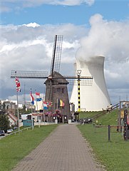
| current | 19:37, 8 August 2005 | | 2,144 × 2,848 (1.62 MB) | Friedrich Tellberg | Bild: Doel, Scheldedeich, Mühle aus dem 17. Jh. und Atomkraftwerk Fotograf: Friedrich Tellberg Datum: 7. August 2005 {{GFDL-self}} Category:Belgium Category:Cities and villages of Belgium |
| 19:36, 8 August 2005 |  | 2,144 × 2,848 (1.62 MB) | Friedrich Tellberg | Bild: Doel, Scheldedeich, Mühle aus dem 17. Jh. und Atomkraftwerk Fotograf: Friedrich Tellberg Datum: 7. August 2005 {{GFDL-self}} Category:Belgium Category:Cities and villages of Belgium |
File usage
The following pages on the English Wikipedia use this file (pages on other projects are not listed):
Global file usage
The following other wikis use this file:
- Usage on de.wikipedia.org
- Usage on eo.wikipedia.org
- Usage on eu.wikipedia.org
- Usage on id.wikipedia.org
- Usage on nl.wikipedia.org
- Usage on pt.wikipedia.org
- Usage on vi.wikipedia.org
- Usage on www.wikidata.org