
File:Denmark Street in 2010, by Martin Addison, geograph.org.uk 1957933.jpg
Size of this preview: 406 × 599 pixels. Other resolutions: 163 × 240 pixels | 325 × 480 pixels | 521 × 768 pixels | 1,085 × 1,600 pixels.
Original file (1,085 × 1,600 pixels, file size: 562 KB, MIME type: image/jpeg)
| This is a file from the Wikimedia Commons. Information from its description page there is shown below. Commons is a freely licensed media file repository. You can help. |
Summary
| Description |
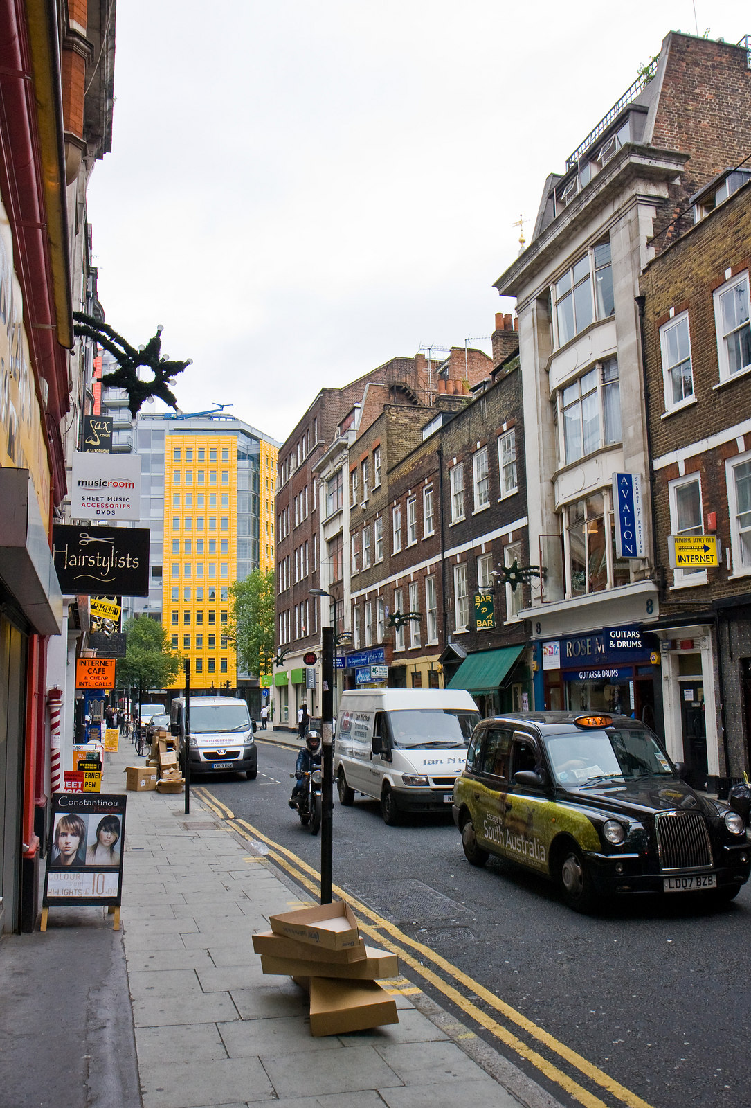
English: ;Denmark Street
This short road connecting St. Giles High Street with Charing Cross Road lies at the heart of London's music centre. Many of the shops sell instruments and sheet music. The cardboard boxes in the foreground provide evidence of a recent delivery of guitars. The bright yellow building at the end of the street is part of the Central St. Giles development. |
||
| Date | |||
| Source |
This file is licensed under the Creative Commons Attribution-Share Alike 2.0 Generic license. Attribution: Martin Addison
|
||
| Author | Geograph: Martin Addison | ||
| Other versions |
|
||
| Attribution (required by the license) | Martin Addison / Denmark Street / | ||


| Camera location | | View this and other nearby images on: OpenStreetMap |
|---|
Licensing
This file is licensed under the Creative Commons Attribution-Share Alike 2.0 Generic license.
- You are free:
- to share – to copy, distribute and transmit the work
- to remix – to adapt the work
- Under the following conditions:
- attribution – You must give appropriate credit, provide a link to the license, and indicate if changes were made. You may do so in any reasonable manner, but not in any way that suggests the licensor endorses you or your use.
- share alike – If you remix, transform, or build upon the material, you must distribute your contributions under the same or compatible license as the original.
File history
Click on a date/time to view the file as it appeared at that time.
| Date/Time | Thumbnail | Dimensions | User | Comment | |
|---|---|---|---|---|---|
| current | 11:53, 10 September 2017 | | 1,085 × 1,600 (562 KB) | Geograph Update Bot | Higher-resolution version from Geograph. |
| 02:06, 26 July 2013 |  | 434 × 640 (106 KB) | Clusternote | User created page with UploadWizard |
File usage
The following pages on the English Wikipedia use this file (pages on other projects are not listed):
Global file usage
The following other wikis use this file:
- Usage on ca.wikipedia.org
- Usage on fa.wikipedia.org
- Usage on fi.wikipedia.org
- Usage on fr.wikipedia.org
- Usage on it.wikipedia.org
- Usage on lv.wikipedia.org
- Usage on no.wikipedia.org
- Usage on www.wikidata.org
- Usage on zh.wikipedia.org