
File:Dürnkrut feld.jpg

Original file (2,014 × 2,620 pixels, file size: 2.94 MB, MIME type: image/jpeg)
| This is a file from the Wikimedia Commons. Information from its description page there is shown below. Commons is a freely licensed media file repository. You can help. |
Summary
| Description |
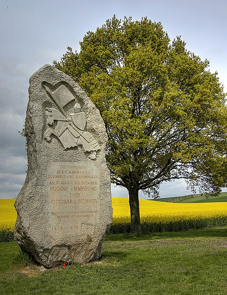
memorial: Battle on the Marchfeld Zur Erinnerung an die Schlacht bei Dürnkrut und Jedenspeigen am 26. August 1278 zwischen Rudolf v. Habsburg und Ottokar v. Böhmen Gewidmet von den Marktgemeinden Dürnkrut und Jedenspeigen 1278 - 1978 Dedicated by the market communities of Dürnkrut and Jedenspeigen 1278 - 1978] |
|||||||||||||||||
| Date | ||||||||||||||||||
| Source | Self-photographed by Doronenko, 13 April 2007 | |||||||||||||||||
| Author |
|
|||||||||||||||||

| Camera location | | View this and other nearby images on: OpenStreetMap |
|---|
Licensing
- Object
|
Freedom of Panorama This picture of an otherwise copyrighted work may be distributed under the conditions of § 54 (1) Z. 5 of the Austrian copyright law which allows to reproduce, distribute, and publish architectural works of an actual building or other works of visual arts which were created to permanently remain at a public place. Note: Due to the principle of Lex loci protectionis, this applies only to reuse of this picture in Austria. Reuse in other countries is subject to local law. Further information can be found on Commons and in German Wikipedia.
|
- Photograph

|
Permission is granted to copy, distribute and/or modify this document under the terms of the GNU Free Documentation License, Version 1.2 or any later version published by the Free Software Foundation; with no Invariant Sections, no Front-Cover Texts, and no Back-Cover Texts. A copy of the license is included in the section entitled GNU Free Documentation License. |
| This file is licensed under the Creative Commons Attribution-Share Alike 3.0 Unported license. | ||
| ||
| This licensing tag was added to this file as part of the GFDL licensing update. |
- You are free:
- to share – to copy, distribute and transmit the work
- to remix – to adapt the work
- Under the following conditions:
- attribution – You must give appropriate credit, provide a link to the license, and indicate if changes were made. You may do so in any reasonable manner, but not in any way that suggests the licensor endorses you or your use.
File history
Click on a date/time to view the file as it appeared at that time.
| Date/Time | Thumbnail | Dimensions | User | Comment | |
|---|---|---|---|---|---|
| current | 19:17, 24 August 2022 | | 2,014 × 2,620 (2.94 MB) | Doronenko | Reverted to version as of 14:23, 24 April 2016 (UTC) |
| 11:35, 24 August 2022 |  | 1,380 × 1,971 (1.36 MB) | Zemanst | improved graphicsů; repeat shot | |
| 14:23, 24 April 2016 |  | 2,014 × 2,620 (2.94 MB) | Doronenko | better version of my old picture of bad quality | |
| 01:50, 18 December 2011 |  | 500 × 752 (96 KB) | Rotatebot | Bot: Reset EXIF-specified Orientation of image (EXIF-Orientation set from 6 to 1 - EXIF had minor errors. Some EXIF could be lost. - , rotated 0°) | |
| 18:23, 13 April 2007 |  | 752 × 500 (96 KB) | Doronenko | {{Information |Description=Dürnkrut, a monument on the place of the battle between Ottokar II of Bohemia and Rudolf I of Habsburg (Battle of Dürnkrut and Jedenspeigen) |Source=self |Date=April 13, 2007 |Author=Stanislav Doronenko |Permission= |other_ver |
File usage
Global file usage
The following other wikis use this file:
- Usage on be.wikipedia.org
- Usage on cs.wikipedia.org
- Usage on de.wikipedia.org
- Usage on eo.wikipedia.org
- Usage on es.wikipedia.org
- Usage on fr.wikipedia.org
- Usage on it.wikipedia.org
- Usage on ja.wikipedia.org
- Usage on pl.wikipedia.org
- Usage on ro.wikipedia.org
- Usage on ru.wikipedia.org
- Usage on sk.wikipedia.org
- Usage on uk.wikipedia.org
- Usage on www.wikidata.org