
File:Cuyahoga County Airport Diagram, June 2018.svg

Size of this PNG preview of this SVG file: 445 × 599 pixels. Other resolutions: 178 × 240 pixels | 356 × 480 pixels | 570 × 768 pixels | 761 × 1,024 pixels | 1,521 × 2,048 pixels | 520 × 700 pixels.
Original file (SVG file, nominally 520 × 700 pixels, file size: 179 KB)
| This is a file from the Wikimedia Commons. Information from its description page there is shown below. Commons is a freely licensed media file repository. You can help. |
Summary
| Description |
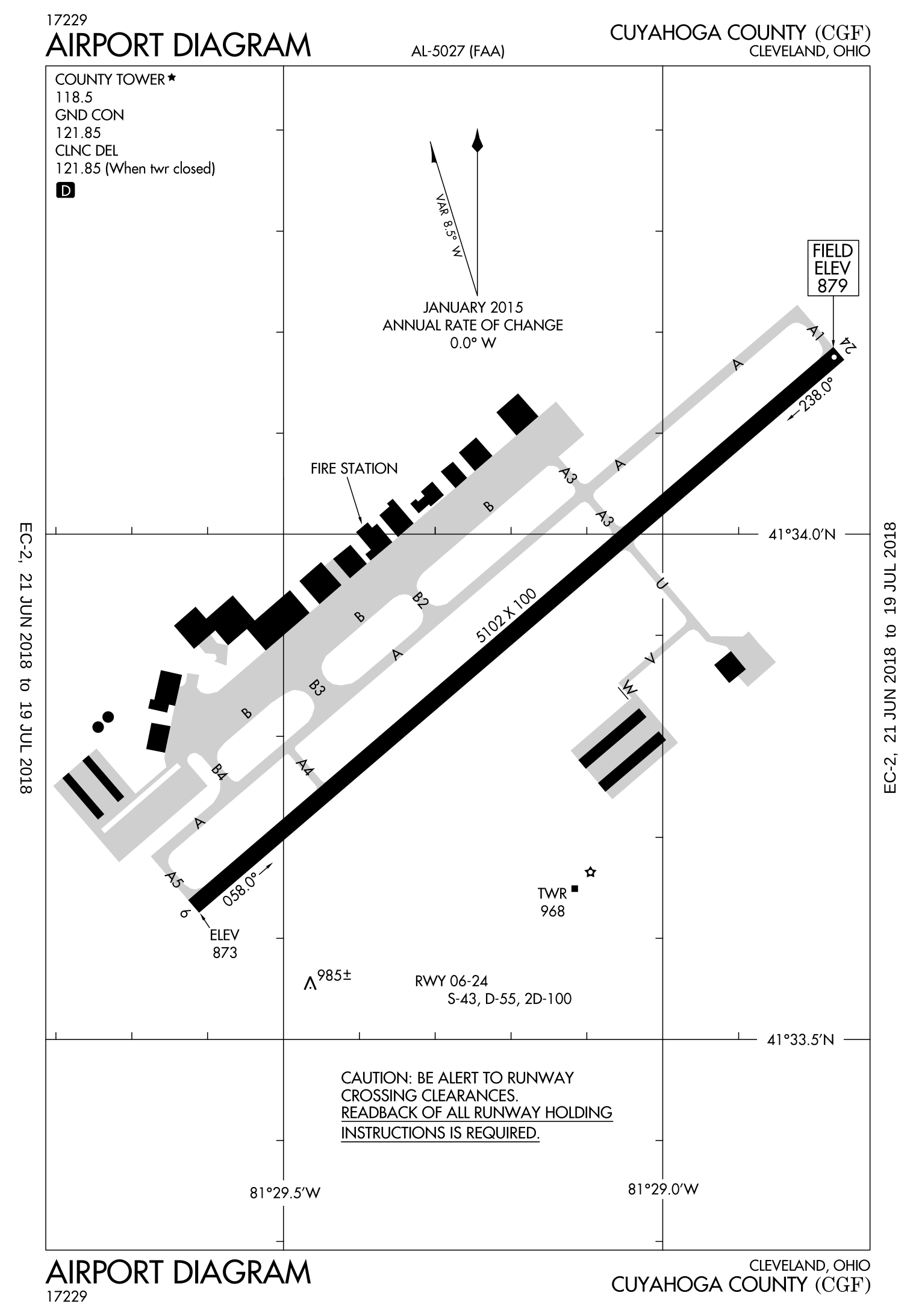
English: This is a diagram, provided by the FAA, that shows the layout of the Cuyahoga County airport. |
| Date | |
| Source | https://nfdc.faa.gov/nfdcApps/services/ajv5/airportDisplay.jsp?airportId=CGF |
| Author | Federal Aviation Administration |
| SVG development |
Licensing
| This image is a work of a United States Department of Transportation employee, taken or made as part of that person's official duties. As a work of the U.S. federal government, the image is in the public domain. |
File history
Click on a date/time to view the file as it appeared at that time.
| Date/Time | Thumbnail | Dimensions | User | Comment | |
|---|---|---|---|---|---|
| current | 04:50, 14 September 2023 | | 520 × 700 (179 KB) | Beao | Removed border |
| 20:12, 24 August 2023 |  | 765 × 990 (537 KB) | Smasongarrison | Reverted to version as of 20:55, 7 July 2018 (UTC) | |
| 20:09, 24 August 2023 |  | 765 × 990 (537 KB) | Smasongarrison | fixed view box // Editing SVG source code using c:User:Rillke/SVGedit.js | |
| 20:55, 7 July 2018 |  | 765 × 990 (537 KB) | W4otn | Uploading a public-domain item using File Upload Wizard |
File usage
The following pages on the English Wikipedia use this file (pages on other projects are not listed):
Global file usage
The following other wikis use this file:
- Usage on www.wikidata.org