
File:Chattanooga-1867-flood-tva1.jpg
Size of this preview: 532 × 600 pixels. Other resolutions: 213 × 240 pixels | 426 × 480 pixels | 847 × 955 pixels.
Original file (847 × 955 pixels, file size: 292 KB, MIME type: image/jpeg)
| This is a file from the Wikimedia Commons. Information from its description page there is shown below. Commons is a freely licensed media file repository. You can help. |
Summary
| Description |
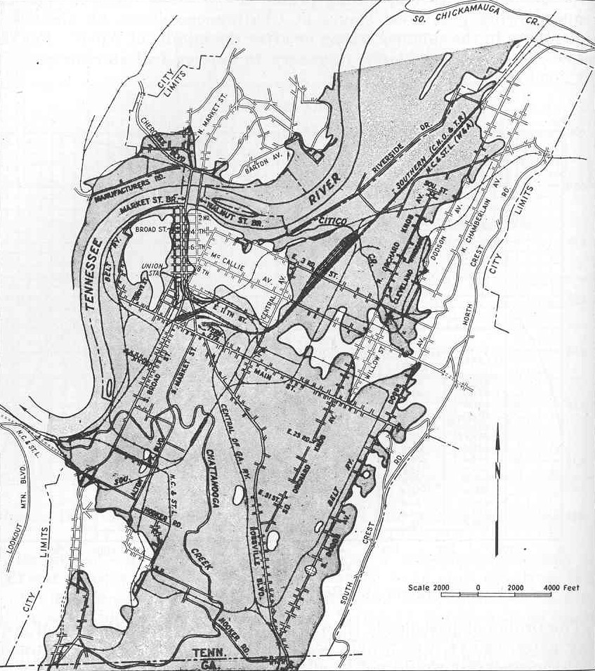
English: Shaded map showing the extent of the March 1867 flood in downtown Chattanooga, Tennessee, USA. Dam construction by the Tennessee Valley Authority in the upper Tennessee Valley in the 1930s and 1940s largely ended Chattanooga's persistent flood problems. |
| Date | |
| Source | Tennessee Valley Authority, The Chickamauga Project: A Comprehensive Report on the Planning, Design, Construction, and Initial Operations of the Chickamauga Project, Technical Report No. 6 (Knoxville, Tenn.: Tennessee Valley Authority, 1942), p. 36. |
| Author | Tennessee Valley Authority |
Licensing
| This image is a work of a United States Tennessee Valley Authority employee, taken or made as part of that person's official duties. As a work of the U.S. federal government, the image is in the public domain in the United States. |
File history
Click on a date/time to view the file as it appeared at that time.
| Date/Time | Thumbnail | Dimensions | User | Comment | |
|---|---|---|---|---|---|
| current | 14:50, 13 January 2009 | | 847 × 955 (292 KB) | BrineStans | {{Information |Description={{en|1=Shaded map showing the extent of the March 1867 flood in downtown Chattanooga, Tennessee, USA. Dam construction by the Tennessee Valley Authority in the upper Tennessee Valley in the 1930s and 1940s largely ended Chattan |
File usage
The following pages on the English Wikipedia use this file (pages on other projects are not listed):