
File:CapeHopeOverview.png

Size of this preview: 800 × 477 pixels. Other resolutions: 320 × 191 pixels | 640 × 382 pixels | 907 × 541 pixels.
Original file (907 × 541 pixels, file size: 59 KB, MIME type: image/png)
| This is a file from the Wikimedia Commons. Information from its description page there is shown below. Commons is a freely licensed media file repository. You can help. |
Summary
| Description |
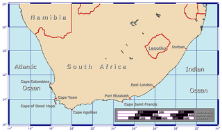
Afrikaans: Benamings van die kape aan die Suid-Afrikaanse kus
Generated using GMT. |
| Date | 28 January 2006 (original upload date) |
| Source | Own work |
| Author | Johantheghost |
Licensing
I, the copyright holder of this work, hereby publish it under the following licenses:

|
Permission is granted to copy, distribute and/or modify this document under the terms of the GNU Free Documentation License, Version 1.2 or any later version published by the Free Software Foundation; with no Invariant Sections, no Front-Cover Texts, and no Back-Cover Texts. A copy of the license is included in the section entitled GNU Free Documentation License. |
| This file is licensed under the Creative Commons Attribution-Share Alike 3.0 Unported license. | ||
| ||
| This licensing tag was added to this file as part of the GFDL licensing update. |
This file is licensed under the Creative Commons Attribution-Share Alike 2.5 Generic, 2.0 Generic and 1.0 Generic license.
- You are free:
- to share – to copy, distribute and transmit the work
- to remix – to adapt the work
- Under the following conditions:
- attribution – You must give appropriate credit, provide a link to the license, and indicate if changes were made. You may do so in any reasonable manner, but not in any way that suggests the licensor endorses you or your use.
- share alike – If you remix, transform, or build upon the material, you must distribute your contributions under the same or compatible license as the original.
You may select the license of your choice.
File history
Click on a date/time to view the file as it appeared at that time.
| Date/Time | Thumbnail | Dimensions | User | Comment | |
|---|---|---|---|---|---|
| current | 12:23, 9 February 2006 | | 907 × 541 (59 KB) | Johantheghost | Less violent colours. |
| 00:15, 29 January 2006 |  | 907 × 541 (59 KB) | Johantheghost | Scale at last... | |
| 23:48, 28 January 2006 |  | 907 × 541 (58 KB) | Johantheghost | ||
| 22:45, 28 January 2006 |  | 907 × 541 (58 KB) | Johantheghost | A map showing the location of the Cape of Good Hope and Cape Agulhas. Generated using [http://gmt.soest.hawaii.edu/ GMT]. |
File usage
The following pages on the English Wikipedia use this file (pages on other projects are not listed):
Global file usage
The following other wikis use this file:
- Usage on arc.wikipedia.org
- Usage on ar.wikipedia.org
- Usage on el.wikipedia.org
- Usage on hu.wikipedia.org
- Usage on ms.wikipedia.org
- Usage on ro.wikipedia.org
- Usage on sq.wikipedia.org
- Usage on sr.wikipedia.org
- Usage on zh-yue.wikipedia.org