
File:CQA Four Mile Bridge.jpg
Size of this preview: 753 × 600 pixels. Other resolutions: 301 × 240 pixels | 603 × 480 pixels | 964 × 768 pixels | 1,280 × 1,020 pixels | 2,560 × 2,039 pixels | 4,624 × 3,683 pixels.
Original file (4,624 × 3,683 pixels, file size: 1.88 MB, MIME type: image/jpeg)
| This is a file from the Wikimedia Commons. Information from its description page there is shown below. Commons is a freely licensed media file repository. You can help. |
|
This is an image of a place or building that is listed on the National Register of Historic Places in the United States of America. Its reference number is 85000423. |
| Camera location | | View this and other nearby images on: OpenStreetMap |
|---|
| Description |
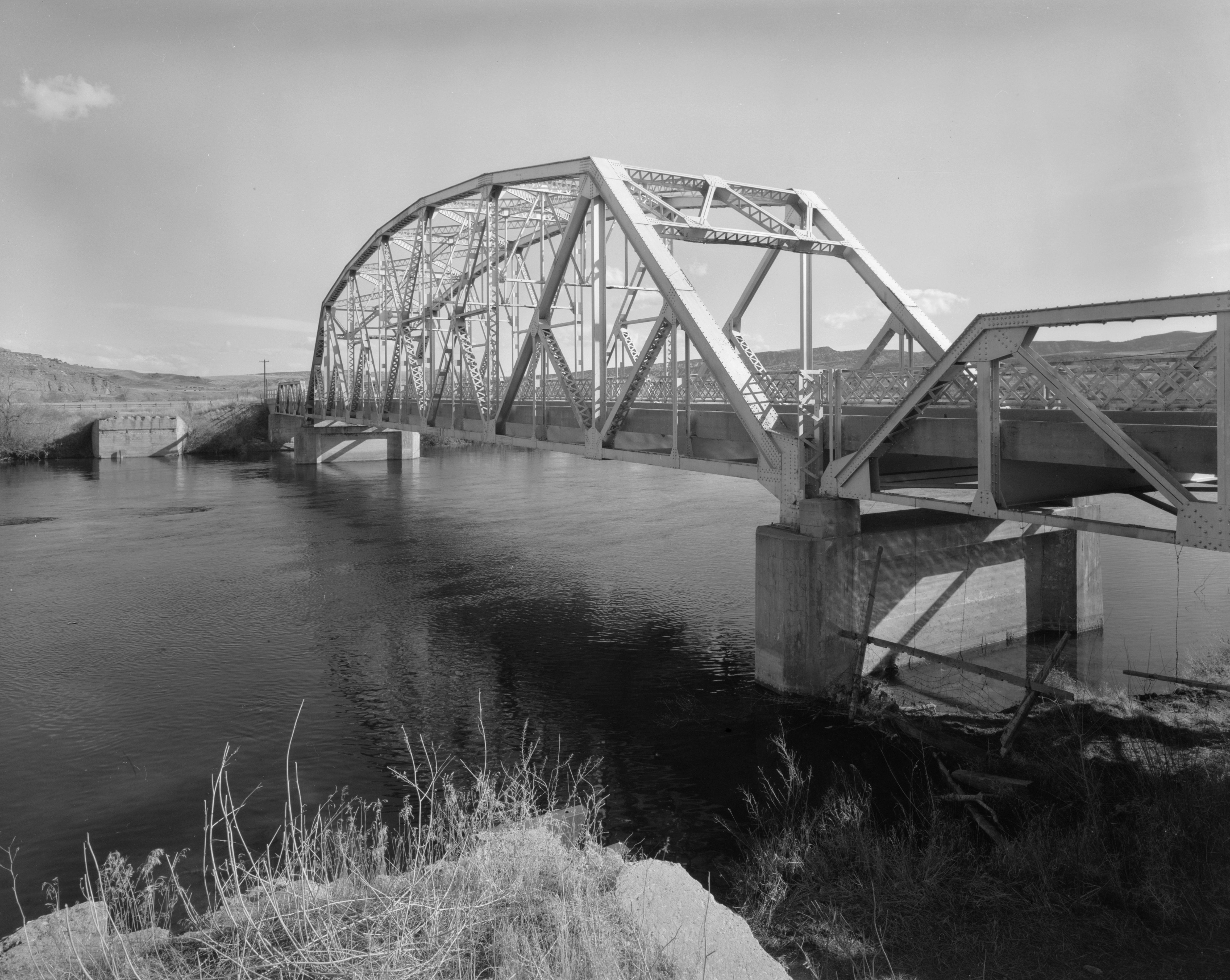
English: Eastern side of the CQA Four Mile Bridge, which carries WYO 173 over the Bighorn River near Thermopolis in Hot Springs County, Wyoming, United States. Built in 1927, this Pennsylvania through truss bridge is listed on the National Register of Historic Places. |
||||
| Date | |||||
| Source |
Library of Congress, Prints and Photograph Division HAER: WYO,9-THERM.V,2-1
|
||||
| Author | Clayton B. Fraser | ||||
| Permission (Reusing this file) |
|

File history
Click on a date/time to view the file as it appeared at that time.
| Date/Time | Thumbnail | Dimensions | User | Comment | |
|---|---|---|---|---|---|
| current | 16:14, 27 April 2009 | | 4,624 × 3,683 (1.88 MB) | Martin H. | high res; cropped |
| 15:18, 25 April 2009 |  | 1,024 × 820 (170 KB) | Nyttend | {{Location|43|36|13|N|108|11|48|W}} {{Information |Description={{en|Eastern side of the {{w|CQA Four Mile Bridge}}, which carries {{w|Wyoming Highway 173|WYO 173}} over the {{w|Bighorn River}} near {{w|Thermopolis, Wyoming|Thermopolis}} in {{w|Hot Springs |
File usage
The following pages on the English Wikipedia use this file (pages on other projects are not listed):
Global file usage
The following other wikis use this file:
- Usage on arz.wikipedia.org
- Usage on ca.wikipedia.org
- Usage on ceb.wikipedia.org
- Usage on da.wikipedia.org
- Usage on de.wikipedia.org
- Usage on no.wikipedia.org
- Usage on sv.wikipedia.org
- Usage on www.wikidata.org
- Usage on xmf.wikipedia.org