
File:Brooklyn Battery Tunnel Entrance Next to Whitehall Bulding, as Seen from Battery Park, Manhattan (7237078642).jpg

Original file (4,000 × 3,000 pixels, file size: 3.02 MB, MIME type: image/jpeg)
| This is a file from the Wikimedia Commons. Information from its description page there is shown below. Commons is a freely licensed media file repository. You can help. |
.jpg)
Summary
| Description |
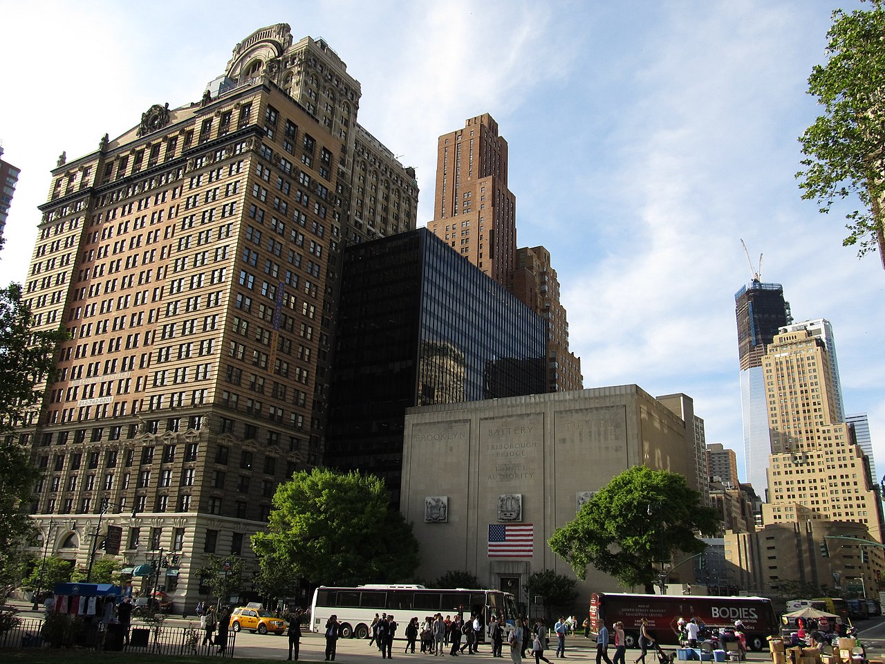
The Whitehall Building is a 20-story skyscraper located at 17 Battery Place, across the street from Battery Park in lower Manhattan in New York City. The original building was constructed from 1902-1904 as a speculative office building designed by architect Henry Hardenbergh. It was named for Peter Stuyvesant's 17th-century home, "White Hall", which had been located nearby. It was converted to apartments in 1999. <a href="http://en.wikipedia.org/wiki/Whitehall_Building" rel="nofollow">en.wikipedia.org/wiki/Whitehall_Building</a> The Brooklyn–Battery Tunnel, officially known as the Hugh L. Carey Tunnel, is a toll road in New York City which crosses under the East River at its mouth, connecting the Borough of Brooklyn on Long Island with the Borough of Manhattan. The tunnel nearly passes underneath Governors Island, but does not provide vehicular access to the island. It consists of twin tubes, carrying four traffic lanes, and at 9,117 feet (2,779 m) is the longest continuous underwater vehicular tunnel in North America. It was opened to traffic in 1950. It currently carries the unsigned Interstate 478, and formerly carried New York State Route 27A. <a href="http://en.wikipedia.org/wiki/Brooklyn_Battery_Tunnel" rel="nofollow">en.wikipedia.org/wiki/Brooklyn_Battery_Tunnel</a> <a href="http://en.wikipedia.org/wiki/Wikipedia:Text_of_Creative_Commons_Attribution-ShareAlike_3.0_Unported_License" rel="nofollow">en.wikipedia.org/wiki/Wikipedia:Text_of_Creative_Commons_...</a> |
| Date | |
| Source | Brooklyn Battery Tunnel Entrance Next to Whitehall Bulding, as Seen from Battery Park, Manhattan |
| Author | Ken Lund from Reno, Nevada, USA |
| Camera location | | View this and other nearby images on: OpenStreetMap |
|---|
.jpg¶ms=040.704298_N_-074.014849_E_globe:Earth_type:camera_source:Flickr_&language=en)
Licensing
- You are free:
- to share – to copy, distribute and transmit the work
- to remix – to adapt the work
- Under the following conditions:
- attribution – You must give appropriate credit, provide a link to the license, and indicate if changes were made. You may do so in any reasonable manner, but not in any way that suggests the licensor endorses you or your use.
- share alike – If you remix, transform, or build upon the material, you must distribute your contributions under the same or compatible license as the original.
| This image was originally posted to Flickr by Ken Lund at https://flickr.com/photos/75683070@N00/7237078642 (archive). It was reviewed on 11 December 2019 by FlickreviewR 2 and was confirmed to be licensed under the terms of the cc-by-sa-2.0. |
| Annotations | This image is annotated: View the annotations at Commons |
File history
Click on a date/time to view the file as it appeared at that time.
| Date/Time | Thumbnail | Dimensions | User | Comment | |
|---|---|---|---|---|---|
| current | 13:18, 11 December 2019 | | 4,000 × 3,000 (3.02 MB) | Drabdullayev17 | Transferred from Flickr via #flickr2commons |
.jpg)