
File:Braun - map of Cambridge.jpg
Size of this preview: 768 × 600 pixels. Other resolutions: 307 × 240 pixels | 615 × 480 pixels | 983 × 768 pixels | 1,280 × 1,000 pixels | 2,329 × 1,819 pixels.
Original file (2,329 × 1,819 pixels, file size: 1.47 MB, MIME type: image/jpeg)
| This is a file from the Wikimedia Commons. Information from its description page there is shown below. Commons is a freely licensed media file repository. You can help. |
Summary
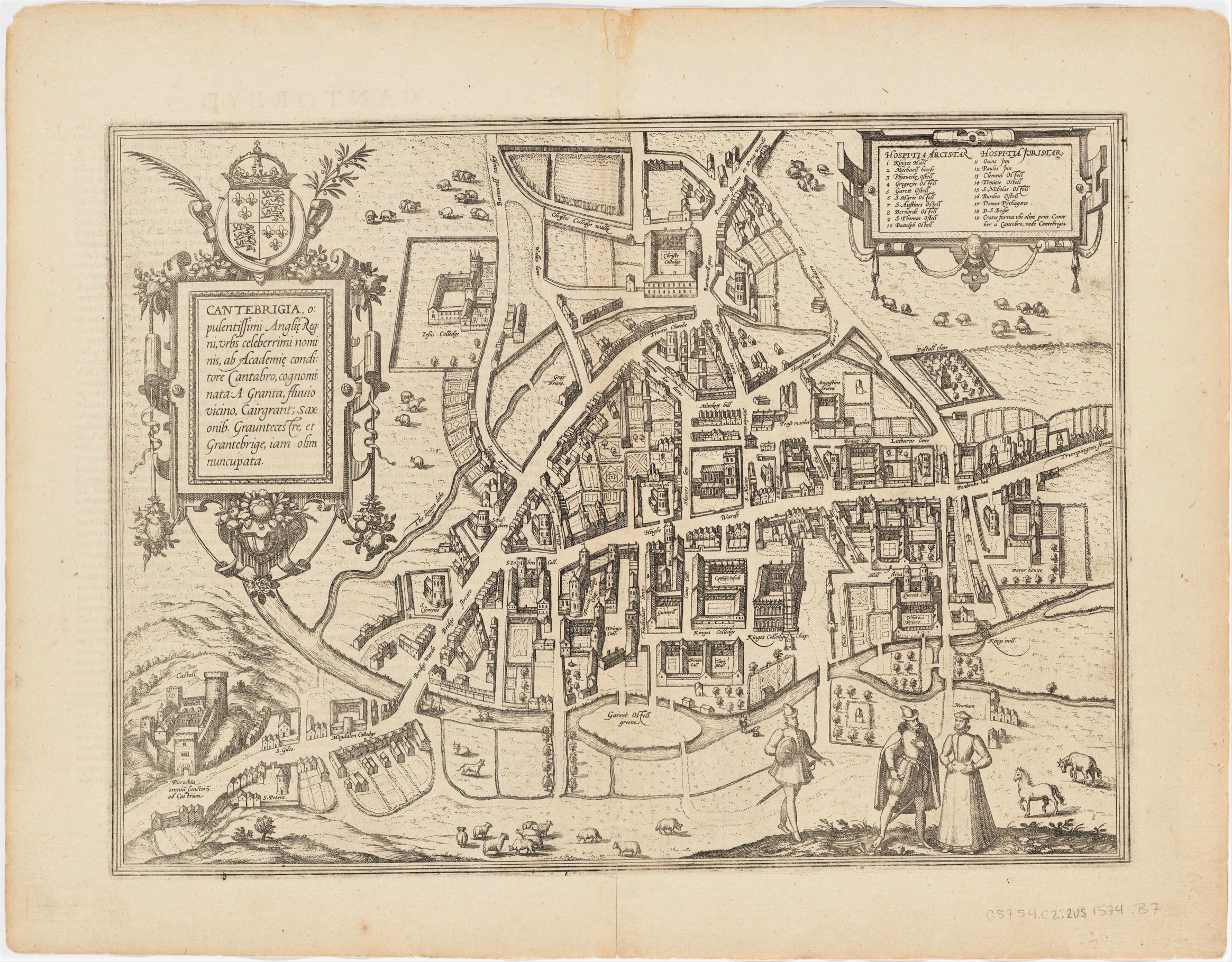
| Georg Braun: English: Cantebrigia: opulentissimi Angliae Regni urbs celeberrimi nominis ab Academiae conditore Cantabro cognominata a granta fluuio vicino cairgrant saxonib Grauntecestre et Grantebrige iam olim nuncupata
( |
|||||||||||||||||||||||
|---|---|---|---|---|---|---|---|---|---|---|---|---|---|---|---|---|---|---|---|---|---|---|---|
| Artist |
|
||||||||||||||||||||||
| Title |
English: Cantebrigia: opulentissimi Angliae Regni urbs celeberrimi nominis ab Academiae conditore Cantabro cognominata a granta fluuio vicino cairgrant saxonib Grauntecestre et Grantebrige iam olim nuncupata |
||||||||||||||||||||||
| Object type | map | ||||||||||||||||||||||
| Date | Unknown date | ||||||||||||||||||||||
| Collection | Harvard University, Harvard Map Collection | ||||||||||||||||||||||
| Notes | Published by George Braun & Franz Hogenberg | ||||||||||||||||||||||
| References | G5754_C2_2U5_1574_B7_6781224025 | ||||||||||||||||||||||
| Source/Photographer | link to Harvard Map Collection | ||||||||||||||||||||||
| Permission (Reusing this file) |
|
||||||||||||||||||||||
Licensing
This file is licensed under the Creative Commons Attribution-Share Alike 4.0 International license.
- You are free:
- to share – to copy, distribute and transmit the work
- to remix – to adapt the work
- Under the following conditions:
- attribution – You must give appropriate credit, provide a link to the license, and indicate if changes were made. You may do so in any reasonable manner, but not in any way that suggests the licensor endorses you or your use.
- share alike – If you remix, transform, or build upon the material, you must distribute your contributions under the same or compatible license as the original.
File history
Click on a date/time to view the file as it appeared at that time.
| Date/Time | Thumbnail | Dimensions | User | Comment | |
|---|---|---|---|---|---|
| current | 17:02, 19 November 2020 | | 2,329 × 1,819 (1.47 MB) | Amitchell125 | Uploaded a work by Braun, Georg from Harvard - https://www.oldmapsonline.org/map/harvard/10684581 with UploadWizard |
File usage
The following pages on the English Wikipedia use this file (pages on other projects are not listed):