
File:Boundary Stone (District of Columbia) NE 2.jpg

Size of this preview: 450 × 600 pixels. Other resolutions: 180 × 240 pixels | 360 × 480 pixels | 576 × 768 pixels | 768 × 1,024 pixels | 1,301 × 1,734 pixels.
Original file (1,301 × 1,734 pixels, file size: 620 KB, MIME type: image/jpeg)
| This is a file from the Wikimedia Commons. Information from its description page there is shown below. Commons is a freely licensed media file repository. You can help. |
_NE_2.jpg)
|
This is an image of a place or building that is listed on the National Register of Historic Places in the United States of America. Its reference number is 96001257. |
| Description |
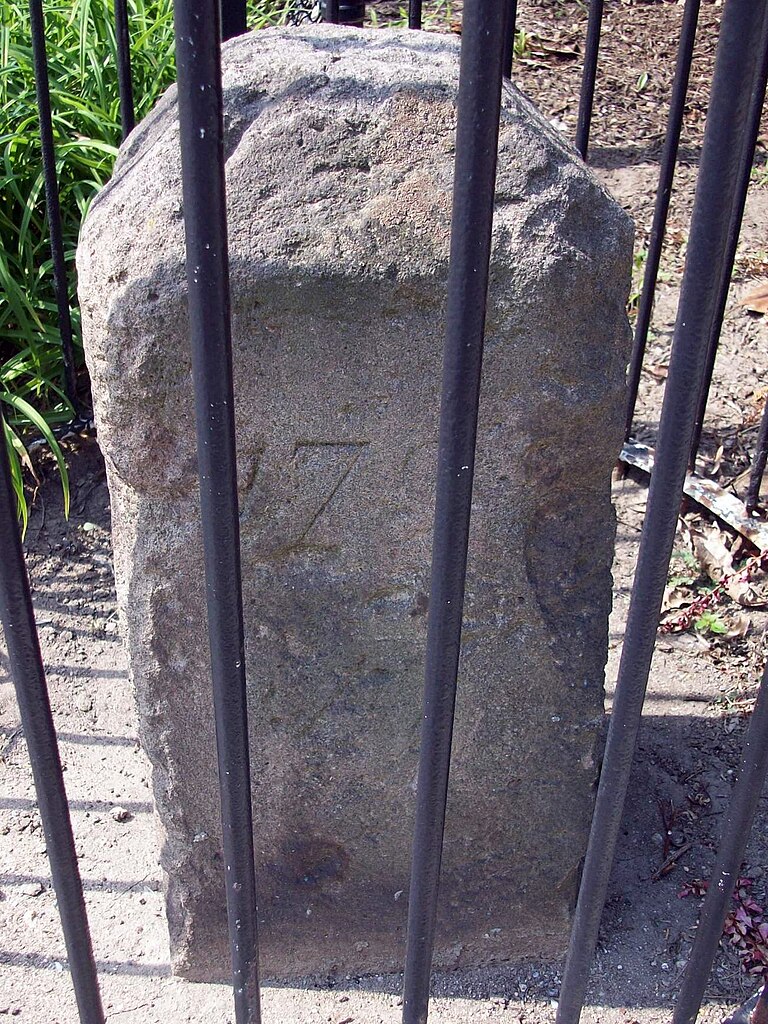
Boundary Stone NE 2 between the District of Columbia and Takoma Park, Maryland (6980 Maple Street NW} Boundary Stone |
| Date | |
| Source | Flickr |
| Author | Bruce Andersen from Washington, DC |
| Permission (Reusing this file) |
This file is licensed under the Creative Commons Attribution-Share Alike 2.0 Generic license.
|
| This image was originally posted to Flickr by evrik at https://www.flickr.com/photos/12087947@N00/4936546126. It was reviewed on 03:15, 29 August 2010 (UTC) by FlickreviewR, who found it to be licensed under the terms of the cc-by-sa-2.0, which is compatible with the Commons. It is, however, not the same license as specified on upload, which was the cc-by-sa, and it is unknown whether that license ever was valid. |
| Camera location | | View this and other nearby images on: OpenStreetMap |
|---|
_NE_2.jpg¶ms=038.975366_N_-077.014589_E_globe:Earth_type:camera__&language=en)
File history
Click on a date/time to view the file as it appeared at that time.
| Date/Time | Thumbnail | Dimensions | User | Comment | |
|---|---|---|---|---|---|
| current | 03:08, 29 August 2010 | | 1,301 × 1,734 (620 KB) | Evrik | {{Flickr |description=Boundary Stone between the District of Columbia and Takoma Park, Maryland (6980 Maple Street NW} |flickr_url=http://www.flickr.com/photo |
File usage
The following pages on the English Wikipedia use this file (pages on other projects are not listed):
Global file usage
The following other wikis use this file:
- Usage on ca.wikipedia.org
- Usage on www.wikidata.org
_NE_2.jpg)