
File:Bodenehr schiltach.jpg
Original file (2,783 × 2,057 pixels, file size: 1.52 MB, MIME type: image/jpeg)
| This is a file from the Wikimedia Commons. Information from its description page there is shown below. Commons is a freely licensed media file repository. You can help. |
Summary
| Description |
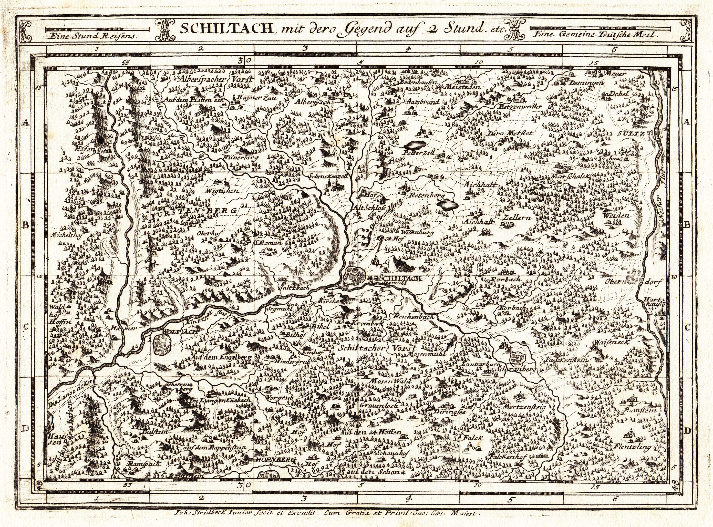
Deutsch: Karte Schiltach, mit dero Gegend auf 2 Stund etc. aus Atlas Curieux oder Neuer und Compendieuser Atlas [..…], herausgegeben und verlegt von Gabriel Bodenehr, Augsburg ca. 1716. Sie zeigt das Obere Kinzigtal im Schwarzwald. Bodenehrs Karte hatte vor allem den Zweck, Reisenden eine ungefähre Vorstellung über Entfernungsangaben zu machen. Daher ist der Kupferstich seines Mitarbeiters Stridbeck junior (siehe lateinischer Urheberhinweis im unteren Teil der Karte) für unser heutiges Verständnis auch nicht sehr exakt und enthält Fehler. Auch ältere Karten des Gebietes sind weit genauer. So wurde beispielsweise die Wolf am linken Bildrand mit dem Harmersbach ("Hamer") verwechselt, der sich in Wirklichkeit aber viel weiter westlich befindet. |
| Date | circa 1716 |
| Source | Atlas Curieux oder Neuer und Compendieuser Atlas in welchem ausser dem General Land Charten von AMERICA, AFRIKA, ASIA und EUROPA, und der in letzterem gelegenen Reichen und Ländern, sehr viele speziale von besonderen Provincien und Territorien, Sonderlich deren, die in letzten Kriegen renommiert worden, enthalten sind. |
| Author | Gabriel Bodenehr, Scan des Originals von Eribula. |
| Permission (Reusing this file) |
Gemeinfrei, da Urheber schon länger als 70 Jahre tot. |
Licensing
|
This work is in the public domain in its country of origin and other countries and areas where the copyright term is the author's life plus 70 years or fewer.
| |
| This file has been identified as being free of known restrictions under copyright law, including all related and neighboring rights. | |
Original upload log
Transferred from de.wikipedia to Commons by Ireas using CommonsHelper.
- 2009-05-14 19:33 Eribula 2783×2057× (1590976 bytes) {{Information |Beschreibung = Karte aus "Atlas Curieux oder Neuer und Compendieuser Atlas in welchem ausser dem General Land Charten von AMERICA, AFRIKA, ASIA und EUROPA, und der in letzterem gelegenen Reichen und Ländern, sehr viele speziale von besonde
File history
Click on a date/time to view the file as it appeared at that time.
| Date/Time | Thumbnail | Dimensions | User | Comment | |
|---|---|---|---|---|---|
| current | 01:26, 15 September 2010 | | 2,783 × 2,057 (1.52 MB) | File Upload Bot (Magnus Manske) | {{BotMoveToCommons|de.wikipedia|year={{subst:CURRENTYEAR}}|month={{subst:CURRENTMONTHNAME}}|day={{subst:CURRENTDAY}}}} {{Information |Description={{de|Karte ''de:Schiltach, mit dero Gegend auf 2 Stund etc.'' aus ''Atlas Curieux oder Neuer und Compe |
File usage
Global file usage
The following other wikis use this file:
- Usage on azb.wikipedia.org
- Usage on de.wikipedia.org
- Usage on uk.wikipedia.org