
File:Big Black River Railroad Bridge.jpg
Size of this preview: 800 × 560 pixels. Other resolutions: 320 × 224 pixels | 640 × 448 pixels | 1,024 × 717 pixels | 1,280 × 896 pixels | 2,560 × 1,792 pixels | 4,571 × 3,199 pixels.
Original file (4,571 × 3,199 pixels, file size: 1.08 MB, MIME type: image/jpeg)
| This is a file from the Wikimedia Commons. Information from its description page there is shown below. Commons is a freely licensed media file repository. You can help. |
|
This is an image of a place or building that is listed on the National Register of Historic Places in the United States of America. Its reference number is 88002418. |
| Camera location | | View this and other nearby images on: OpenStreetMap |
|---|
| Description |
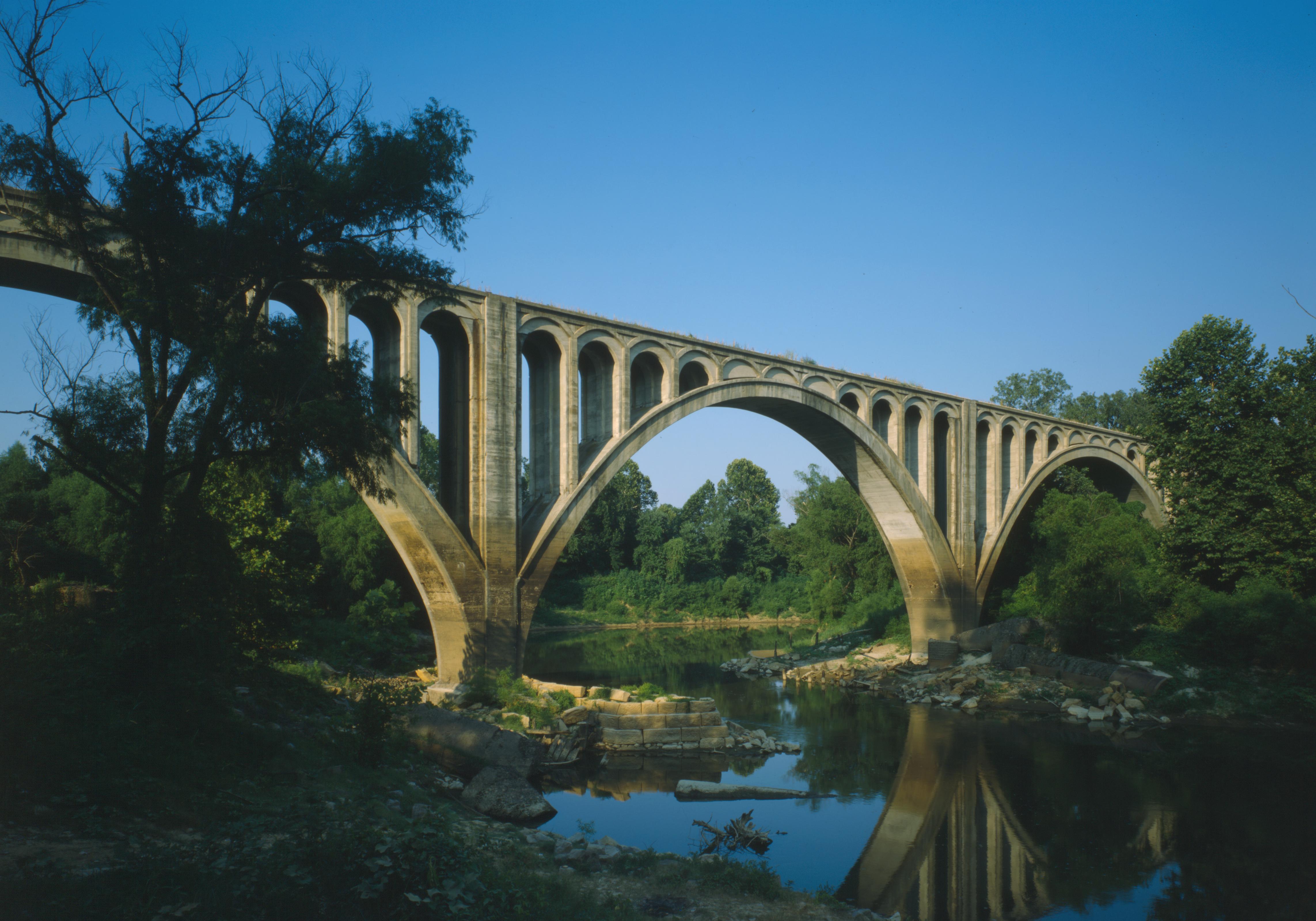
English: Southern (downstream) side of the Big Black River Railroad Bridge, which carries an Illinois Central railroad line over the Big Black River east of Bovina across the Hinds/Warren county line in the U.S. state of Mississippi. Built in 1917, this open-spandrel concrete deck arch bridge is listed on the National Register of Historic Places. |
|||||||||||||||||||||||
| Date | ||||||||||||||||||||||||
| Source | Library of Congress, Prints and Photograph Division HAER: MISS,75-BOVI.V,1-6 | |||||||||||||||||||||||
| Author |
|
|||||||||||||||||||||||
| Permission (Reusing this file) |
|
|||||||||||||||||||||||
.jpg)

|
This image is available from the United States Library of Congress's Prints and Photographs division
under the digital ID hhh.ms0290. This tag does not indicate the copyright status of the attached work. A normal copyright tag is still required. See Commons:Licensing.
|
File history
Click on a date/time to view the file as it appeared at that time.
| Date/Time | Thumbnail | Dimensions | User | Comment | |
|---|---|---|---|---|---|
| current | 18:51, 25 January 2010 | | 4,571 × 3,199 (1.08 MB) | Nyttend | {{Location|32|20|49|N|90|42|17|W}} {{Information |Description={{en|Southern (downstream) side of the {{w|Big Black River Railroad Bridge}}, which carries an {{w|Illinois Central Railroad|Illinois Central}} railroad line over the {{w|Big Black River}} east |
File usage
The following pages on the English Wikipedia use this file (pages on other projects are not listed):
Global file usage
The following other wikis use this file:
- Usage on ar.wikipedia.org
- Usage on arz.wikipedia.org
- Usage on ceb.wikipedia.org
- Usage on cs.wikipedia.org
- Usage on de.wikipedia.org
- Usage on no.wikipedia.org
- Usage on pl.wikipedia.org
- Usage on www.wikidata.org