
File:Beverungen Weserbergland.jpg

Size of this preview: 800 × 600 pixels. Other resolutions: 320 × 240 pixels | 640 × 480 pixels | 1,024 × 768 pixels | 1,280 × 960 pixels | 2,560 × 1,920 pixels | 2,816 × 2,112 pixels.
Original file (2,816 × 2,112 pixels, file size: 2.49 MB, MIME type: image/jpeg)
| This is a file from the Wikimedia Commons. Information from its description page there is shown below. Commons is a freely licensed media file repository. You can help. |
Summary
| Description |
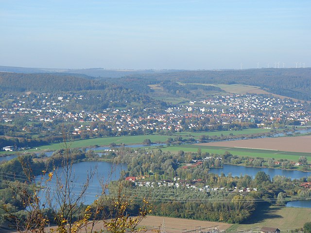
Deutsch: Beverungen, Weserbergland |
| Date | Taken on 22 October 2006 |
| Source | Self-photographed |
| Author | Theonly1 |
| Camera location | | View this and other nearby images on: OpenStreetMap |
|---|
Licensing
Theonly1, the copyright holder of this work, hereby publishes it under the following license:

|
Permission is granted to copy, distribute and/or modify this document under the terms of the GNU Free Documentation License, Version 1.2 or any later version published by the Free Software Foundation; with no Invariant Sections, no Front-Cover Texts, and no Back-Cover Texts. A copy of the license is included in the section entitled GNU Free Documentation License. |
| This file is licensed under the Creative Commons Attribution-Share Alike 3.0 Unported license. | ||
| Attribution: Theonly1 | ||
| ||
| This licensing tag was added to this file as part of the GFDL licensing update. |
Original upload log
Transferred from de.wikipedia to Commons by Ludger1961.
The original description page was here. All following user names refer to de.wikipedia.
- 2007-10-14 17:59 Theonly1 2816×2112 (2612376 bytes) {{Information |Beschreibung = Beverungen, Blick in nördliche Richtung |Quelle = selbst fotografiert |Urheber = ~~~ |Datum = 2007-10-14 |Genehmigung = |Andere Versionen = |Anmerkungen = }}
- 2006-10-23 18:39 Theonly1 2048×1536 (1318685 bytes) {{Information |Beschreibung=Beverungen, Weserbergland |Quelle=selbst fotografiert |Urheber=Theo Mennekes ~~~ |Datum=2006-10-22 |Genehmigung= |Andere Versionen= |Anmerkungen=Blick auf Beverungen in nördliche Richtung }}
File history
Click on a date/time to view the file as it appeared at that time.
| Date/Time | Thumbnail | Dimensions | User | Comment | |
|---|---|---|---|---|---|
| current | 00:02, 11 February 2008 | | 2,816 × 2,112 (2.49 MB) | Ludger1961 | {{Information |Description={{de|Beverungen, Weserbergland}} |Source=Transferred from [http://de.wikipedia.org de.wikipedia]; Transfer was stated to be made by ludger1961.<br/> (Original text : ''selbst fotografiert'') |Date=2006-10-23 |
File usage
The following pages on the English Wikipedia use this file (pages on other projects are not listed):
Global file usage
The following other wikis use this file:
- Usage on ar.wikipedia.org
- Usage on azb.wikipedia.org
- Usage on be.wikipedia.org
- Usage on bg.wikipedia.org
- Usage on ca.wikipedia.org
- Usage on ceb.wikipedia.org
- Usage on ce.wikipedia.org
- Usage on da.wikipedia.org
- Usage on de.wikipedia.org
- Usage on de.wikivoyage.org
- Usage on de.wiktionary.org
- Usage on eo.wikipedia.org
- Usage on es.wikipedia.org
- Usage on et.wikipedia.org
- Usage on eu.wikipedia.org
- Usage on fa.wikipedia.org
- Usage on fi.wikipedia.org
- Usage on fr.wikipedia.org
- Usage on hu.wikipedia.org
- Usage on it.wikipedia.org
- Usage on it.wikivoyage.org
- Usage on ku.wikipedia.org
- Usage on ky.wikipedia.org
- Usage on lld.wikipedia.org
- Usage on mk.wikipedia.org
- Usage on nl.wikipedia.org
- Usage on nn.wikipedia.org
- Usage on no.wikipedia.org
- Usage on pl.wikipedia.org
- Usage on pl.wiktionary.org
- Usage on pt.wikipedia.org
- Usage on ro.wikipedia.org
- Usage on ru.wikipedia.org
- Usage on sr.wikipedia.org
- Usage on sv.wikipedia.org
- Usage on tr.wikipedia.org
- Usage on tt.wikipedia.org
- Usage on uk.wikipedia.org
- Usage on uz.wikipedia.org
- Usage on www.wikidata.org
- Usage on zh.wikipedia.org