
File:Antigua and Barbuda location map.svg

Size of this PNG preview of this SVG file: 521 × 599 pixels. Other resolutions: 209 × 240 pixels | 417 × 480 pixels | 667 × 768 pixels | 890 × 1,024 pixels | 1,780 × 2,048 pixels | 864 × 994 pixels.
Original file (SVG file, nominally 864 × 994 pixels, file size: 135 KB)
| This is a file from the Wikimedia Commons. Information from its description page there is shown below. Commons is a freely licensed media file repository. You can help. |
| Description |
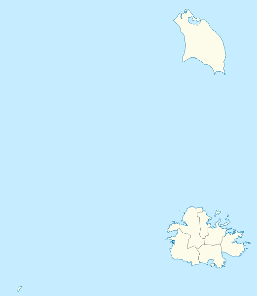
Deutsch: Positionskarte von Antigua und Barbuda. Geographische Begrenzungen der Karte:
English: Location map of Antigua and Barbuda. Geographic limits of the map:
|
| Date | |
| Source | Own work using: OpenStreetMap data for the coastlines |
| Author |
Graphic made by Carport |
| Other versions |
_location_map.svg) |
| SVG development | This map was created with Adobe Illustrator. |
Licensing
This file is licensed under the Creative Commons Attribution-Share Alike 2.0 Generic license.
- You are free:
- to share – to copy, distribute and transmit the work
- to remix – to adapt the work
- Under the following conditions:
- attribution – You must give appropriate credit, provide a link to the license, and indicate if changes were made. You may do so in any reasonable manner, but not in any way that suggests the licensor endorses you or your use.
- share alike – If you remix, transform, or build upon the material, you must distribute your contributions under the same or compatible license as the original.
File history
Click on a date/time to view the file as it appeared at that time.
| Date/Time | Thumbnail | Dimensions | User | Comment | |
|---|---|---|---|---|---|
| current | 17:25, 21 October 2013 | | 864 × 994 (135 KB) | TUBS | +subdivisions |
| 19:58, 23 November 2009 |  | 1,080 × 1,243 (182 KB) | Carport | {{Information |Description={{de|1=Positionskarte von {{w|Antigua und Barbuda|3=de}}. Geographische Begrenzungen der Karte: * N: 17.755° N * S: 16.919° N * W: 62.4° W * E: 61.639° W}} {{en|1=Location map of {{w|Antigua and Barbuda}}. Geographic limits |
File usage
The following pages on the English Wikipedia use this file (pages on other projects are not listed):
- Antigua and Barbuda
- Barbuda Codrington Airport
- Bendals
- Betty's Hope
- Boon Point
- Buckleys
- Cape Shirley
- Cedar Grove, Antigua and Barbuda
- Clarkes Hill, Antigua and Barbuda
- Coco Point Lodge Airstrip
- Codrington, Barbuda
- Coolidge, Antigua and Barbuda
- Crabs Hill
- Devil's Bridge (Antigua and Barbuda)
- Diamonds, Antigua and Barbuda
- Falmouth, Antigua and Barbuda
- Falmouth Harbour
- Five Island Harbour
- Freemans, Antigua and Barbuda
- Freetown, Antigua and Barbuda
- Glanvilles
- Golden Grove, St. John's
- Gravenor Bay
- Great Bird Island (Antigua and Barbuda)
- Green Island (Antigua and Barbuda)
- Guiana Island
- Indian Town Point
- Jennings, Antigua and Barbuda
- John Hughes, Antigua and Barbuda
- Johnsons Point
- Liberta, Antigua and Barbuda
- List of Caribbean islands
- List of World Heritage Sites in Antigua and Barbuda
- List of cricket grounds in the West Indies
- Long Island (Antigua and Barbuda)
- Maiden Island (Antigua and Barbuda)
- Mercers Creek Bay
- New Winthorpes
- Newfield, Antigua and Barbuda
- Nonsuch Bay, Antigua and Barbuda
- Old Road, Antigua and Barbuda
- Pares, Antigua and Barbuda
- Parham, Antigua and Barbuda
- Piggotts
- Sawcolts
- Sea View Farm
- Seatons (village)
- St. Philip's, Antigua and Barbuda
- Swetes
- V. C. Bird International Airport
- Villa, St. John's
- Willikies
- Yeptons
- York Island (Antigua and Barbuda)
- User:CROIX/John Hughes
- User:CROIX/List of capital cities of Antigua and Barbuda
- User:CROIX/New Barbuda Airport
- User:CROIX/Old Road
- User:CROIX/Pares/rewrite
- User:CROIX/parhamrewrite
- User:ChampsRT/SandBox
- User talk:Gene Poole/sandbox
- Module:Location map/data/Antigua and Barbuda
- Module:Location map/data/Antigua and Barbuda/doc
Global file usage
The following other wikis use this file:
- Usage on af.wikipedia.org
- Usage on an.wikipedia.org
- Usage on ar.wikipedia.org
- Usage on ast.wikipedia.org
- Usage on ay.wikipedia.org
- Usage on az.wikipedia.org
- Usage on be.wikipedia.org
- Usage on bg.wikipedia.org
- Usage on bn.wikipedia.org
- Usage on bs.wikipedia.org
- Usage on ceb.wikipedia.org
- Plantilya:Location map Antigua and Barbuda
- York Island (pulo sa Antigwa ug Barbuda, Parish of Saint Philip)
- Willoughby Bay (luuk sa Antigwa ug Barbuda)
- William Point (punta sa Antigwa ug Barbuda)
- White Cliff (pangpang sa Antigwa ug Barbuda)
- West Channel (agianan sa Antigwa ug Barbuda)
- Welch Point (punta sa Antigwa ug Barbuda)
- Tucks Point (punta)
- Mount Thomas (bukid sa Antigwa ug Barbuda)
- Table Hill (bungtod sa Antigwa ug Barbuda)
- Sugar Loaf Hill (bungtod sa Antigwa ug Barbuda)
- Spanish Point (punta sa Antigwa ug Barbuda)
- South Point (punta sa Antigwa ug Barbuda)
- South Channel (agianan nga kadagatan sa Antigwa ug Barbuda)
- Soldier Point (punta sa Antigwa ug Barbuda, Parish of Saint John)
- Soldier Point (punta sa Antigwa ug Barbuda, Parish of Saint Philip)
- Soldier Bay (luuk sa Antigwa ug Barbuda)
- Snapper Point (punta sa Antigwa ug Barbuda)
- Smith Island (pulo sa Antigwa ug Barbuda)
- Smith Hill (bungtod sa Antigwa ug Barbuda)
- The Sisters (pulo sa Antigwa ug Barbuda)
- Signal Hill (bukid sa Antigwa ug Barbuda)
- Shoal Point (punta sa Antigwa ug Barbuda)
- Scotts Hill (bungtod sa Antigwa ug Barbuda)
- Sandy Island Channel (agianan sa Antigwa ug Barbuda)
- Sandy Island (pulo sa Antigwa ug Barbuda)
- Parish of Saint Peter (parokya sa Antigwa ug Barbuda)
View more global usage of this file.