
File:Administrative map 94.png
No higher resolution available.
Administrative_map_94.png (542 × 466 pixels, file size: 21 KB, MIME type: image/png)
| This is a file from the Wikimedia Commons. Information from its description page there is shown below. Commons is a freely licensed media file repository. You can help. |
Made by en:User:Hardouin. (en:Image:Administrative map 94.png)
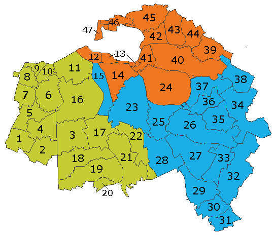
Administrative map of Val-de-Marne

|
Permission is granted to copy, distribute and/or modify this document under the terms of the GNU Free Documentation License, Version 1.2 or any later version published by the Free Software Foundation; with no Invariant Sections, no Front-Cover Texts, and no Back-Cover Texts. A copy of the license is included in the section entitled GNU Free Documentation License. |
| This file is licensed under the Creative Commons Attribution-Share Alike 3.0 Unported license. | ||
| ||
| This licensing tag was added to this file as part of the GFDL licensing update. |
File history
Legend: (cur) = this is the current file, (del) = delete this old version, (rev) = revert to this old version. Click on date to download the file or see the image uploaded on that date. (Delete all revisions of this file) (cur) 21:26, July 23, 2005 . . Hardouin . . 542x466 (16331 bytes) (Made map myself) (del) (rev) 21:17, July 23, 2005 . . Hardouin . . 543x469 (16278 bytes) ( Made map myself)
File history
Click on a date/time to view the file as it appeared at that time.
| Date/Time | Thumbnail | Dimensions | User | Comment | |
|---|---|---|---|---|---|
| current | 19:21, 1 February 2020 | | 542 × 466 (21 KB) | Nicolas22g | Reverted to version as of 19:19, 1 February 2020 (UTC) |
| 19:21, 1 February 2020 |  | 542 × 466 (16 KB) | Nicolas22g | Reverted to version as of 17:58, 29 August 2005 (UTC) | |
| 19:19, 1 February 2020 |  | 542 × 466 (21 KB) | Nicolas22g | Updated for the reorganisation of the cantons of France in 2017 | |
| 17:58, 29 August 2005 |  | 542 × 466 (16 KB) | Jelte | Made by en:User:Hardouin Administrative map of w:Val-de-Marne {{GFDL}} |
File usage
The following pages on the English Wikipedia use this file (pages on other projects are not listed):
Global file usage
The following other wikis use this file:
- Usage on af.wikipedia.org
- Usage on az.wikipedia.org
- Usage on ca.wikipedia.org
- Usage on ceb.wikipedia.org
- Usage on cv.wikipedia.org
- Usage on eo.wikipedia.org
- Usage on et.wikipedia.org
- Usage on fa.wikipedia.org
- Usage on fr.wikipedia.org
- Discussion:Château de Vincennes
- Discussion:Seine
- Discussion:Bièvre (affluent de la Seine)
- Catégorie:Vincennes
- Catégorie:Val-de-Marne
- Discussion:Aéroport de Paris-Orly
- Discussion:Alain Lipietz
- Discussion:Villeneuve-Saint-Georges
- Arrondissement de l'Haÿ-les-Roses
- Catégorie:Créteil
- Catégorie:Commune dans le Val-de-Marne
- Catégorie:Canton dans le Val-de-Marne
- Délice de Saint-Cyr
- Canton de Bry-sur-Marne
- Discussion:Thiais
- Lac de Créteil
- Discussion:Climat du Val-de-Marne
- Canton de Villecresnes
- Discussion:Cachan
- Discussion:Georges Marchais
- Écrans documentaires
- Catégorie:Station de métro dans le Val-de-Marne
- Discussion:Gare de Bry-sur-Marne (RATP)
- Canton d'Ormesson-sur-Marne
- Catégorie:Ligne 1 du métro de Paris
- Catégorie:Ligne 8 du métro de Paris
- Catégorie:Ligne 7 du métro de Paris
- Catégorie:Club de football dans le Val-de-Marne
- Discussion:Sheila
- Catégorie:Gare dans le Val-de-Marne
- Discussion:Créteil Soleil
- Canton de Saint-Maur-des-Fossés-Centre
- Canton de Saint-Maur-La Varenne
- Canton de Saint-Maur-des-Fossés-Ouest
- Discussion:Champigny-sur-Marne
- Discussion:Créteil
- Discussion:Vincennes
- Discussion:Forêt de Notre-Dame
- Discussion:Marne-la-Vallée
- Discussion:Arcueil
View more global usage of this file.