
File:AMH-6637-KB Map of Madagascar with four inserts.jpg

Original file (2,400 × 1,642 pixels, file size: 1,003 KB, MIME type: image/jpeg)
| This is a file from the Wikimedia Commons. Information from its description page there is shown below. Commons is a freely licensed media file repository. You can help. |
Summary
Nederlands: Kaart van Madagascar met een viertal inzetten
English: Map of Madagascar with four inserts( |
|||||||||||||||||||||||
|---|---|---|---|---|---|---|---|---|---|---|---|---|---|---|---|---|---|---|---|---|---|---|---|
| Author |
Nederlands: Anoniem / Anonymous (graveur / etser), Cornelis Claesz (uitgever)
English: Anoniem / Anonymous (engraver / etcher), Cornelis Claesz (publisher) |
||||||||||||||||||||||
| Title |
Nederlands: Kaart van Madagascar met een viertal inzetten
English: Map of Madagascar with four inserts |
||||||||||||||||||||||
| Description |
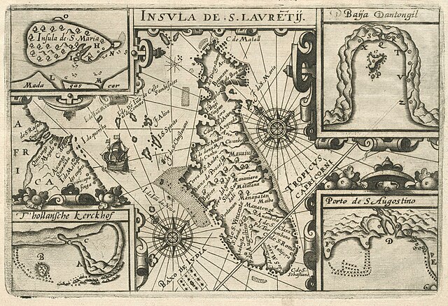
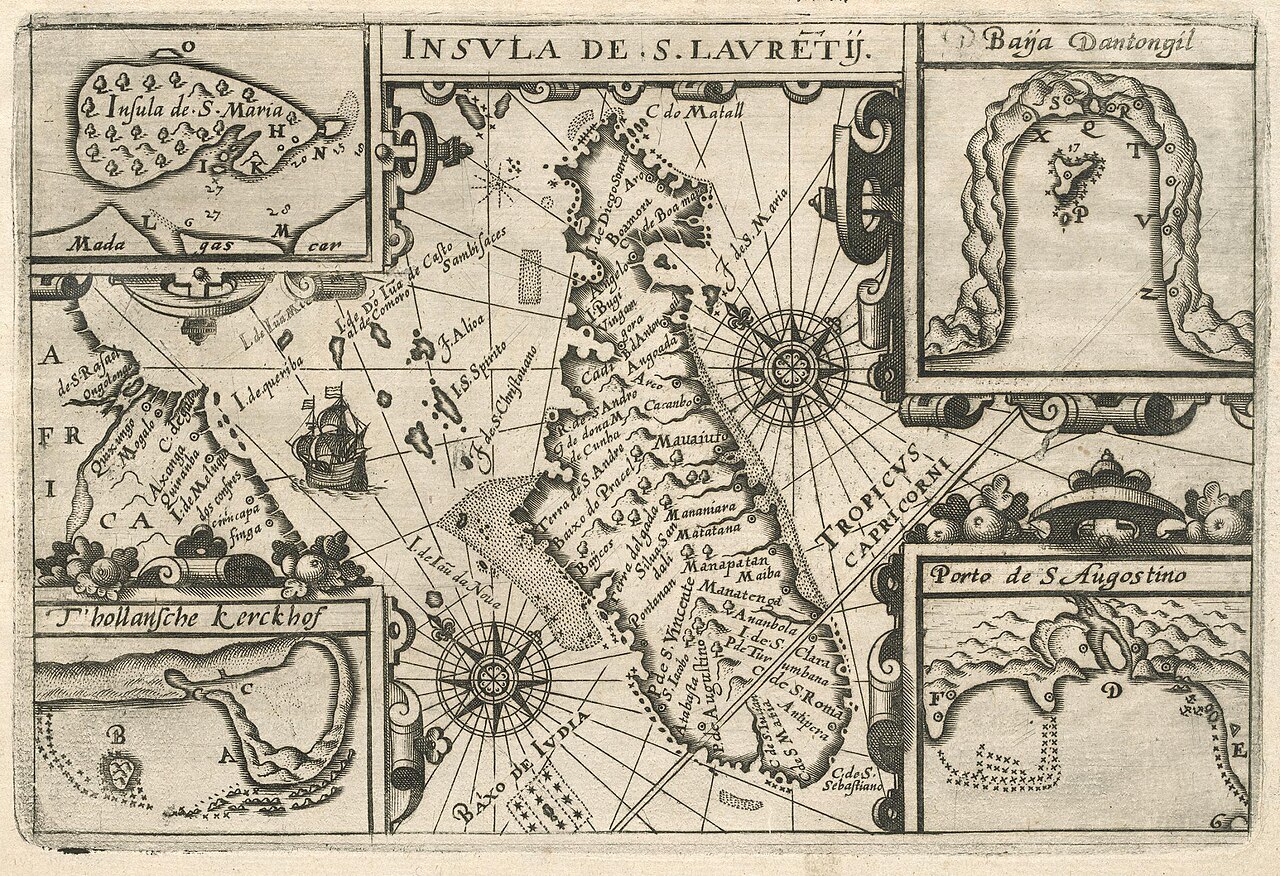
Nederlands: Kaart van Madagascar met een viertal inzetten.
Insula De S. Lauretij. De vloot van De Houtman heeft ongeveer een maand rond Madagascar gedwaald voor ze ergens aan land konden om vers water en voedsel in te nemen. Inzetten: Insual de S. Marie / Baija Dantongil / Porto de S Augostino / T'hollansche kerckhof.English: Map of Madagascar with four inserts.
De Houtman's fleet roamed around Madagascar for around a month before they could make landfall somewhere to take on fresh food and water. Insets: Insual de S. Marie / Baija Dantongil / Porto de S Augostino / T'hollansche kerckhof. |
||||||||||||||||||||||
| Date | circa 1598 | ||||||||||||||||||||||
| Medium |
Nederlands: gravure op papier
English: engraving on paper |
||||||||||||||||||||||
| Dimensions | height: 15.5 cm (6.1 in); width: 22.5 cm (8.8 in) | ||||||||||||||||||||||
| Collection |
|
||||||||||||||||||||||
| Accession number |
1700 C 2 voor p. 8 |
||||||||||||||||||||||
| Inscriptions |
Insula De S. Lauretij
|
||||||||||||||||||||||
| Notes |
English: Subjects: ship / vessel, chart / map / plan, banderole / cartouche / ornamentation, compass / dial
Nederlands: Onderwerpen: schip / vaartuig, plattegrond / kaart, banderol / cartouche / versiering, kompas / windroos |
||||||||||||||||||||||
| Source/Photographer |
|
||||||||||||||||||||||
| Permission (Reusing this file) |
|
||||||||||||||||||||||

File history
Click on a date/time to view the file as it appeared at that time.
| Date/Time | Thumbnail | Dimensions | User | Comment | |
|---|---|---|---|---|---|
| current | 11:11, 10 June 2014 | | 2,400 × 1,642 (1,003 KB) | HuskyBot | == {{int:filedesc}} == {{Artwork |title = {{nl|1=Kaart van Madagascar met een viertal inzetten}} {{en|1=Map of Madagascar with four inserts}} |description = {{nl|1=Kaart van Madagascar met een viertal inzetten.... |