
File:1777BurgoyneTiconderoga.jpg
Size of this preview: 318 × 599 pixels. Other resolutions: 127 × 240 pixels | 255 × 480 pixels | 408 × 768 pixels | 544 × 1,024 pixels | 1,382 × 2,602 pixels.
Original file (1,382 × 2,602 pixels, file size: 1.22 MB, MIME type: image/jpeg)
| This is a file from the Wikimedia Commons. Information from its description page there is shown below. Commons is a freely licensed media file repository. You can help. |
| Description |
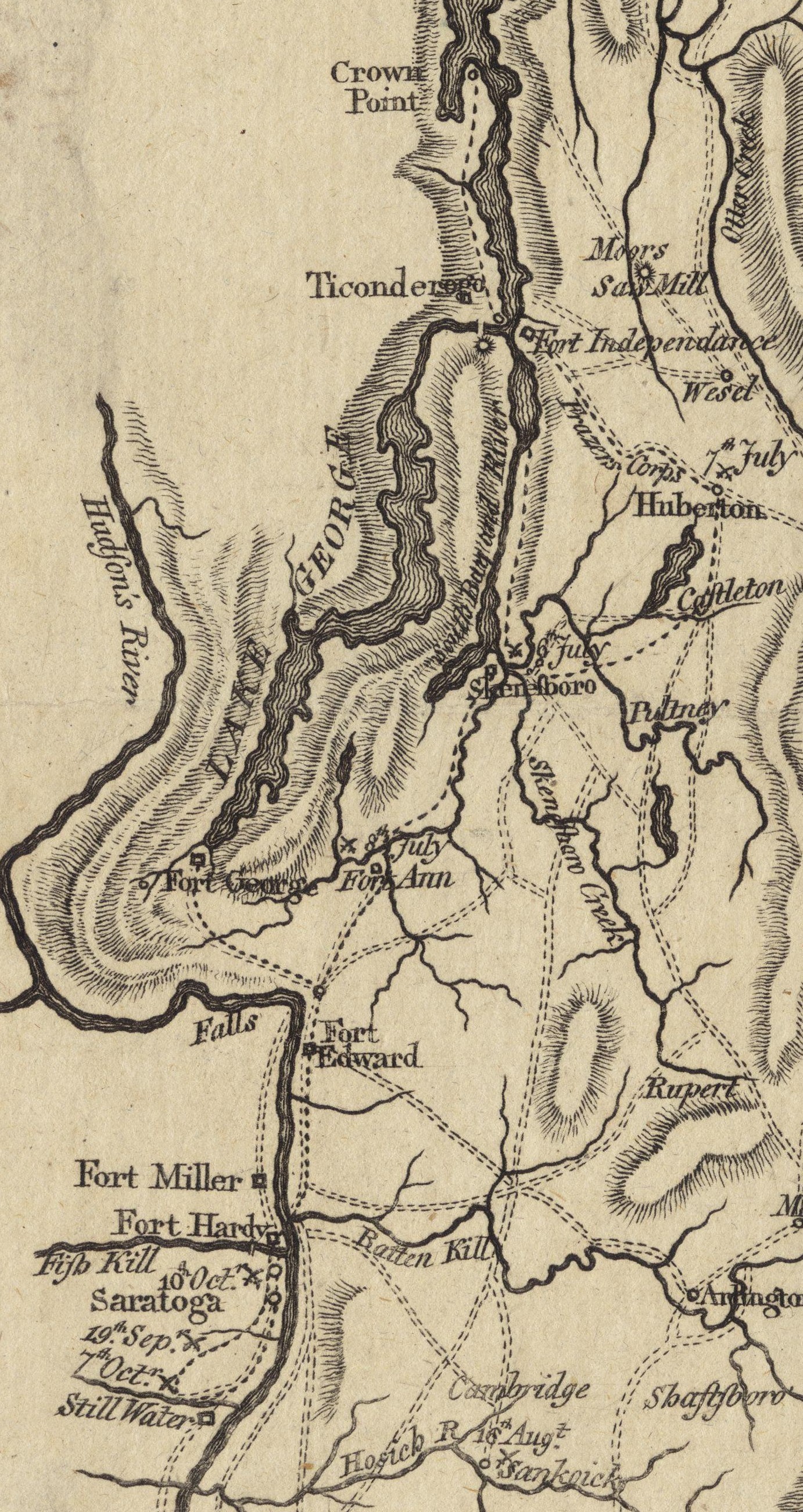
English: This is a detail from the source map, which shows the geographic area of John Burgoyne's 1777 Saratoga campaign. This detail shows the area around Fort Ticonderoga, including the roads and approaches used by the British and American forces before and after the Battle of Ticonderoga. |
||||||||||||||||||||||
| Date | |||||||||||||||||||||||
| Source | Boston Public Library Digital Map collection (call number: G3801.S3 1777 .N49) | ||||||||||||||||||||||
| Author |
|
||||||||||||||||||||||
| Permission (Reusing this file) |
|
||||||||||||||||||||||
File history
Click on a date/time to view the file as it appeared at that time.
| Date/Time | Thumbnail | Dimensions | User | Comment | |
|---|---|---|---|---|---|
| current | 17:08, 21 June 2009 | | 1,382 × 2,602 (1.22 MB) | Magicpiano | Cleaner version of map from [http://maps.bpl.org/details_11085/ Boston Public Library Map collection] |
| 14:14, 27 March 2009 |  | 1,036 × 1,592 (601 KB) | Magicpiano | {{Information |Description={{en|1=This is a detail from the first map in the original source, which contains maps showing the areas and military movements of w:John Burgoyne's 1777 w:Saratoga campaign. This detail shows the area around [[w:Fort |
File usage
The following pages on the English Wikipedia use this file (pages on other projects are not listed):
Global file usage
The following other wikis use this file:
- Usage on de.wikipedia.org
- Usage on fr.wikipedia.org
- Usage on it.wikipedia.org
- Usage on ja.wikipedia.org
- Usage on nl.wikipedia.org
- Usage on www.wikidata.org