
El Capitán State Beach
| El Capitán State Beach | |
|---|---|
 El Capitán State Beach looking east | |
  | |
| Location | Santa Barbara County, California |
| Nearest city | Goleta, California |
| Coordinates | 34°27′38″N 120°1′27″W / 34.46056°N 120.02417°W |
| Area | 2,634 acres (10.66 km2) |
| Established | 1953 |
| Governing body | California Department of Parks and Recreation |
El Capitán State Beach is a protected beach in the state park system of California. The most easterly of three state parks along the Gaviota Coast, it is located about 20 miles (32 km) west of downtown Santa Barbara, in Santa Barbara County. The beach is named for José Francisco Ortega, who retired from the Spanish Army in 1795 with the rank of captain and received the Rancho Nuestra Señora del Refugio as a land grant.[1][2]
Features[edit]
El Capitán has a day-use beach as well as a campground with 131 sites (6 of which are RV only) and 5 group sites. There are tide pools on the beach and sycamore and oak trees in the campground area. Monarch butterflies congregate at El Capitán in autumn to breed.[1]
History[edit]
The parkland was acquired between 1953 and 1967 and the State Parks Commission classified El Capitán State Beach in June of 1962.[3] In 2002 the state acquired 2,500 acres at a discount from the owners of El Capitan Ranch. The property rises above the existing park through oak woodlands and chaparral to the ridgelines of the Santa Ynez Mountains.[4][5] The Refugio oil spill occurred just north of nearby Refugio State Beach in 2015 when a pipeline carrying crude oil ruptured. The spill went into a culvert that ran under US 101 and into the ocean. The spill spread over 7 miles (11 km) of coastline, including El Capitán and Refugio state beaches. Both parks were closed for much of the summer during the clean-up, including during the typically busy Memorial Day weekend. The pipeline which caused the disaster is no longer in service.[6]
In 2016, the park's water system was destroyed when the Sherpa Fire swept through a canyon near the main campgrounds. The park had already closed due to the smoke and fire danger.[7] In 2021, a project removed barriers for steelhead trout swimming upstream to reproduce by rebuilding the entrance bridge.[8]
Gallery[edit]
-
 Welcome sign.
 -
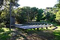 Amphitheater at campground.
 -
 Lifeguard station.
 -
 View of beach looking west.


See also[edit]
References[edit]
- ^ a b "El Capitán Beach Trail". California State Parks. Archived from the original on December 24, 2011. Retrieved December 13, 2011.
- ^ Modugno, Tom (February 17, 2019). "Who Was El Capitan? | Edhat". www.edhat.com. Retrieved February 24, 2019.
- ^ "El Capitán Entrance Improvements Project" (Press release). California State Parks. October 27, 2022. Retrieved January 5, 2023.
- ^ Kettmann, Matt (January 5, 2023). "Daring Dreams for Dos Pueblos Ranch". The Santa Barbara Independent. Retrieved January 5, 2023.
- ^ "State Buys El Capitan Ranch for Park". Los Angeles Times. October 10, 2002. Retrieved January 5, 2023.
- ^ Panzar, Javier; Reyes, Emily Alpert; Mozingo, Joe (May 23, 2015). "Santa Barbara County oil cleanup continues; pipeline may be dug up soon". Los Angeles Times.
- ^ Serna, Joseph; Fernandez, Alexia (June 17, 2016). "Santa Barbara County declares state of emergency after wildfire grows to 4,000 acres overnight". Los Angeles Times. Retrieved June 17, 2016.
- ^ Kettmann, Matt (April 14, 2021). "El Capitán State Beach Closing for One Year". The Santa Barbara Independent. Retrieved February 26, 2022.