
East Millstone, New Jersey
East Millstone, New Jersey | |
|---|---|
 East Millstone along Amwell Road (CR 514) | |
 East Millstone Location in Somerset County  East Millstone Location in New Jersey  East Millstone Location in the United States | |
| Coordinates: 40°29′47″N 74°33′58″W / 40.496445°N 74.565986°W[1][2] | |
| Country | |
| State | |
| County | Somerset |
| Township | Franklin |
| Incorporated | February 18, 1873 |
| Dissolved | December 31, 1949 |
| Area | |
| • Total | 2.30 sq mi (5.95 km2) |
| • Land | 2.23 sq mi (5.78 km2) |
| • Water | 0.06 sq mi (0.16 km2) 2.70% |
| Elevation | 85 ft (26 m) |
| Population | |
| • Total | 588 |
| • Density | 263.21/sq mi (101.65/km2) |
| Time zone | UTC−05:00 (Eastern (EST)) |
| • Summer (DST) | UTC−04:00 (Eastern (EDT)) |
| Area code(s) | 609/640 and 732/848 |
| FIPS code | 34-19330[1][6] |
| GNIS feature ID | 02583985[1] |
East Millstone is an unincorporated community and census-designated place (CDP)[7] located in Franklin Township in Somerset County, in the U.S. state of New Jersey.[8][9][10]
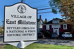
As of the 2010 U.S. census, the CDP's population was 579.[11] It is a small rural community that grew and prospered with a small industrial base in the 19th Century, centered on the Delaware and Raritan Canal at Amwell Road and the long-abandoned Millstone and New Brunswick Railroad that terminated in East Millstone. East Millstone was an independent municipality from 1873–1949. The East Millstone Historic District was listed on the National Register of Historic Places in 1983.
History[edit]
East Millstone existed as an independent municipality for more than 75 years. It was incorporated as a town by an act of the New Jersey Legislature on February 18, 1873, from portions of Franklin Township, and existed on its own until December 31, 1949, when it was returned to Franklin Township.[12] The residents voted 119–28 in favor of dissolution on March 9, 1949.[13]
The independent municipality of Millstone, New Jersey, a borough which is not part of Franklin Township, is located across the Millstone River, which is directly west of the Delaware and Raritan Canal.
East Millstone maintains its rural character into the 21st Century, with a firehouse, a post office and just a handful of local businesses. The housing stock is also quite old, with no new development in the East Millstone section of Franklin Township in recent years.[14]
Historic district[edit]
East Millstone Historic District | |
 Victorian style house | |
| Location | Amwell Road and Delaware & Raritan Canal |
|---|---|
| Area | 62 acres (25 ha) |
| Architectural style | Greek Revival, Late Victorian, Federal |
| NRHP reference No. | 83001613[15] |
| NJRHP No. | 2494[16] |
| Significant dates | |
| Added to NRHP | March 17, 1983 |
| Designated NJRHP | February 3, 1983 |
The East Millstone Historic District is a historic district encompassing the village. It was added to the National Register of Historic Places on March 17, 1983 for its significance in architecture, commerce, industry, and transportation. It includes 109 contributing buildings. The Franklin Inn, historically known as the Van Liew Farmhouse, is among the oldest houses in the village.[17]
Geography[edit]
According to the U.S. Census Bureau, East Millstone had a total area of 2.296 square miles (5.946 km2), including 2.234 square miles (5.785 km2) of land and 0.062 square miles (0.161 km2) of water (2.70%).[1][2]
Demographics[edit]
| Census | Pop. | Note | %± |
|---|---|---|---|
| 1880 | 432 | — | |
| 1890 | 475 | 10.0% | |
| 1900 | 447 | −5.9% | |
| 1910 | 356 | −20.4% | |
| 1920 | 427 | 19.9% | |
| 1930 | 364 | −14.8% | |
| 1940 | 387 | 6.3% | |
| 2010 | 579 | — | |
| 2020 | 588 | 1.6% | |
| Population sources: 1880-1890[18] 1890-1910[19] 1910-1930[20] 1920-1940[21] 2010[11] 2020[5] | |||
2010 census[edit]
The 2010 United States census counted 579 people, 233 households, and 161 families in the CDP. The population density was 259.2 per square mile (100.1/km2). There were 246 housing units at an average density of 110.1 per square mile (42.5/km2). The racial makeup was 78.58% (455) White, 10.54% (61) Black or African American, 0.00% (0) Native American, 7.77% (45) Asian, 0.00% (0) Pacific Islander, 0.35% (2) from other races, and 2.76% (16) from two or more races. Hispanic or Latino of any race were 2.94% (17) of the population.[11]
Of the 233 households, 23.6% had children under the age of 18; 60.5% were married couples living together; 6.0% had a female householder with no husband present and 30.9% were non-families. Of all households, 22.7% were made up of individuals and 5.2% had someone living alone who was 65 years of age or older. The average household size was 2.48 and the average family size was 2.94.[11]
16.4% of the population were under the age of 18, 5.0% from 18 to 24, 23.1% from 25 to 44, 39.6% from 45 to 64, and 15.9% who were 65 years of age or older. The median age was 47.5 years. For every 100 females, the population had 101.7 males. For every 100 females ages 18 and older there were 99.2 males.[11]
Gallery[edit]
-
 Historic district
 -
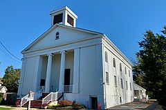 Calvary Community Church
 -
 Bridge Tender's House for the Delaware and Raritan Canal
 -


References[edit]
- ^ a b c d Gazetteer of New Jersey Places, United States Census Bureau. Accessed July 21, 2016.
- ^ a b US Gazetteer files: 2010, 2000, and 1990, United States Census Bureau. Accessed September 4, 2014.
- ^ "ArcGIS REST Services Directory". United States Census Bureau. Retrieved October 11, 2022.
- ^ U.S. Geological Survey Geographic Names Information System: East Millstone Census Designated Place, Geographic Names Information System. Accessed August 23, 2012.
- ^ a b Census Data Explorer: East Millstone CDP, New Jersey, United States Census Bureau. Accessed June 15, 2023.
- ^ Geographic Codes Lookup for New Jersey, Missouri Census Data Center. Accessed June 9, 2023.
- ^ State of New Jersey Census Designated Places - BVP20 - Data as of January 1, 2020, United States Census Bureau. Accessed December 1, 2022.
- ^ GCT-PH1 - Population, Housing Units, Area, and Density: 2010 - County -- County Subdivision and Place from the 2010 Census Summary File 1 for Somerset County, New Jersey Archived 2020-02-12 at archive.today, United States Census Bureau. Accessed February 11, 2013.
- ^ 2006-2010 American Community Survey Geography for New Jersey, United States Census Bureau. Accessed February 11, 2013.
- ^ New Jersey: 2010 - Population and Housing Unit Counts - 2010 Census of Population and Housing (CPH-2-32), United States Census Bureau, August 2012. Accessed February 11, 2013.
- ^ a b c d e DP-1 - Profile of General Population and Housing Characteristics: 2010 Demographic Profile Data for East Millstone CDP, New Jersey Archived 2020-02-12 at archive.today, United States Census Bureau. Accessed August 23, 2012.
- ^ Snyder, John P. The Story of New Jersey's Civil Boundaries: 1606-1968, John P. Snyder, Bureau of Geology and Topography; Trenton, New Jersey; 1969. p. 223. Accessed August 23, 2012.
- ^ "Voters Erase Town of East Millstone". The Courier-News. March 10, 1949. p. 1. Retrieved October 24, 2017 – via Newspapers.com.

- ^ Brahms, William B., Franklin Township, Somerset County, NJ: A History, FTPL; ISBN 0-9668586-0-3
- ^ "National Register Information System – (#83001613)". National Register of Historic Places. National Park Service. November 2, 2013.
- ^ "New Jersey and National Registers of Historic Places – Somerset County" (PDF). New Jersey Department of Environmental Protection – Historic Preservation Office. September 30, 2020. p. 6.
- ^ Gibson, David; Bauer, Steven (November 1, 1981). "National Register of Historic Places Inventory/Nomination: East Millstone Historic District". National Park Service. With accompanying 48 photos
- ^ Report on Population of the United States at the Eleventh Census: 1890. Part I, p. 239. United States Census Bureau, 1895. Accessed October 20, 2016.
- ^ Thirteenth Census of the United States, 1910: Population by Counties and Minor Civil Divisions, 1910, 1900, 1890, United States Census Bureau, p. 338. Accessed August 23, 2012.
- ^ Fifteenth Census of the United States : 1930 - Population Volume I, United States Census Bureau, p. 718. Accessed August 23, 2012.
- ^ Sixteenth Census of the United States : 1940 - Population Volume I, United States Census Bureau, p. 674. Accessed February 12, 2013.
External links[edit]
 Media related to East Millstone, New Jersey at Wikimedia Commons
Municipalities and communities of Somerset County, New Jersey, United States | ||
|---|---|---|
| Boroughs |  | |
| Townships | ||
| CDPs |
| |
| Other communities | ||
| Footnotes | ‡This populated place also has portions in an adjacent county or counties | |
| International | |
|---|---|
| National | |
- Census-designated places in Somerset County, New Jersey
- Census-designated places in New Jersey
- Former municipalities in Somerset County, New Jersey
- Former towns in New Jersey
- Franklin Township, Somerset County, New Jersey
- National Register of Historic Places in Somerset County, New Jersey
- Historic districts on the National Register of Historic Places in New Jersey
- New Jersey Register of Historic Places