
Dayton, Waupaca County, Wisconsin
Dayton, Wisconsin | |
|---|---|
 Nelson Park in northeastern Dayton | |
 Location of Dayton, Wisconsin | |
| Coordinates: 44°18′24″N 89°9′25″W / 44.30667°N 89.15694°W | |
| Country | |
| State | |
| County | Waupaca |
| Area | |
| • Total | 36.4 sq mi (94.2 km2) |
| • Land | 35.2 sq mi (91.3 km2) |
| • Water | 1.2 sq mi (3.0 km2) |
| Elevation | 892 ft (272 m) |
| Population (2020) | |
| • Total | 2,674 |
| • Density | 73/sq mi (28/km2) |
| Time zone | UTC-6 (Central (CST)) |
| • Summer (DST) | UTC-5 (CDT) |
| FIPS code | 55-19025[2] |
| GNIS feature ID | 1583056[1] |
| Website | http://town-dayton.com |
Dayton is a town in Waupaca County, Wisconsin, United States. The population was 2,674 at the 2020 census. The unincorporated communities of Little Hope, Parfreyville, and Rural are located in the town. The census-designated place of Chain O' Lake is also partially located within the town.
History[edit]
The town was named for Lyman Dayton, a Connecticut native who moved to the area in 1850.[3]
Geography[edit]
According to the United States Census Bureau, the town has a total area of 36.4 square miles (94.2 km2), of which, 35.2 square miles (91.2 km2) of it is land and 1.1 square miles (3.0 km2) of it (3.16%) is water.
Demographics[edit]
As of the census[2] of 2020, there were 2,674 people residing in the town. The racial makeup of the town included 93.6% White, 0.7% African American, 1.4% Native American, 1.1% Asian, and 0.2% Hawaiian or Pacific Islander. Hispanic or Latino of any race were 2.0% of the population.
Notable people[edit]
- Andrew R. Potts, Wisconsin state legislator and farmer, was born in Rural, in the Town of Dayton; Potts served as chairman of the Dayton Town Board[4]
Images[edit]
-
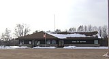 Dayton Town Hall
 -
 Nelson Park in northeastern Dayton along the Crystal River
 -
 The Red Mill in Little Hope, Wisconsin
 -
 Crystal River


References[edit]
- ^ a b "US Board on Geographic Names". United States Geological Survey. October 25, 2007. Retrieved January 31, 2008.
- ^ a b "U.S. Census website". United States Census Bureau. Retrieved January 31, 2008.
- ^ Callary, Edward. Place Names of Wisconsin. Madison, WI: University of Wisconsin Press. pp. 71–72. ISBN 978-0-299-30964-0.
- ^ 'Wisconsin Blue Book 1917,' Biographical Sketch of Andrew R. Potts, pg. 512-513
External links[edit]
Municipalities and communities of Waupaca County, Wisconsin, United States | ||
|---|---|---|
| Cities |  | |
| Villages | ||
| Towns | ||
| CDPs | ||
| Other communities | ||
| Former communities | ||
| Footnotes | ‡This populated place also has portions in an adjacent county or counties | |