
Davison Township, Michigan
Davison Township, Michigan | |
|---|---|
 Location within Genesee County | |
 Davison Township Location within the state of Michigan  Davison Township Davison Township (the United States) | |
| Coordinates: 43°00′51″N 83°31′34″W / 43.01417°N 83.52611°W | |
| Country | United States |
| State | Michigan |
| County | Genesee |
| Settled | 1837 |
| Organized | 1840 |
| Government | |
| • Supervisor | Jim Slezak |
| • Clerk | Mary Miller |
| • Treasurer | Tim Miller |
| • Trustees | Matthew D. Karr Lori A. Tallman |
| Area | |
| • Total | 33.7 sq mi (87.3 km2) |
| • Land | 33.5 sq mi (86.7 km2) |
| • Water | 0.2 sq mi (0.6 km2) 0.68% |
| Elevation | 810 ft (247 m) |
| Population (2010) | |
| • Total | 19,575 |
| • Density | 529.1/sq mi (204.3/km2) |
| Time zone | UTC-5 (EST) |
| • Summer (DST) | UTC-4 (EDT) |
| ZIP code(s) | |
| Area code | 810 |
| FIPS code | 26-19900[1] |
| GNIS feature ID | 1626160[2] |
| Website | davisontwp-mi |
Township of Davison is a civil township of Genesee County in the U.S. state of Michigan consisting of the survey township of North 7 East 8[3] less the administratively autonomous city of Davison. The population was 19,575 at the 2010 census, up from 17,722 at the 2000 census.
Davison was named after Judge Norman Davison, a judge of Lapeer County and a delegate to state constitution convention of 1835.[4] He resided in a nearby town formerly known as Davisonville, now known as Atlas.[3]
History[edit]
The Township was originally in Lapeer County and was formed from portions of Atlas and Richfield townships. Andrew Jesse Seelye visiting his cousin in Waterford, Michigan in 1835 purchase 240 acres in the future Davison Township section 33 in May 1936. Andrew was joined by his brother and sister, Alson and Debby, which all three established permanent residents in 1837. On March 28, 1937, Atlas Township highway commissioners Paul G. Davison and Asa Farrar laid out the first road in the Atlas side of the township along the eastern side of section 31 to the section corner of 17, 18, 19 & 20. Ira Porter permanently settled in section 1 in January 1838 in the Richfield Township uphalf.[3]
Goodenough Townsend and other residents of the survey township petitioned the legislature in 1839 to form a civil township government under the name of Middlebury. Since Shiawassee County already had an existing township using that name, the township was formed about 6 April 1840 under a different name, Davison, in honor of Norman Davison (Aug 1786 Ashford CT - 26 Mar 1841 Davisonville, Atlas Twp., MI) who was admired by many in the area. The first township meeting was held on at Townsend's home with Abel Seeley serving as moderator and Townsend elected by the 14 voters to be the first township supervisor. All but two voters held an office.[3]
Davison Township was transferred from Lapeer County to Genesee County by act of the state legislature on March 9, 1843. In 1849, the Davison Centre Post Office was established with Townsend serving as postmaster until 1853.[3]
In January, 2010, it was announced that Davison, Michigan City Manager Dale Martin and Davison Township Supervisor Kurt Soper had begun preliminary meetings discussing the possibility of merging the two municipalities.[5]
On Monday November 27, 2017, the northern loop set of municipalities, including Davison, began receiving water from the Karegnondi Water Authority pipeline and treated by Genesee County Drain Commission Water and Waste Division.[6]
Geography[edit]
According to the United States Census Bureau, the township has a total area of 33.7 square miles (87 km2), of which 33.5 square miles (87 km2) is land and 0.2 square miles (0.52 km2) (0.68%) is water.
The primary waterways are Black and Kearsley creeks. Davison Township shares two lakes with the neighboring township in Lapeer County, Elba Township, with Potter Lake (approximately 150 acres) in section 1 and Hasler Lake in section 36. Black Creek begins at Potter Lake in Elba traveling northwest into Richfield Township then turning south in Davison Township then heads west through Davison City to merge into Kearsley Creek near the western border in section 7.[3]
Demographics[edit]
| Census | Pop. | Note | %± |
|---|---|---|---|
| 1960 | 4,948 | — | |
| 1970 | 8,260 | 66.9% | |
| 1980 | 13,708 | 66.0% | |
| 1990 | 14,671 | 7.0% | |
| 2000 | 17,722 | 20.8% | |
| 2010 | 19,575 | 10.5% | |
| Source: Census Bureau. Census 1960-[7] 2000, 2010. | |||
As of the census[1] of 2000, there were 17,722 people, 7,455 households, and 4,733 families residing in the township. The population density was 529.1 inhabitants per square mile (204.3/km2). There were 7,853 housing units at an average density of 234.5 per square mile (90.5/km2). The racial makeup of the township was 94.30% White, 2.05% African American, 0.37% Native American, 0.87% Asian, 0.01% Pacific Islander, 0.51% from other races, and 1.89% from two or more races. Hispanic or Latino of any race were 2.09% of the population.
There were 7,455 households, out of which 30.4% had children under the age of 18 living with them, 50.2% were married couples living together, 10.0% had a female householder with no husband present, and 36.5% were non-families. 29.3% of all households were made up of individuals, and 7.7% had someone living alone who was 65 years of age or older. The average household size was 2.37 and the average family size was 2.97.
In the township the population was spread out, with 24.4% under the age of 18, 11.5% from 18 to 24, 29.7% from 25 to 44, 23.3% from 45 to 64, and 11.1% who were 65 years of age or older. The median age was 36 years. For every 100 females, there were 91.9 males. For every 100 females age 18 and over, there were 89.9 males.
The median income for a household in the township was $45,417, and the median income for a family was $57,716. Males had a median income of $45,197 versus $28,942 for females. The per capita income for the township was $23,595. About 4.9% of families and 6.3% of the population were below the poverty line, including 6.9% of those under age 18 and 3.8% of those age 65 or over.
Government[edit]
The township receives water from the Karegnondi Water Authority pipeline treated by Genesee County Drain Commission Water and Waste Division.[6]
Davison is part of the following:[8]
- Genesee County Commissioner District 3
- Michigan House of Representatives District 68
- State Senate District 26
- 67th District Court Division 2
- Michigan's 8th Congressional District
- Genesee District Library[9]
Educational services are primarily provided by Davison Community Schools while small parts of the township are served by Goodrich Area Schools.[10]
References[edit]
- ^ a b "U.S. Census website". United States Census Bureau. Retrieved January 31, 2008.
- ^ U.S. Geological Survey Geographic Names Information System: Davison Township, Michigan
- ^ a b c d e f Ellis, Franklin (1879). "Davison". History of Genesee County, Michigan: With Illustrations and Biographical Sketches of Its Prominent Men and Pioneers. Everts & Abbott. pp. 398–405. Retrieved May 1, 2015.
- ^ Wood, Edwin O. (1916). "XXVI Villages of Genesee County". History of Genesee County, Michigan, Her People, Industries and Institutions. Michigan Historical Commission. Retrieved May 1, 2015.
- ^ "Davison Index".
- ^ a b Acosta, Roberto (November 26, 2017). "New Genesee County treatment plant to begin delivering water Monday". Retrieved November 27, 2017.
- ^ "1960 to 1990 Census Count by for Michigan and Subcounties" (PDF). Michigan Information Center. Archived from the original (PDF) on April 29, 2004.
- ^ Genesee County Political District Map Book (PDF) (Map). Genesee County GIS Department. 2017. pp. 1, 11, 12. Retrieved October 10, 2017.
- ^ Thorne, Blake (May 4, 2011). "Voters support new tax for Genesee District Library". Flint Journal. Mlive Media Group. Retrieved September 7, 2016.
- ^ Genesee ISD (PDF) (Map). Retrieved October 10, 2017.
External links[edit]
Municipalities and communities of Genesee County, Michigan, United States | ||
|---|---|---|
| Cities | 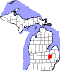 | |
| Villages | ||
| Charter townships | ||
| Civil townships | ||
| CDPs | ||
| Other communities | ||
| Footnotes | ‡This populated place also has portions in an adjacent county or counties | |