
Cobden, Minnesota
Cobden | |
|---|---|
 Location of Cobden, Minnesota | |
| Coordinates: 44°16′57″N 94°50′48″W / 44.28250°N 94.84667°W | |
| Country | United States |
| State | Minnesota |
| County | Brown |
| Government | |
| • Type | Mayor - Council |
| • Mayor | Allen Krebs [citation needed] |
| Area | |
| • Total | 0.99 sq mi (2.57 km2) |
| • Land | 0.99 sq mi (2.57 km2) |
| • Water | 0.00 sq mi (0.00 km2) |
| Elevation | 1,040 ft (320 m) |
| Population (2020) | |
| • Total | 36 |
| • Density | 36.25/sq mi (14.00/km2) |
| Time zone | UTC-6 (Central (CST)) |
| • Summer (DST) | UTC-5 (CDT) |
| ZIP code | 56085 |
| Area code | 507 |
| FIPS code | 27-12394[3] |
| GNIS feature ID | 2393581[2] |
Cobden is a city in Brown County, Minnesota, United States. The population was 36 at the 2010 census.[4]
History[edit]
A post office was established as Cobden in 1886, and remained in operation until it was discontinued in 1972.[5] Cobden was platted in 1901, and incorporated in 1905.[6] The city was named for Richard Cobden, a British statesman.[7]
Geography[edit]
According to the United States Census Bureau, the city has a total area of 0.96 square miles (2.49 km2), all land.[8]
Demographics[edit]
| Census | Pop. | Note | %± |
|---|---|---|---|
| 1910 | 87 | — | |
| 1920 | 108 | 24.1% | |
| 1930 | 108 | 0.0% | |
| 1940 | 136 | 25.9% | |
| 1950 | 118 | −13.2% | |
| 1960 | 114 | −3.4% | |
| 1970 | 113 | −0.9% | |
| 1980 | 72 | −36.3% | |
| 1990 | 62 | −13.9% | |
| 2000 | 61 | −1.6% | |
| 2010 | 36 | −41.0% | |
| 2020 | 36 | 0.0% | |
| U.S. Decennial Census[9] | |||
2010 census[edit]
As of the census[10] of 2010, there were 36 people, 18 households, and 7 families residing in the city. The population density was 37.5 inhabitants per square mile (14.5/km2). There were 20 housing units at an average density of 20.8 per square mile (8.0/km2). The racial makeup of the city was 91.7% White, 2.8% Native American, and 5.6% from two or more races. Hispanic or Latino of any race were 11.1% of the population.
There were 18 households, of which 27.8% had children under the age of 18 living with them, 33.3% were married couples living together, 5.6% had a female householder with no husband present, and 61.1% were non-families. 50.0% of all households were made up of individuals, and 11.2% had someone living alone who was 65 years of age or older. The average household size was 2.00 and the average family size was 2.86.
The median age in the city was 45.5 years. 19.4% of residents were under the age of 18; 2.9% were between the ages of 18 and 24; 25% were from 25 to 44; 41.6% were from 45 to 64; and 11.1% were 65 years of age or older. The gender makeup of the city was 63.9% male and 36.1% female.
2000 census[edit]
As of the census[3] of 2000, there were 61 people, 23 households, and 18 families residing in the city. The population density was 63.7 inhabitants per square mile (24.6/km2). There were 29 housing units at an average density of 30.3 per square mile (11.7/km2). The racial makeup of the city was 98.36% White, and 1.64% from two or more races.
There were 23 households, out of which 34.8% had children under the age of 18 living with them, 73.9% were married couples living together, 4.3% had a female householder with no husband present, and 21.7% were non-families. 17.4% of all households were made up of individuals, and 8.7% had someone living alone who was 65 years of age or older. The average household size was 2.65 and the average family size was 2.83.
In the city, the population was spread out, with 26.2% under the age of 18, 11.5% from 18 to 24, 32.8% from 25 to 44, 11.5% from 45 to 64, and 18.0% who were 65 years of age or older. The median age was 35 years. For every 100 females, there were 103.3 males. For every 100 females age 18 and over, there were 95.7 males.
The median income for a household in the city was $43,750, and the median income for a family was $48,750. Males had a median income of $29,375 versus $20,625 for females. The per capita income for the city was $15,179. There were 11.1% of families and 6.6% of the population living below the poverty line, including no under eighteens and none of those over 64.
Notable person[edit]
- Lefty Bertrand, professional baseball player.
See also[edit]
References[edit]
- ^ "2020 U.S. Gazetteer Files". United States Census Bureau. Retrieved July 24, 2022.
- ^ a b U.S. Geological Survey Geographic Names Information System: Cobden, Minnesota
- ^ a b "U.S. Census website". United States Census Bureau. Retrieved January 31, 2008.
- ^ "2010 Census Redistricting Data (Public Law 94-171) Summary File". American FactFinder. United States Census Bureau. Retrieved April 27, 2011.[dead link]
- ^ "Brown County". Jim Forte Postal History. Retrieved February 28, 2015.
- ^ Upham, Warren (1920). Minnesota Geographic Names: Their Origin and Historic Significance. Minnesota Historical Society. p. 69.
- ^ Chicago and North Western Railway Company (1908). A History of the Origin of the Place Names Connected with the Chicago & North Western and Chicago, St. Paul, Minneapolis & Omaha Railways. p. 58.
- ^ "US Gazetteer files 2010". United States Census Bureau. Archived from the original on July 2, 2012. Retrieved November 13, 2012.
- ^ "Census of Population and Housing". Census.gov. Retrieved June 4, 2015.
- ^ "U.S. Census website". United States Census Bureau. Retrieved November 13, 2012.
External links[edit]
![]() Media related to Cobden, Minnesota at Wikimedia Commons
Media related to Cobden, Minnesota at Wikimedia Commons
Municipalities and communities of Brown County, Minnesota, United States | ||
|---|---|---|
| Cities | 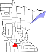 | |
| Townships | ||
| CDPs | ||
| Unincorporated communities | ||
| Footnotes | ‡This populated place also has portions in an adjacent county or counties | |