
Coaling, Alabama
Town of Coaling [1] | |
|---|---|
 The Fire Department Building in Coaling, Alabama | |
 Location of Coaling in Tuscaloosa County, Alabama. | |
| Coordinates: 33°10′9″N 87°20′45″W / 33.16917°N 87.34583°W | |
| Country | United States |
| State | Alabama |
| County | Tuscaloosa |
| Government | |
| • Type | Mayor/City Council From |
| • Mayor | Gary William Averett |
| Area | |
| • Total | 5.08 sq mi (13.16 km2) |
| • Land | 5.01 sq mi (12.98 km2) |
| • Water | 0.07 sq mi (0.18 km2) |
| Elevation | 407 ft (124 m) |
| Population (2020) | |
| • Total | 2,035 |
| • Density | 405.94/sq mi (156.74/km2) |
| Time zone | UTC-6 (Central (CST)) |
| • Summer (DST) | UTC-5 (CDT) |
| ZIP code | 35449, 35453 |
| Area code(s) | 205, 659 |
| FIPS code | 01-16000 |
| GNIS feature ID | 0116314 |
| Website | coalingalabama |
Coaling is a town[3] in Tuscaloosa County, Alabama, United States. It incorporated in September 1997.[4] At the 2020 census, the population was 2,035. It is part of the Tuscaloosa, Alabama Metropolitan Statistical Area.
History[edit]

On April 27, 2011, parts of Coaling were devastated by an EF-3 tornado at approximately 5:15 a.m. Three homes were completely destroyed, at least ten others were severely damaged, and twice as many more sustained light damage. Though there were no fatalities, some residents were hospitalized for injuries.
Geography[edit]
Coaling is located at 33°10′10″N 87°20′45″W / 33.16944°N 87.34583°W (33.169442, -87.345859).[5]
According to the U.S. Census Bureau, the city had a total area of 3.7 square miles (9.6 km2), of which 3.7 square miles (9.6 km2) is land and 0.1 square miles (0.26 km2) (1.61%) is water.
Government[edit]
The city employs three police officers.
Demographics[edit]
| Census | Pop. | Note | %± |
|---|---|---|---|
| 1880 | 190 | — | |
| 2000 | 1,115 | — | |
| 2010 | 1,657 | 48.6% | |
| 2020 | 2,035 | 22.8% | |
| U.S. Decennial Census[6] 2013 Estimate[7] | |||
Coaling first appeared on the 1880 U.S. Census as the village of Coaling Station. It did not appear again as a separate community on the census until 2000 after its incorporation in 1997.
As of the census[8] of 2010, there were 1,657 people, 429 households, and 335 families residing in the city. The population density was 303.6 inhabitants per square mile (117.2/km2). There were 458 housing units at an average density of 124.7 per square mile (48.1/km2). The racial makeup of the city was 86.42% White, 11.40% Black or African American, 0.06% Native American, 0.50% from other races, and 0.81% from two or more races. 1.68% of the population were Hispanic or Latino of any race.
Out of the 429 households, 38.5% had children under the age of 18 living with them, 64.3% were married couples living together, 10.5% had a female householder with no husband present, and 21.7% were non-families. 18.9% of all households were made up of individuals, and 6.8% had someone living alone who was 65 years of age or older. The average household size was 2.60 and the average family size was 2.97.
In the city the population was spread out, with 71.57% under the age of 18, 4.58% from 20 - 24, 15.63% from 25 - 34, 22.57% from 35 - 49, 19.25% from 50 - 64 and 6.94% who were 65 years of age or older. The median age was 35 years. For every 100 males there were 98.3 males. For every 100 females age 18 and over, there were 88.7 males.
The median income for a household in the city was $45,662, and the median income for a family was $55,125. Males had a median income of $31,371 versus $21,394 for females. The per capita income for the city was $18,664. None of the families and 1.4% of the population were living below the poverty line, including no under eighteens and 15.9% of those over 64.
References[edit]
- ^ Code of Alabama 1975, Title 11, Chapter 40, Section 11-40-1 Archived March 17, 2010, at the Wayback Machine
- ^ "2020 U.S. Gazetteer Files". United States Census Bureau. Retrieved October 29, 2021.
- ^ U.S. Census change list Archived August 6, 2010, at the Wayback Machine
- ^ "Coaling".
- ^ "US Gazetteer files: 2010, 2000, and 1990". United States Census Bureau. February 12, 2011. Retrieved April 23, 2011.
- ^ "U.S. Decennial Census". Census.gov. Retrieved June 6, 2013.
- ^ "Annual Estimates of the Resident Population: April 1, 2010 to July 1, 2013". Retrieved June 3, 2014.
- ^ "U.S. Census website". United States Census Bureau. Retrieved January 31, 2008.
33°10′10″N 87°20′45″W / 33.169442°N 87.345859°W
Municipalities and communities of Tuscaloosa County, Alabama, United States | ||
|---|---|---|
| Cities | 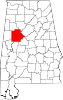 | |
| Towns | ||
| CDPs | ||
| Other unincorporated communities | ||
| Ghost town | ||
| Footnotes | ‡This populated place also has portions in an adjacent county or counties | |