
Clark's Point, Alaska
Clark's Point, Alaska
Saguyaq | |
|---|---|
| Country | |
| State | |
| Census area | Dillingham |
| Government | |
| • Mayor | Harry Wassily, Sr.[1] |
| • State senator | Lyman Hoffman (D)[2] |
| • State rep. | Bryce Edgmon (I) |
| Area | |
| • Total | 4.11 sq mi (10.64 km2) |
| • Land | 3.32 sq mi (8.61 km2) |
| • Water | 0.79 sq mi (2.03 km2) |
| Population (2020) | |
| • Total | 67 |
| • Density | 20.16/sq mi (7.78/km2) |
| Time zone | UTC-9 (Alaska (AKST)) |
| • Summer (DST) | UTC-8 (AKDT) |
| ZIP code | 99569[4] |
| Area code | 907 |
| FIPS code | 02-15430[5] |
| GNIS | 1400426 [5] |
Clark's Point (Central Yupik: Saguyaq) is a city in Dillingham Census Area, Alaska, United States. The population was 62 at the 2010 census.
Geography[edit]
Clark's Point is located at 58°49′57″N 158°33′09″W / 58.832560°N 158.552542°W.[6]
According to the United States Census Bureau, the city has a total area of 4.1 square miles (11 km2), of which, 3.1 square miles (8.0 km2) of it is land and 0.9 square miles (2.3 km2) of it (22.66%) is water.
Demographics[edit]
| Census | Pop. | Note | %± |
|---|---|---|---|
| 1890 | 7 | — | |
| 1930 | 25 | — | |
| 1940 | 22 | −12.0% | |
| 1950 | 128 | 481.8% | |
| 1960 | 138 | 7.8% | |
| 1970 | 95 | −31.2% | |
| 1980 | 79 | −16.8% | |
| 1990 | 60 | −24.1% | |
| 2000 | 75 | 25.0% | |
| 2010 | 62 | −17.3% | |
| 2020 | 67 | 8.1% | |
| U.S. Decennial Census[7] | |||
Clark's (or Clarks) Point first appeared on the 1890 U.S. Census as the unincorporated Inuit village of "Stugarok."[8] It would not appear again until 1930, when it returned as Clark's Point, also an unincorporated village. It formally incorporated in 1971.
As of the census[9] of 2000, there were 75 people, 24 households, and 15 families residing in the city. The population density was 23.9 inhabitants per square mile (9.2/km2). There were 51 housing units at an average density of 16.2 per square mile (6.3/km2). The racial makeup of the city was 6.67% White, 90.67% Native Alaskan, 1.33% Pacific Islander, and 1.33% from two or more races.
There were 24 households, out of which 33.3% had children under the age of 18 living with them, 45.8% were married couples living together, 16.7% had a female householder with no husband present, and 37.5% were non-families. 25.0% of all households were made up of individuals, and 4.2% had someone living alone who was 65 years of age or older. The average household size was 3.13 and the average family size was 3.93.
In the city, the population was spread out, with 38.7% under the age of 18, 6.7% from 18 to 24, 25.3% from 25 to 44, 21.3% from 45 to 64, and 8.0% who were 65 years of age or older. The median age was 30 years. For every 100 females, there were 114.3 males. For every 100 females age 18 and over, there were 119.0 males.
The median income for a household in the city was $28,125, and the median income for a family was $41,250. Males had a median income of $30,625 versus $41,250 for females. The per capita income for the city was $10,988. There were 20.0% of families and 45.7% of the population living below the poverty line, including 66.7% of under eighteens and 36.4% of those over 64.
Education[edit]
It was previously served by the Clarks Point School, operated by the Southwest Region School District. Due to declining enrollment, the school closed in May 2012.[10] The Clark's Point school re-opened in August 2017.[11]
References[edit]
- ^ 2023 Alaska Municipal Officials Directory (PDF). Juneau: Alaska Municipal League. January 2023. p. 57. Retrieved November 12, 2023.
- ^ "Senator Lyman Hoffman". Alaska Senate Majority. Alaskasenate.org. Archived from the original on April 8, 2020. Retrieved November 16, 2019.
- ^ "2020 U.S. Gazetteer Files". United States Census Bureau. Retrieved October 29, 2021.
- ^ "Clarks Point ZIP Code". zipdatamaps.com. 2022. Retrieved November 11, 2022.
- ^ a b "Feature Detail Report for: Clarks Point". Geographic Names Information System. United States Geological Survey. Retrieved June 17, 2020.
- ^ "US Gazetteer files: 2010, 2000, and 1990". United States Census Bureau. February 12, 2011. Retrieved April 23, 2011.
- ^ "Census of Population and Housing". Census.gov. Retrieved June 4, 2015.
- ^ "Geological Survey Professional Paper". 1949.
- ^ "U.S. Census website". United States Census Bureau. Retrieved January 31, 2008.
- ^ "Clarks Point Archived 2018-10-30 at the Wayback Machine." Southwest Region School District. Retrieved on March 26, 2017.
- ^ "[1] Archived 2018-10-30 at the Wayback Machine." Southwest Region School District. Retrieved on September 14, 2017.
58°49′57″N 158°33′09″W / 58.83256°N 158.552542°W
Municipalities and communities of Dillingham Census Area, Alaska, United States | ||
|---|---|---|
| Cities | 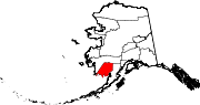 | |
| CDPs | ||
| Unincorporated communities | ||
| Ghost towns | ||