
Clarita, Oklahoma
Clarita, Oklahoma | |
|---|---|
 Clarita Location within the state of Oklahoma  Clarita Clarita (the United States) | |
| Coordinates: 34°28′57″N 96°26′12″W / 34.48250°N 96.43667°W | |
| Country | United States |
| State | Oklahoma |
| County | Coal |
| Area | |
| • Total | 7.91 sq mi (20.48 km2) |
| • Land | 7.90 sq mi (20.47 km2) |
| • Water | 0.00 sq mi (0.01 km2) |
| Elevation | 692 ft (211 m) |
| Population (2020) | |
| • Total | 135 |
| • Density | 17.08/sq mi (6.60/km2) |
| Time zone | UTC-6 (Central (CST)) |
| • Summer (DST) | UTC-5 (CDT) |
| FIPS code | 40-14750 |
| GNIS feature ID | 2629912[2] |
Clarita is a small unincorporated community in Coal County, Oklahoma, United States.[2] The post office was established January 19, 1910.
Clarita's school district, Olney Public School District, is one of the smallest public school districts in the state of Oklahoma. For the most recent data available, for a combined district, K-12, Olney finished between Boley (51) and Sweetwater (60), with 58 students. Olney School is now closed although the reunion is still held at the lunch room.[3]
The Census Bureau defined a census-designated place (CDP) which includes, and bears the name of, Clarita in 2015; the 2010 population within the 2015 CDP boundary is 171 and contains 70 housing units.
Demographics[edit]
| Census | Pop. | Note | %± |
|---|---|---|---|
| 2020 | 135 | — | |
| U.S. Decennial Census[4] | |||
References[edit]
- ^ "ArcGIS REST Services Directory". United States Census Bureau. Retrieved September 20, 2022.
- ^ a b c U.S. Geological Survey Geographic Names Information System: Clarita, Oklahoma
- ^ School District Database at the Oklahoma State Department of Education (OSDE) Archived 2007-08-02 at the Wayback Machine
- ^ "Census of Population and Housing". Census.gov. Retrieved June 4, 2016.
External links[edit]
Municipalities and communities of Coal County, Oklahoma, United States | ||
|---|---|---|
| Cities | 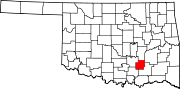 | |
| Towns | ||
| CDPs | ||
| Other communities | ||
| Indian reservations | ||
| Footnotes | ‡This populated place also has portions in an adjacent county or counties | |
This Oklahoma state location article is a stub. You can help Wikipedia by expanding it. |