
Cedar, Kansas
Cedar, Kansas | |
|---|---|
 Location within Smith County and Kansas | |
 | |
| Coordinates: 39°39′26″N 98°56′25″W / 39.65722°N 98.94028°W[1] | |
| Country | United States |
| State | Kansas |
| County | Smith |
| Founded | 1870s |
| Incorporated | 1916 |
| Area | |
| • Total | 0.18 sq mi (0.46 km2) |
| • Land | 0.18 sq mi (0.46 km2) |
| • Water | 0.00 sq mi (0.00 km2) |
| Elevation | 1,631 ft (497 m) |
| Population | |
| • Total | 11 |
| • Density | 61/sq mi (24/km2) |
| Time zone | UTC-6 (CST) |
| • Summer (DST) | UTC-5 (CDT) |
| ZIP code | 67628 |
| Area code | 785 |
| FIPS code | 20-11325 |
| GNIS ID | 2393773[1] |
Cedar is a city in Smith County, Kansas, United States.[1] As of the 2020 census, the population of the city was 11.[3]
History[edit]
Cedar was a station and shipping point on the Missouri Pacific Railroad.[4]
The first post office in Cedar was established in 1871, but it was called Cedarville until 1906.[5]
Geography[edit]
According to the United States Census Bureau, the city has a total area of 0.18 square miles (0.47 km2), all of it land.[6]
Demographics[edit]
| Census | Pop. | Note | %± |
|---|---|---|---|
| 1920 | 140 | — | |
| 1930 | 148 | 5.7% | |
| 1940 | 144 | −2.7% | |
| 1950 | 86 | −40.3% | |
| 1960 | 73 | −15.1% | |
| 1970 | 46 | −37.0% | |
| 1980 | 53 | 15.2% | |
| 1990 | 25 | −52.8% | |
| 2000 | 26 | 4.0% | |
| 2010 | 14 | −46.2% | |
| 2020 | 11 | −21.4% | |
| U.S. Decennial Census | |||
2020 census[edit]
The 2020 United States census counted 11 people, 7 households, and 5 families in Cedar.[7][8] The population density was 61.8 per square mile (23.9/km2). There were 10 housing units at an average density of 56.2 per square mile (21.7/km2).[8][9] The racial makeup was 100.0% (11) white or European American (100.0% non-Hispanic white), 0.0% (0) black or African-American, 0.0% (0) Native American or Alaska Native, 0.0% (0) Asian, 0.0% (0) Pacific Islander or Native Hawaiian, 0.0% (0) from other races, and 0.0% (0) from two or more races.[10] Hispanic or Latino of any race was 0.0% (0) of the population.[11]
Of the 7 households, 14.3% had children under the age of 18; 71.4% were married couples living together; 28.6% had a female householder with no spouse or partner present. 28.6% of households consisted of individuals and 14.3% had someone living alone who was 65 years of age or older.[8] The average household size was 2.4 and the average family size was 2.7.[12]
0.0% of the population was under the age of 18, 0.0% from 18 to 24, 0.0% from 25 to 44, 54.5% from 45 to 64, and 45.5% who were 65 years of age or older. The median age was 62.8 years. For every 100 females, there were 57.1 males.[8] For every 100 females ages 18 and older, there were 57.1 males.[8]
The 2016-2020 5-year American Community Survey estimates show that the median household income was $58,750 (with a margin of error of +/- $18,057) and the median family income was $59,167 (+/- $14,677).[13] The median income for those above 16 years old was $46,250 (+/- $45,029).[14]
2010 census[edit]
As of the census[15] of 2010, there were 14 people, 8 households, and 5 families residing in the city. The population density was 77.8 inhabitants per square mile (30.0/km2). There were 16 housing units at an average density of 88.9 per square mile (34.3/km2). The racial makeup of the city was 100.0% White.
There were 8 households, of which 12.5% had children under the age of 18 living with them, 62.5% were married couples living together, and 37.5% were non-families. 37.5% of all households were made up of individuals, and 25% had someone living alone who was 65 years of age or older. The average household size was 1.75 and the average family size was 2.20.
The median age in the city was 71.3 years. 7.1% of residents were under the age of 18; 0% were between the ages of 18 and 24; 7.1% were from 25 to 44; 14.2% were from 45 to 64; and 71.4% were 65 years of age or older. The gender makeup of the city was 50.0% male and 50.0% female.
2000 census[edit]
As of the census[16] of 2000, there were 26 people, 10 households, and 9 families residing in the city. The population density was 147.2 inhabitants per square mile (56.8/km2). There were 17 housing units at an average density of 96.3 per square mile (37.2/km2). The racial makeup of the city was 100.00% White.
There were 10 households, out of which 40.0% had children under the age of 18 living with them, 80.0% were married couples living together, and 10.0% were non-families. 10.0% of all households were made up of individuals, and 10.0% had someone living alone who was 65 years of age or older. The average household size was 2.60 and the average family size was 2.67.
In the city, the population was spread out, with 23.1% under the age of 18, 3.8% from 18 to 24, 30.8% from 25 to 44, 7.7% from 45 to 64, and 34.6% who were 65 years of age or older. The median age was 40 years. For every 100 females, there were 160.0 males. For every 100 females age 18 and over, there were 100.0 males.
The median income for a household in the city was $31,875, and the median income for a family was $30,625. Males had a median income of $32,500 versus $8,750 for females. The per capita income for the city was $13,770. None of the population and none of the families were below the poverty line.
Government[edit]
The Cedar government consists of a mayor and five council members. The council meets the 1st Monday of each month at 7 pm.[17]
Education[edit]
The community is served by Smith Center USD 237 public school district.[18]
References[edit]
- ^ a b c d U.S. Geological Survey Geographic Names Information System: Cedar, Kansas
- ^ "2019 U.S. Gazetteer Files". United States Census Bureau. Retrieved July 24, 2020.
- ^ a b "Profile of Cedar, Kansas in 2020". United States Census Bureau. Archived from the original on March 23, 2022. Retrieved March 23, 2022.
- ^ Blackmar, Frank Wilson (1912). Kansas: A Cyclopedia of State History, Embracing Events, Institutions, Industries, Counties, Cities, Towns, Prominent Persons, Etc. Standard Publishing Company. p. 301.
- ^ "Kansas Post Offices, 1828-1961". Kansas Historical Society. Archived from the original on October 9, 2013. Retrieved June 23, 2014.
- ^ "US Gazetteer files 2010". United States Census Bureau. Archived from the original on January 25, 2012. Retrieved July 6, 2012.
- ^ "US Census Bureau, Table P16: HOUSEHOLD TYPE". data.census.gov. Retrieved January 16, 2024.
- ^ a b c d e "US Census Bureau, Table DP1: PROFILE OF GENERAL POPULATION AND HOUSING CHARACTERISTICS". data.census.gov. Retrieved January 16, 2024.
- ^ Bureau, US Census. "Gazetteer Files". Census.gov. Retrieved December 30, 2023.
- ^ "US Census Bureau, Table P1: RACE". data.census.gov. Retrieved January 16, 2024.
- ^ "US Census Bureau, Table P2: HISPANIC OR LATINO, AND NOT HISPANIC OR LATINO BY RACE". data.census.gov. Retrieved January 16, 2024.
- ^ "US Census Bureau, Table S1101: HOUSEHOLDS AND FAMILIES". data.census.gov. Retrieved January 16, 2024.
- ^ "US Census Bureau, Table S1903: MEDIAN INCOME IN THE PAST 12 MONTHS (IN 2020 INFLATION-ADJUSTED DOLLARS)". data.census.gov. Retrieved January 16, 2024.
- ^ "US Census Bureau, Table S2001: EARNINGS IN THE PAST 12 MONTHS (IN 2020 INFLATION-ADJUSTED DOLLARS)". data.census.gov. Retrieved January 16, 2024.
- ^ "U.S. Census website". United States Census Bureau. Retrieved July 6, 2012.
- ^ "U.S. Census website". United States Census Bureau. Retrieved January 31, 2008.
- ^ Cedar – Directory of Public Officials Archived 2011-05-05 at the Wayback Machine
- ^ USD 237
Further reading[edit]
External links[edit]
Municipalities and communities of Smith County, Kansas, United States | ||
|---|---|---|
| Cities | 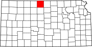 | |
| Unincorporated communities | ||
| Ghost towns | ||
| Townships | ||