Briceburg, California
Briceburg | |
|---|---|
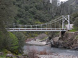
 Bridge over the Merced River at Briceburg | |
| Coordinates: 37°36′18″N 119°58′01″W / 37.60500°N 119.96694°W | |
| Country | United States |
| State | California |
| County | Mariposa County |
| Elevation | 1,138 ft (347 m) |
Briceburg (formerly, Bear Creek)[2] is an unincorporated community in Mariposa County, California.[1] It is located on the Merced River near the confluence with Bear Creek, 5 miles (8 km) north-northwest of Midpines,[2] at an elevation of 1138 feet (347 m).[1] It is accessed via a bridge over the Merced River that connects Highway 140 with Briceburg Road. The bridge is a 160-foot (49 m) suspension bridge built by the US Forest Service in 1937 and constructed by 30 Civilian Conservation Corps enrollees. Forest Service Engineer J.W. Nute was in charge of construction.[3] The community name honors William M. Brice, who built a store at the location in 1926.[2]
After a 2019 fire,[4] Pacific Gas & Electric decided to create a self-reliant power system rather than rebuilding poles and wires to serve the remote community. The stand-alone power grid includes solar panels, batteries and a backup generator.[5]
References[edit]
- ^ a b c U.S. Geological Survey Geographic Names Information System: Briceburg, California
- ^ a b c Durham, David L. (1998). California's Geographic Names: A Gazetteer of Historic and Modern Names of the State. Clovis, Calif.: Word Dancer Press. p. 749-750. ISBN 1-884995-14-4.
- ^ Mariposa Gazette
- ^ "Briceburg Fire fully contained at 5,563 acres, according to fire officials".
- ^ Nguyen, Daisy (June 30, 2021). "California tests off-the-grid solutions to power outages". AP News. Retrieved July 2, 2021.


