
Bontebok, Netherlands
(Redirected from Bontebok, Heerenveen)
Bontebok | |
|---|---|
Village | |
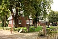
 Local farm and house | |
 Coat of arms | |
 Location in the Heerenveen municipality | |
 Bontebok Location in the Netherlands  Bontebok Bontebok (Netherlands) | |
| Coordinates: 52°57′47″N 6°1′32″E / 52.96306°N 6.02556°E | |
| Country | |
| Province | |
| Municipality | |
| Area | |
| • Total | 3.50 km2 (1.35 sq mi) |
| Elevation | 1.7 m (5.6 ft) |
| Population (2021)[1] | |
| • Total | 420 |
| • Density | 120/km2 (310/sq mi) |
| Postal code | 8415[1] |
| Dialing code | 0513 |
Bontebok is a village in Heerenveen in the province of Friesland, the Netherlands. It had a population of around 400 in 2017.[3]
The village was first mentioned in 1640 as Bonte Bock, and is named after an inn which used a goat as a sign board.[4] Bontebok developed during the peat excavation of the area. The inn was located near a sluice where boatmen had to wait. The inn was later joined by a couple of shops and pubs, and a hamlet developed. In 1840, Bontebok was home to 46 people. In 1898, a dairy factory opened in Bontebok.[5]
Gallery[edit]
-
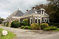
 Farm in Bontebok
 -
 Farm in Bontebok
 -
 Goat statue
 -
 School in Bontebok


References[edit]
- ^ a b c "Kerncijfers wijken en buurten 2021". Central Bureau of Statistics. Retrieved 30 March 2022.
- ^ "Postcodetool for 8415AA". Actueel Hoogtebestand Nederland (in Dutch). Het Waterschapshuis. Retrieved 30 March 2022.
- ^ Kerncijfers wijken en buurten 2017 - CBS Statline
- ^ "Bontebok - (geografische naam)". Etymologiebank (in Dutch). Retrieved 30 March 2022.
- ^ "Bonteboek". Plaatsengids. Retrieved 30 March 2022.
External links[edit]
![]() Media related to Bontebok at Wikimedia Commons
Media related to Bontebok at Wikimedia Commons
This Friesland location article is a stub. You can help Wikipedia by expanding it. |