
Auburn, Kentucky
Auburn, Kentucky | |
|---|---|
 Location of Auburn in Logan County, Kentucky. | |
| Coordinates: 36°51′59″N 86°43′1″W / 36.86639°N 86.71694°W | |
| Country | United States |
| State | Kentucky |
| County | Logan |
| Area | |
| • Total | 1.83 sq mi (4.75 km2) |
| • Land | 1.83 sq mi (4.74 km2) |
| • Water | 0.00 sq mi (0.00 km2) |
| Elevation | 640 ft (195 m) |
| Population (2020) | |
| • Total | 1,589 |
| • Estimate (2022)[2] | 1,616 |
| • Density | 867.36/sq mi (334.91/km2) |
| Time zone | UTC-6 (Central (CST)) |
| • Summer (DST) | UTC-5 (CDT) |
| ZIP code | 42206 |
| Area code | 270 |
| FIPS code | 21-02638 |
| GNIS feature ID | 0486133 |
| Website | auburnky |
Auburn is a home rule-class city[3] in Logan County, Kentucky, in the United States. The population was 1,340 at the 2010 census.
History[edit]
Originally called Federal Grove, the present name dates from the 1860s; it was named after Auburn, New York, the previous residence of several early settlers.[4] It was originally incorporated by the state assembly in 1865, and reincorporated in 1878.[5]
Geography[edit]
Auburn is located at 36°51′59″N 86°43′1″W / 36.86639°N 86.71694°W (36.866523, -86.716910).[6]
According to the United States Census Bureau, the city has a total area of 1.8 square miles (4.7 km2), all land.
Demographics[edit]
| Census | Pop. | Note | %± |
|---|---|---|---|
| 1870 | 610 | — | |
| 1880 | 682 | 11.8% | |
| 1890 | 613 | −10.1% | |
| 1900 | 697 | 13.7% | |
| 1910 | 681 | −2.3% | |
| 1920 | 715 | 5.0% | |
| 1930 | 821 | 14.8% | |
| 1940 | 955 | 16.3% | |
| 1950 | 994 | 4.1% | |
| 1960 | 1,013 | 1.9% | |
| 1970 | 1,160 | 14.5% | |
| 1980 | 1,467 | 26.5% | |
| 1990 | 1,273 | −13.2% | |
| 2000 | 1,444 | 13.4% | |
| 2010 | 1,340 | −7.2% | |
| 2020 | 1,589 | 18.6% | |
| 2022 (est.) | 1,616 | [7] | 1.7% |
| U.S. Decennial Census[8] | |||
As of the census[9] of 2000, there were 1,444 people, 584 households, and 397 families residing in the city. The population density was 821.8 inhabitants per square mile (317.3/km2). There were 653 housing units at an average density of 371.6 per square mile (143.5/km2). The racial makeup of the city was 90.86% White, 6.86% African American, 0.14% Native American, 0.14% Asian, and 2.01% from two or more races. Hispanic or Latino of any race were 0.69% of the population.
There were 584 households, out of which 32.2% had children under the age of 18 living with them, 50.5% were married couples living together, 12.7% had a female householder with no husband present, and 32.0% were non-families. 29.3% of all households were made up of individuals, and 15.4% had someone living alone who was 65 years of age or older. The average household size was 2.36 and the average family size was 2.88.
In the city, the population was spread out, with 23.6% under the age of 18, 8.0% from 18 to 24, 28.8% from 25 to 44, 19.7% from 45 to 64, and 19.8% who were 65 years of age or older. The median age was 38 years. For every 100 females, there were 79.6 males. For every 100 females age 18 and over, there were 76.8 males.
The median income for a household in the city was $30,500, and the median income for a family was $38,173. Males had a median income of $28,365 versus $20,000 for females. The per capita income for the city was $14,779. About 11.3% of families and 15.1% of the population were below the poverty line, including 17.3% of those under age 18 and 18.9% of those age 65 or over.
Education[edit]
Auburn has a lending library, a branch of the Logan County Public Library.[10]
Notable people[edit]
- Floyd Collins, cave explorer, victim of cave accident
See also[edit]
References[edit]
- ^ "2020 U.S. Gazetteer Files". United States Census Bureau. Retrieved March 18, 2022.
- ^ "Annual Estimates of the Resident Population for Incorporated Places in Kentucky: April 1, 2020 to July 1, 2022". United States Census Bureau. Retrieved May 26, 2023.
- ^ "Summary and Reference Guide to House Bill 331 City Classification Reform" (PDF). Kentucky League of Cities. Retrieved December 30, 2014.
- ^ "Dictionary of Places: Auburn". Encyclopedia of Kentucky. New York, New York: Somerset Publishers. 1987. ISBN 0-403-09981-1.
- ^ Commonwealth of Kentucky. Office of the Secretary of State. Land Office. "Auburn, Kentucky". Accessed July 15, 2013.
- ^ "US Gazetteer files: 2010, 2000, and 1990". United States Census Bureau. February 12, 2011. Retrieved April 23, 2011.
- ^ "Annual Estimates of the Resident Population for Incorporated Places in Kentucky: April 1, 2020 to July 1, 2022". United States Census Bureau. Retrieved May 26, 2023.
- ^ "Census of Population and Housing". Census.gov. Retrieved June 4, 2015.
- ^ "U.S. Census website". United States Census Bureau. Retrieved January 31, 2008.
- ^ "Kentucky Public Library Directory". Kentucky Department for Libraries and Archives. Archived from the original on January 11, 2019. Retrieved June 5, 2019.
External links[edit]
Municipalities and communities of Logan County, Kentucky, United States | ||
|---|---|---|
| Cities | 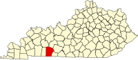 | |
| CDP | ||
| Other unincorporated communities | ||
| Footnotes | ‡This populated place also has portions in an adjacent county or counties | |
| International | |
|---|---|
| National | |