
Arbury Hill
| Arbury Hill | |
|---|---|
.JPG) Arbury Hill from the west | |
| Highest point | |
| Elevation | 225 m (738 ft)[1] |
| Listing | County top |
| Coordinates | 52°13′27″N 1°12′36″W / 52.2243°N 1.2101°W |
| Geography | |
 Arbury Hill Arbury Hill in Northamptonshire | |
| Location | Northamptonshire, England |
| OS grid | SP540587 |
| Topo map | OS Explorer 206 |
Arbury Hill, at 225 m (738 ft), is the joint highest point in the English county of Northamptonshire.[1][2] It is 9 km (5.6 mi) southwest of the town of Daventry.
The slopes of Arbury Hill are a drainage divide between three major river catchment areas, with the Nene to the north, east and south, the Cherwell (a tributary of the Thames) to the south-west and the Leam (a tributary of the Severn) to the west and north-west.[2] There are fine views with Rugby and Coventry visible to the northwest and Northampton to the east. The River Nene rises in a swampy hollow on the northwestern flanks of the hill.[3]
History[edit]
On the summit of Arbury Hill there are the vestiges of an Iron Age Fort (grid reference SP540587), although its date and origin are disputed. The remains are in the form of a square ditch and embankment about 200 metres (yards) across.[4] Although little trace remains of this fort, the outer bank encloses an area of about 12 acres (4.9 ha). It is mentioned as one of the boundary marks in a land grant of Edmund the Elder, as being the place where the three parishes of Badby, Dodford and Everdon meet.[3]
The summit of Arbury Hill was one in a series of points used for triangulation in 1784 to determine the exact diameter and magnitude of the Earth, in a sequence of measurements undertaken by the British Government.[5] There is a Triangulation station on the summit.[6]
There is a motor-cross track on the east side and top of the hill that is used for competitions about three times a year. The soil is clayey, the site is steeply sloping and there are plenty of elevation changes, some off camber turns and a few smallish jumps.[7]
Gallery[edit]

-
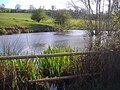 The headwater of the River Nene, on the north east slope of Arbury Hill in 2008
 -
 The southern side of the hill in 2008
.JPG)
.JPG)
References[edit]
- ^ a b Bathurst, David (2012). Walking the county high points of England. Chichester: Summersdale. pp. 56–59. ISBN 978-1-84-953239-6.
- ^ a b OS Explorer Map 207: Newport Pagnell & Northampton South (1:25 000) ISBN 0319 46387 7
- ^ a b John Murray (1878). Handbook for Travellers in Northamptonshire and Rutland ... J. Murray. p. 116.
- ^ 'Badby', in An Inventory of the Historical Monuments in the County of Northamptonshire, Volume 3: Archaeological Sites in North-West Northamptonshire (London, 1981), pp. 7-12. British History Online, accessed 25 October 2017.
- ^ Hugh Murray (1861). The Encyclopedia of All Nations: Comprising a Complete Physical, Statistical, Civil and Political Description of the World ... Including the Late Discoveries and Travels of Dr. Kane, Dr. Barth and Dr. Livingston. H. Bill. pp. 140–143.
- ^ Philosophical Transactions, Giving Some Account of the Present Undertakings, Studies, and Labours of the Ingenious in Many Considerable Parts of the World. Royal Society of London. 1828. p. 226.
- ^ "Badby (Arbury Hill) Motocross Track". Total MX. Retrieved 23 March 2020.