
Adrian, Georgia
Adrian, Georgia | |
|---|---|
 Location in Emanuel County, Georgia | |
| Coordinates: 32°31′55″N 82°35′26″W / 32.53194°N 82.59056°W | |
| Country | United States |
| State | Georgia |
| Counties | |
| Area | |
| • Total | 1.42 sq mi (3.68 km2) |
| • Land | 1.38 sq mi (3.56 km2) |
| • Water | 0.04 sq mi (0.11 km2) |
| Elevation | 286 ft (87 m) |
| Population (2020) | |
| • Total | 552 |
| • Density | 401.45/sq mi (155.02/km2) |
| Time zone | UTC-5 (Eastern (EST)) |
| • Summer (DST) | UTC-4 (EDT) |
| ZIP code | 31002 |
| Area code | 478 |
| FIPS code | 13-00660[2] |
| GNIS feature ID | 0310411[3] |
| Website | cityofadrianga |
Adrian is a city in Emanuel and Johnson County, Georgia, United States. As of the 2020 census, the city had a population of 552.
History[edit]
A post office has been in operation at Adrian since 1891.[4] Adrian incorporated in 1899.[5] It is unknown why the name "Adrian" was applied to this community.[6]
Geography[edit]
Adrian is located at 32°31′55″N 82°35′26″W / 32.53194°N 82.59056°W (32.531960, -82.590680),[7] at the intersection of U.S. Route 80/Georgia State Route 26 with State Routes 15/78. US 80 leads east 16 miles (26 km) to Swainsboro and west 19 miles (31 km) to Dublin, while Routes 15 and 78 lead south 7 miles (11 km) to Interstate 16 and northwest 17 miles (27 km) to Wrightsville.
According to the United States Census Bureau, Adrian has a total area of 1.4 square miles (3.7 km2), of which 1.4 square miles (3.6 km2) is land and 0.04 square miles (0.1 km2), or 3.12%, is water.[8]
Demographics[edit]
| Census | Pop. | Note | %± |
|---|---|---|---|
| 1900 | 833 | — | |
| 1910 | 816 | −2.0% | |
| 1920 | 740 | −9.3% | |
| 1930 | 685 | −7.4% | |
| 1940 | 580 | −15.3% | |
| 1950 | 503 | −13.3% | |
| 1960 | 568 | 12.9% | |
| 1970 | 705 | 24.1% | |
| 1980 | 756 | 7.2% | |
| 1990 | 615 | −18.7% | |
| 2000 | 579 | −5.9% | |
| 2010 | 664 | 14.7% | |
| 2020 | 552 | −16.9% | |
| U.S. Decennial Census[9] 1850-1870[10] 1880[11] 1890-1910[12] 1920-1930[13] 1930-1940[14] 1940-1950[15] 1960-1980[16]1980-2000[17] | |||
As of 2020, its population was 552.
Notable people[edit]
- Izola Curry, assailant who tried to kill Martin Luther King Jr. in 1958, was born in Adrian in 1916.[18]
References[edit]
- ^ "2020 U.S. Gazetteer Files". United States Census Bureau. Retrieved December 18, 2021.
- ^ "U.S. Census website". United States Census Bureau. Retrieved January 31, 2008.
- ^ "US Board on Geographic Names". United States Geological Survey. October 25, 2007. Retrieved January 31, 2008.
- ^ "Post Offices". Jim Forte Postal History. Retrieved March 31, 2018.
- ^ "Adrian". GeorgiaGov. Retrieved March 31, 2018.
- ^ Krakow, Kenneth K. (1975). Georgia Place-Names: Their History and Origins (PDF). Macon, GA: Winship Press. p. 2. ISBN 0-915430-00-2.
- ^ "US Gazetteer files: 2010, 2000, and 1990". United States Census Bureau. February 12, 2011. Retrieved April 23, 2011.
- ^ "Geographic Identifiers: 2010 Demographic Profile Data (G001): Adrian city, Georgia". American Factfinder. U.S. Census Bureau. Archived from the original on February 13, 2020. Retrieved January 26, 2016.
- ^ "Decennial Census of Population and Housing by Decades". US Census Bureau.
- ^ "1870 Census of Population - Georgia" (PDF). US Census Bureau. 1870.
- ^ "1880 Census of Population - Georgia" (PDF). US Census Bureau. 1880.
- ^ "1910 Census of Population - Georgia" (PDF). US Census Bureau. 1930.
- ^ "1930 Census of Population - Georgia" (PDF). US Census Bureau. 1930. p. 253.
- ^ "1940 Census of Population - Georgia" (PDF). US Census Bureau. 1940.
- ^ "1950 Census of Population - Georgia" (PDF). US Census Bureau. 1980.
- ^ "1980 Census of Population - Number of Inhabitants - Georgia" (PDF). US Census Bureau. 1980.
- ^ "2000 Census of Population - General Population Characteristics - Georgia" (PDF). US Census Bureau. 2000.
- ^ Cold Case, Izola Ware Curry
Municipalities and communities of Emanuel County, Georgia, United States | ||
|---|---|---|
| Cities |  | |
| CDPs | ||
| Unincorporated communities | ||
| Footnotes | ‡This populated place also has portions in an adjacent county or counties | |
Municipalities and communities of Johnson County, Georgia, United States | ||
|---|---|---|
| Cities | 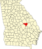 | |
| Unincorporated communities | ||
| Footnotes | ‡This populated place also has portions in an adjacent county or counties | |