
File:Venezuela Administrative Divisions.jpg
Size of this preview: 497 × 600 pixels. Other resolutions: 199 × 240 pixels | 398 × 480 pixels | 636 × 768 pixels | 848 × 1,024 pixels | 1,983 × 2,393 pixels.
Original file (1,983 × 2,393 pixels, file size: 912 KB, MIME type: image/jpeg)
| This is a file from the Wikimedia Commons. Information from its description page there is shown below. Commons is a freely licensed media file repository. You can help. |
Summary
| Description |
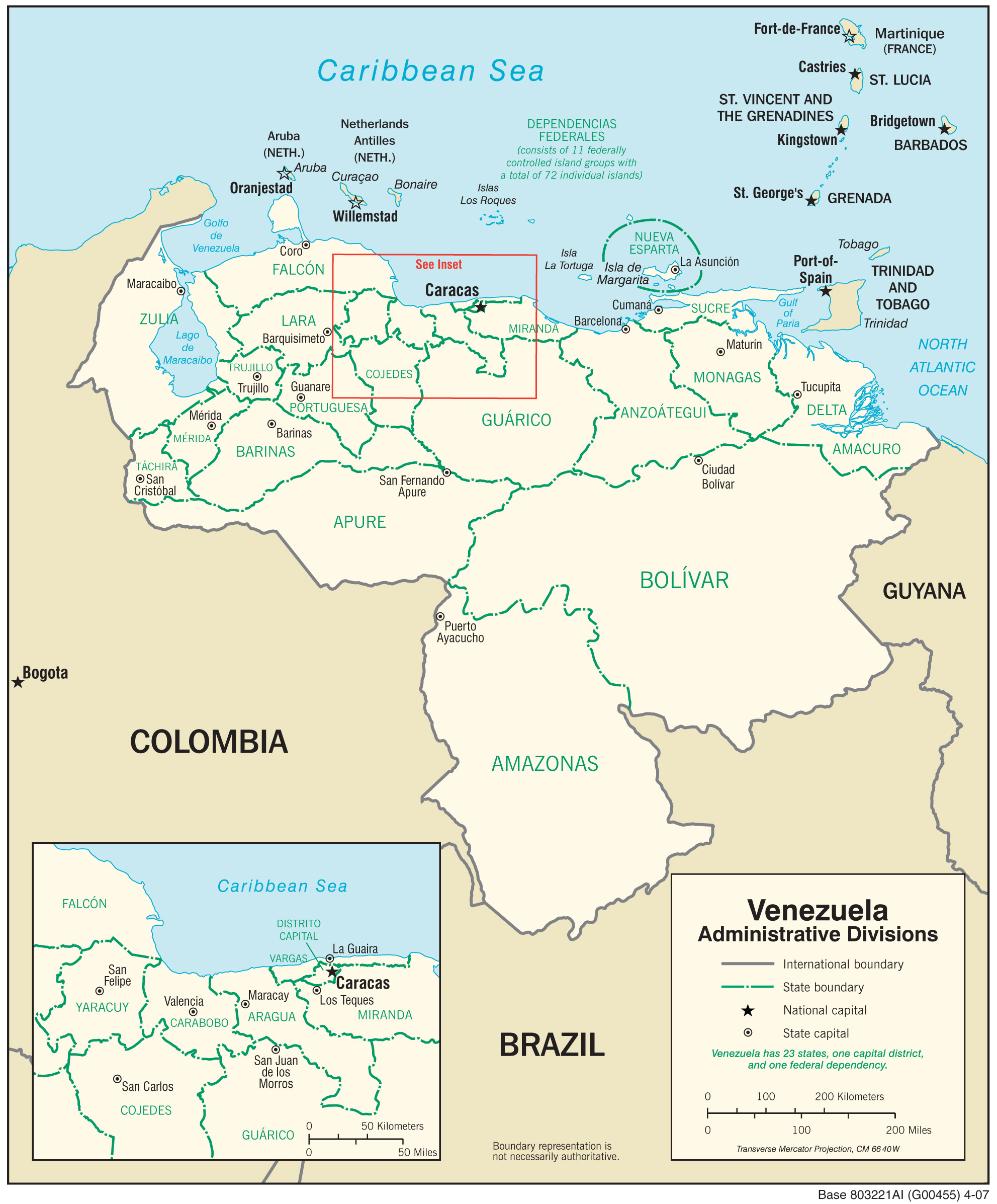
Українська: Територіально-адміністративний устрій Венесуели першого рівня, 2007 рік (англ.). |
| Date | |
| Source | Map from CIA World Factbook 2015. |
| Author | Gerald J. Coleman from Central Intelligence Agency (CIA). |
Licensing
This image is in the public domain because it contains materials that originally came from the United States Central Intelligence Agency's World Factbook.
|
 |
File history
Click on a date/time to view the file as it appeared at that time.
| Date/Time | Thumbnail | Dimensions | User | Comment | |
|---|---|---|---|---|---|
| current | 15:12, 24 November 2017 | | 1,983 × 2,393 (912 KB) | Dim Grits |
File usage
The following pages on the English Wikipedia use this file (pages on other projects are not listed):
Global file usage
The following other wikis use this file:
- Usage on kaa.wikipedia.org
- Usage on mn.wikipedia.org