Adabar Thana
Adabar
আদাবর | |
|---|---|
Thana | |
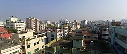
 Skyline of Adabar | |
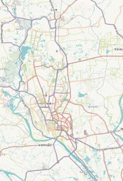
 Expandable map of vicinity of Adabar Thana | |
| Coordinates: 23°46′17″N 90°21′33″E / 23.77132866°N 90.35915521°E | |
| Country | Bangladesh |
| Area | |
| • Total | 2.07 km2 (0.80 sq mi) |
| Population (2011)[1] | |
| • Total | 203,989 |
| • Density | 98,545/km2 (255,230/sq mi) |
| Area code | 1207[2] |
Adabar is a Thana of Dhaka District located on the bank of Buriganga river, in Bangladesh. To the north, there is Darus Salam Thana and Sher-e-Bangla Nagar, to the east and south, there is Mohammadpur Thana and to the west, there is Buriganga river.
History[edit]
Adabar Thana was officially established on June 27, 2007. The formation of Adabar Thana involved a reorganization of administrative boundaries, where it was carved out from part of the existing Mohammadpur Thana. This reorganization aimed to improve local governance and administrative efficiency, given the growing population and urban development in the area.
Prior to the establishment of Adabar Thana, Mohammadpur Thana covered a larger area, which sometimes made it challenging for local authorities to effectively manage and provide services to the residents. By creating Adabar Thana, the authorities aimed to ensure more focused attention and resources for the newly defined area, improving public administration, law enforcement, and service delivery.
Adabar Thana now functions with its own administrative structure, police station, and local government offices, catering to the needs of the residents within its jurisdiction. The establishment of this Thana reflects the broader urban planning and development strategies employed in Dhaka to address the challenges of rapid urbanization.
See also[edit]
References[edit]
- ^ Bangladesh Bureau of Statistics (2011). "Population & Housing Census" (PDF). Bangladesh Government. Archived from the original (PDF) on 3 September 2017. Retrieved 17 April 2015.
- ^ "ঢাকা পোস্টকোড". ডাক অধিদপ্তর. Retrieved 2024-01-17.


